Isolated severe storms possible Monday in Alabama
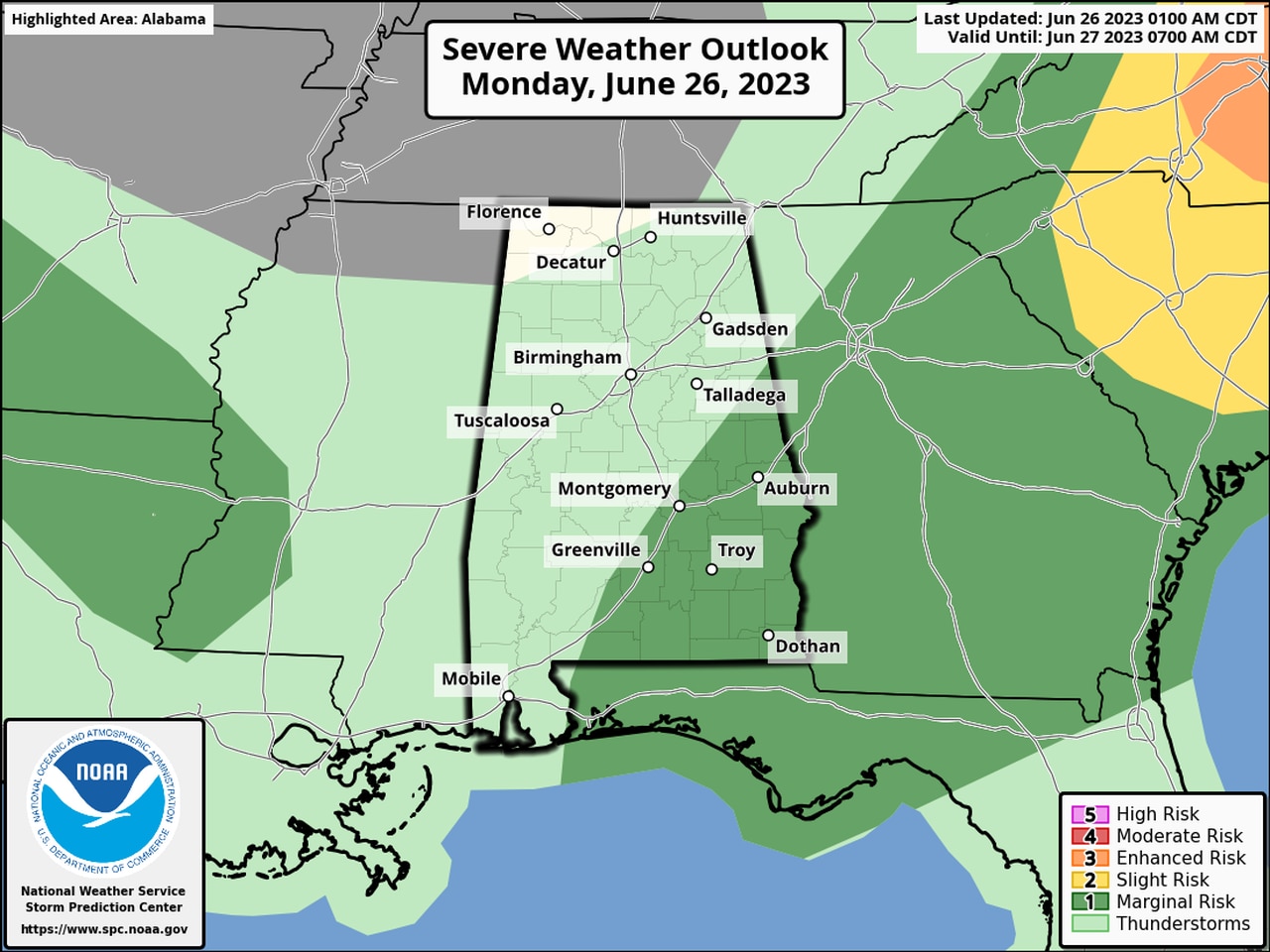
A few severe storms will be possible on Monday afternoon in parts of south and east Alabama.
The strongest storms could have wind gusts up to 60 mph, hail and heavy rain.
Storms will be more likely starting this afternoon during the day’s peak heating.
NOAA’s Storm Prediction Center is forecasting a Level 1 out of 5 risk for severe storms for the eastern part of Alabama today.
A Level 1 risk means isolated severe storms will be possible.
The storms could be generated by a lingering front that has yet to push through Alabama. Conditions will be the most favorable for storms the farther south and east you go.
However, the weather service did note there will be the potential for additional storms later tonight in southwest Alabama if another complex of storms (or MCS) forms and drops into the region. That’s not a sure thing, however.
Another storm complex moved through Alabama early Monday morning, and it prompted several severe thunderstorm warnings throughout the state. Those storms had moved into Florida as of Monday morning.
Those not getting rain could face very warm temperatures on Monday, and a heat advisory will be in effect for western parts of the state. More heat advisories will be likely in the coming days, and rain chances look to drop off starting on Wednesday for much of Alabama.
