Isolated severe storms possible in parts of Alabama
Rain and storms will be possible in parts of Alabama both today and Monday — and a few of them could be on the strong side.
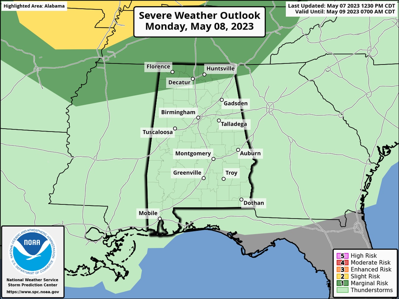
NOAA’s Storm Prediction Center has a Level 1, or marginal risk, for severe weather for extreme north Alabama for both this afternoon (Sunday) and Monday.
A Level 1 risk means that isolated severe storms will be possible.
The National Weather Service in Huntsville said the strongest storms could have damaging wind gusts, hail and heavy rain.
Forecasters said multiple waves of storms could develop to the northwest of Alabama and possibly affect north Alabama through Monday morning.
The weather service added that the timing is still uncertain because the storms “will be forming along weak boundaries that have not yet developed.”
However, the thinking is that the first round of storms could approach north Alabama later this afternoon or into the evening hours. Additional rounds could arrive late tonight and into Monday.
Rain and storms are expected to linger into Monday. Here is Monday’s severe weather outlook:
More isolated severe storms will be possible in north Alabama on Monday.
The weather service was eyeing storms in northern Tennessee on Sunday afternoon. Those are expected to sink southward through tonight:
Severe weather is not expected for the rest of Alabama as of Sunday afternoon, although some rain and storms will be possible, according to forecasters.
Severe weather isn’t in the near-term forecast for Alabama after Monday.