Isolated severe storms possible in Alabama on Tuesday
Fall severe weather season has arrived, and a chance for severe storms will arrive in Alabama on Tuesday.
Damaging winds are the main concern with Tuesday’s storms, which could arrive in the form of a squall line, but there will also be the risk of a tornado or two, especially in western Alabama.
It’s not a slam-dunk severe weather setup, according to the National Weather Service. Instability will be on the lower side, according to forecast models. However, there will be a lot of wind shear present at the time, which is why the risk for tornadoes can’t be ruled out.
NOAA’s Storm Prediction Center has added all but southeast Alabama to a Level 1 out of 5 risk for severe weather on Tuesday (see the map at the top of this post). The National Weather Service added that an eastward expansion of the severe weather risk is not out of the question in the future.
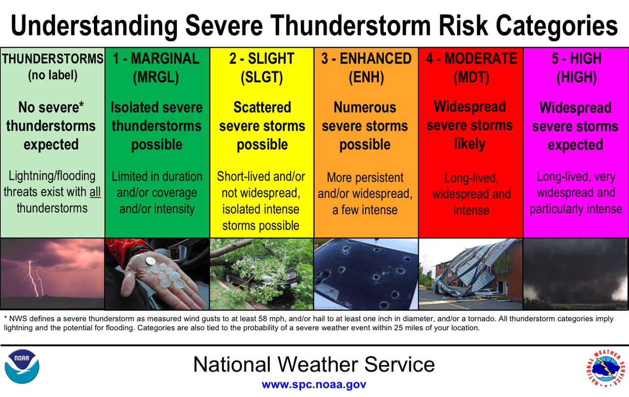
A Level 1 risk is marginal and means that isolated severe storms will be possible.
Here are the severe weather risk categories from the SPC:
These are the thunderstorm risk categories used by the National Weather Service.National Weather Service
Storms will be possible as early as Tuesday morning in western Alabama, and the threat will spread eastward during the afternoon and into the evening hours.
As of Sunday morning it appeared the severe weather threat could wane as the storms push eastward across Alabama into Tuesday evening.
Some heavy rain will be possible on Tuesday, but there are no major flooding concerns.
Drier and cooler weather will return to Alabama on Wednesday and Thursday, but it won’t be as cold as last week, according to the weather service.
The next chance for rain could arrive next weekend.
