Isolated severe storms possible Friday and Saturday
Isolated severe storms will be possible in the southern part of Alabama both today and Saturday.
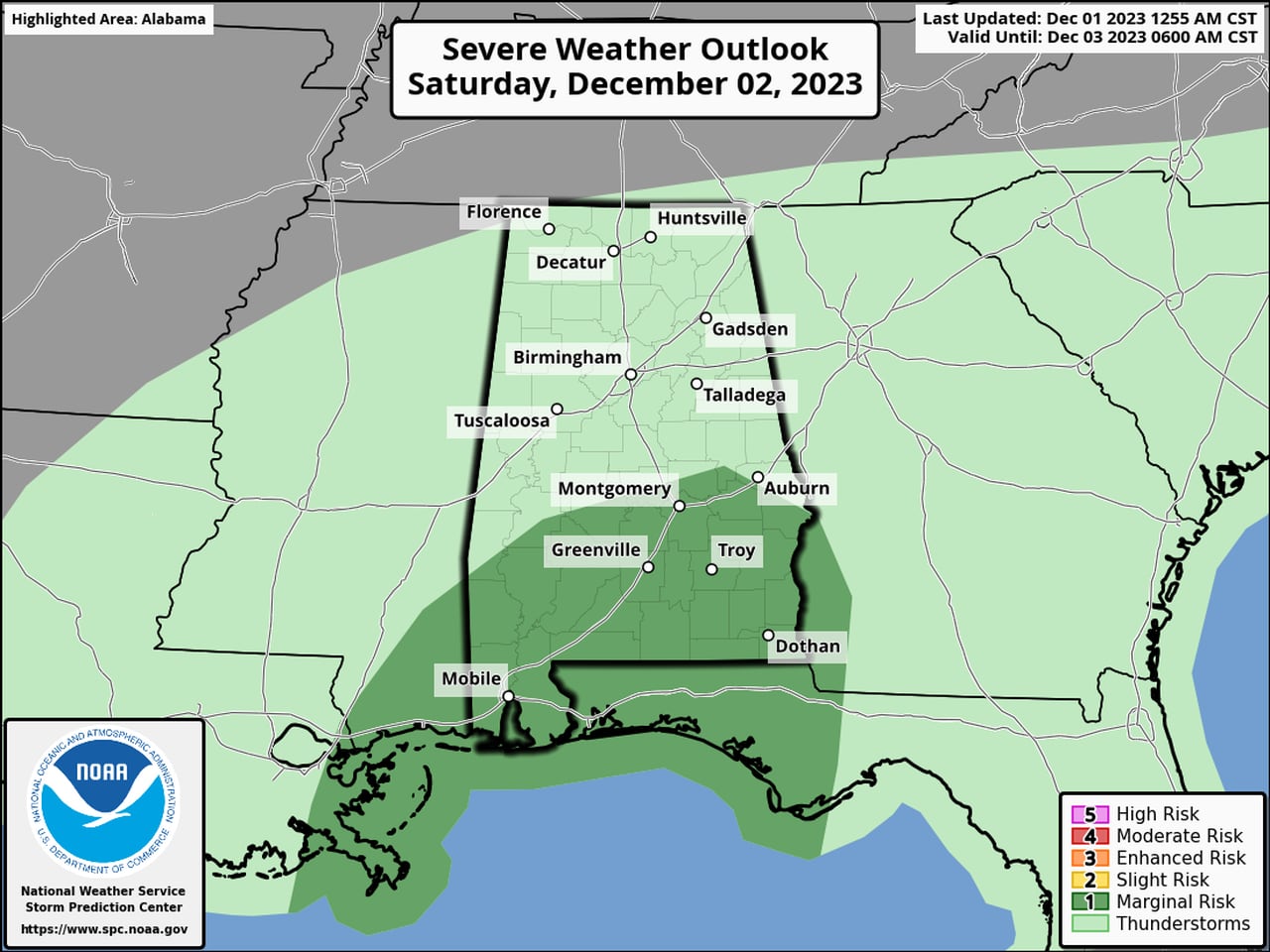
NOAA’s Storm Prediction Center is forecasting a Level 1 out of 5 (marginal) risk for severe weather for the southern third of the state on both days.
A Level 1 risk means that isolated severe storms will be possible.
The threat for a few severe storms will also extend into Saturday. Here is Saturday’s severe weather outlook:
There will be another Level 1 out of 5 risk for severe weather for south Alabama on Saturday.SPC
The National Weather Service said the strongest storms could have damaging wind gusts, and there will be a risk for a tornado as well.
Rain was falling across parts of the state on Friday morning, and the weather service in Mobile was tracking a few stronger storms in southern Mississippi that were headed eastward toward southwest Alabama.
However, forecasters expect the better chance for stronger storms to arrive later this afternoon. The weather service said multiple rounds of rain and storms will be possible overnight and into Saturday, with the better chance for storms over the southern part of the state.
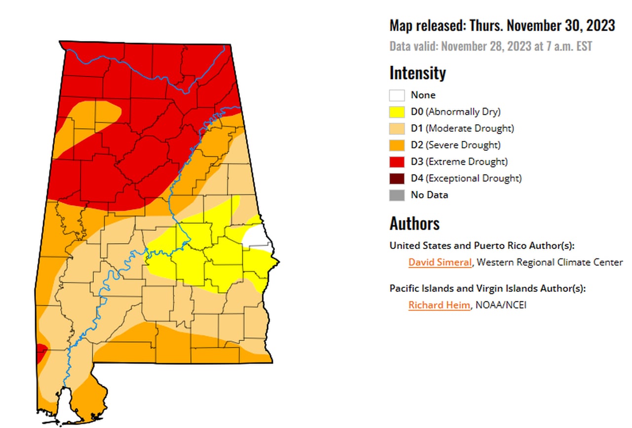
All of Alabama is expected to see some rain from the storm system moving through, with some spots getting 2 inches or even more. That is not as much as was hoped for in earlier forecasts but still could help with Alabama’s ongoing drought. Here is the latest map from the U.S. Drought Monitor, released on Thursday:

Alabama was still in a drought, but the worst drought conditions backed off from north Alabama in the past week. More rain in the forecast for the weekend could bring more improvements.U.S. Drought Monitor
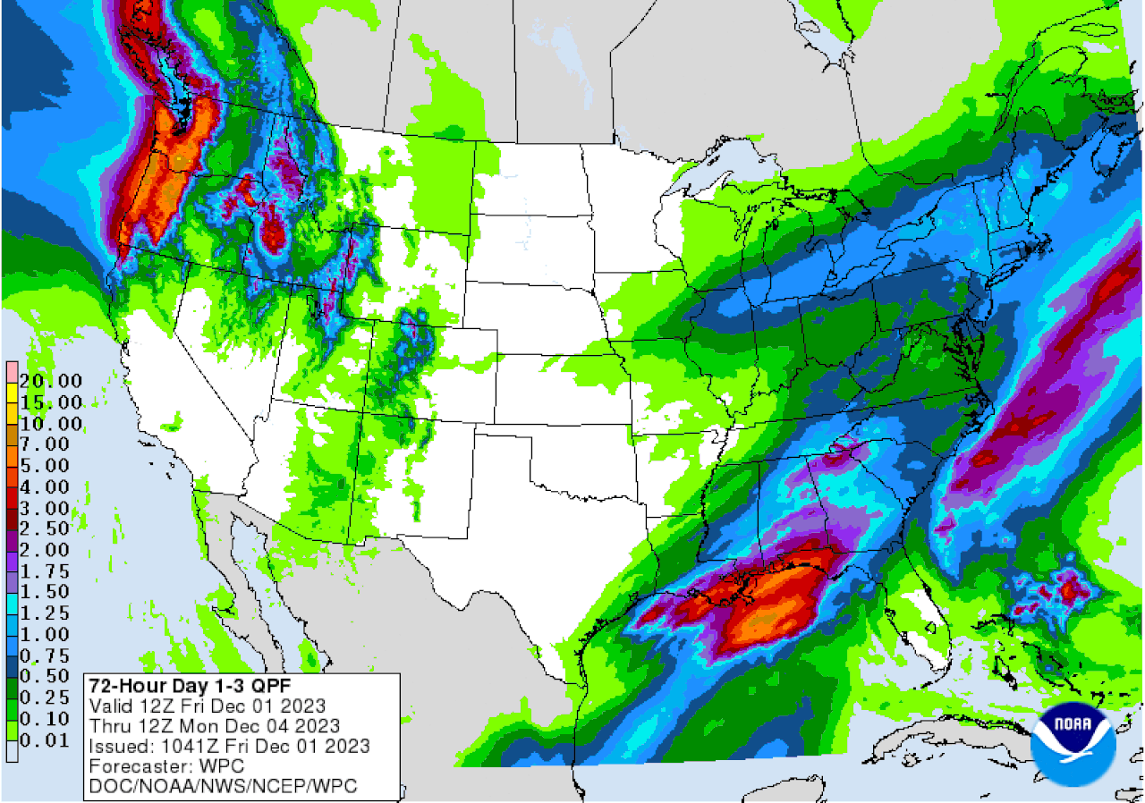
NOAA’s Weather Prediction Center has a three-day precipitation outlook that shows parts of southern Alabama could get 2 inches of rain through the weekend, with lesser amounts expected in north and north-central Alabama:

Higher rain totals continue to shift southward. This is the three-day precipitation outlook and it shows totals around 2 inches possible in parts of south Alabama.Weather Prediction Center
The weather service expects rain chances to end from west to east on Sunday, and drier weather is in the forecast for at least the first half of next week.
