Isolated severe storms, more heat advisories today
Alabama could have to deal with more near-record temperatures on Sunday — and a few severe storms too.
NOAA’s Storm Prediction Center has added a Level 1 out of 5 risk for severe weather for all of Alabama for Sunday.
A Level 1 risk means that isolated severe storms will be possible. The strongest of those could have winds capable of knocking down trees and power lines and heavy rain.
Storms were moving through parts of Mississippi on Sunday morning, and more will be possible this afternoon during the peak heating of the day as a weak front approaches the state.
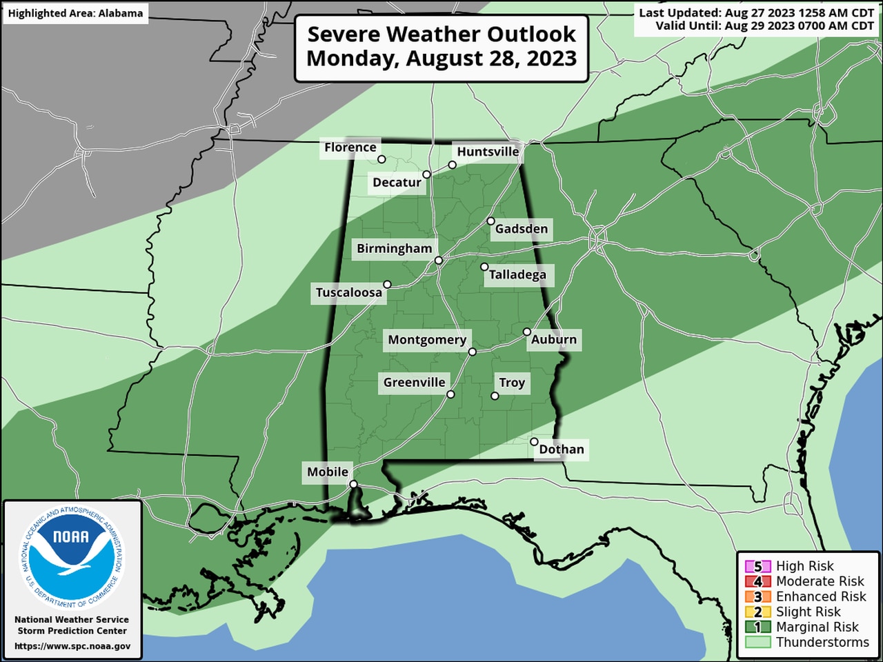
More storms will be possible on Monday as well. Here is the severe weather outlook for Monday:
Isolated severe storms will be possible on Monday in the areas in dark green.
In addition to the storms there will be more heat advisories today for all of Alabama — except for north Alabama. The National Weather Service said the heat index could climb as high as 110 in some spots this afternoon.
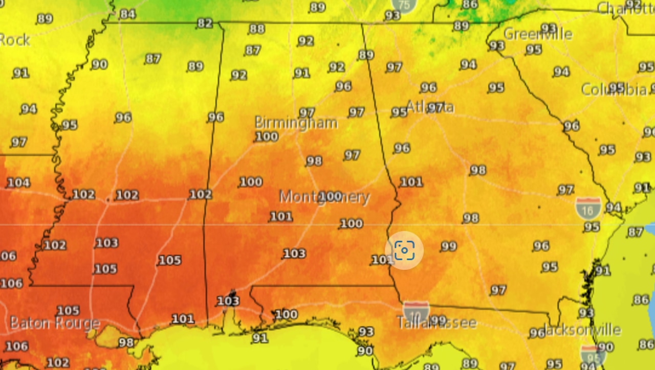
Air temperatures are expected to peak in the mid- to upper 90s this afternoon. Southwest Alabama will likely be the hottest spot, with highs in the 100s possible again.
Here is the high temperature forecast for today:

Here are today’s expected high temperatures.
Mobile reached an all-time record high temperature of 106 degrees on Saturday and had a record high temperature nearly every day last week.
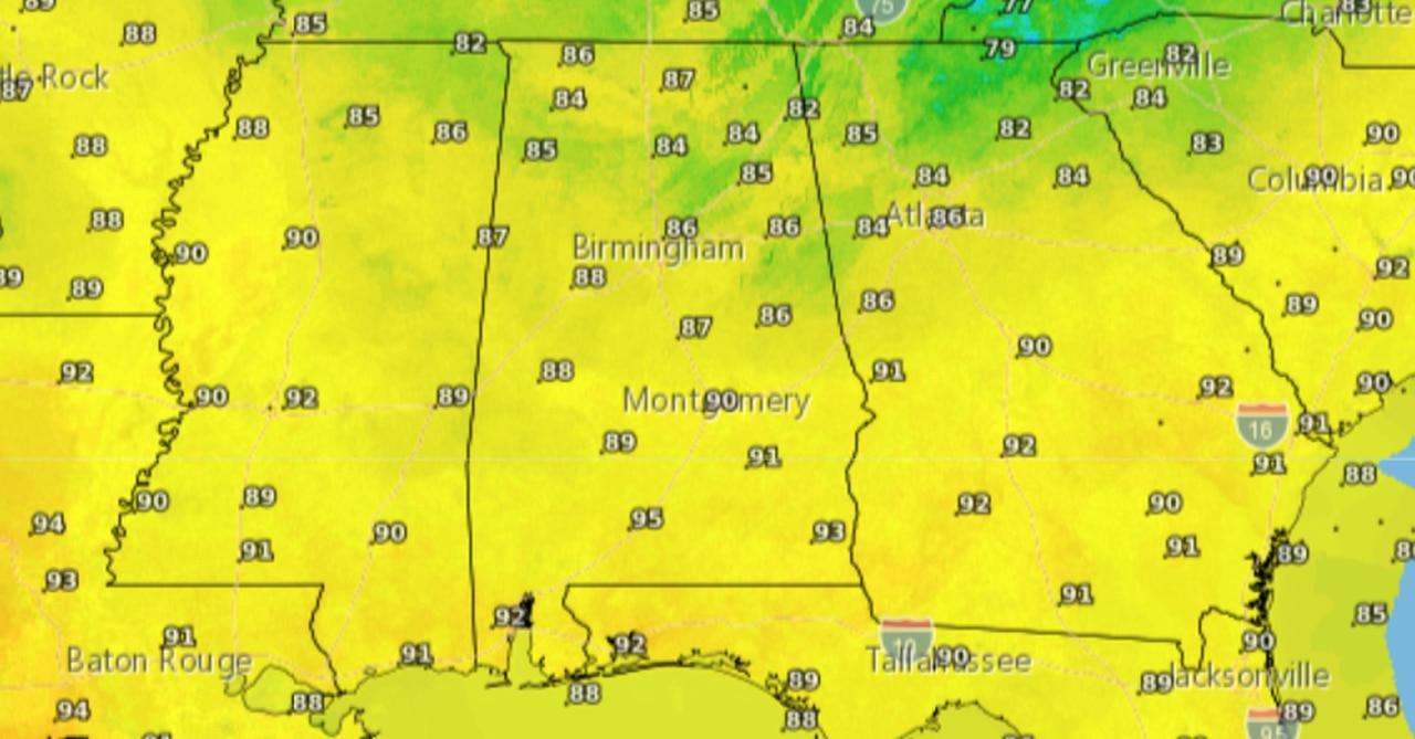
A break is coming from the heat as that front slowly sags southward through the state. By Tuesday high temperatures are expected to be more seasonable — in the 80s and low 90s.
Here is the forecast for Tuesday:

Highs on Tuesday will be in the 80s and low 90s.
Highs on Wednesday will be a degree or two “cooler” as the a tropical system — potentially Hurricane Idalia — moves across northern Florida and southern Georgia. The forecast track for the storm is still very uncertain, however, and those along the Florida and Alabama coasts should keep an eye on the forecast this week in case there are track changes.
