Hurricane Lee path shifts westward and may target Maine
Hurricane Lee remained a Category 3 hurricane with 115 mph winds on Wednesday morning and has begun to take an expected path northward, according to the National Hurricane Center.
Lee is expected to continue on that path and grow in size over the next few days, passing to the west of Bermuda and then heading in the direction of Maine and Atlantic Canada this weekend.
The hurricane center said the “risk of wind, coastal flooding and rain impacts (are) increasing for portions of New England and Atlantic Canada.” Forecasters said watches could be issued for parts of New England and Canada later today.
The hurricane center’s forecast track shows Lee possibly making landfall as a powerful but non-tropical storm late Saturday or early Sunday.
The forecast track has shifted some to the west overnight and now puts more of New England in play.
No matter where Lee makes landfall, wind, rain and heavy seas from the storm will spread far and wide because Lee has grown in size and is now a large hurricane.
Bermuda will experience some of what Lee has to offer on Thursday and Friday, and a tropical storm warning is in effect for the island. The center of the storm is expected to pass west of the island.
As of 7 a.m. CDT Wednesday, the center of Hurricane Lee was located 460 miles south-southwest of Bermuda and was moving northwest at 6 mph.
Lee had sustained winds of 115 mph, making it a Category 3 hurricane. The hurricane center said slow weakening is forecast during the next few days, “however Lee is likely to remain a large and dangerous hurricane into the weekend.”
Forecasters said tropical storm conditions are expected in Bermuda starting as soon as tonight or early Thursday. The island could get 1 to 2 inches of rain from the storm through Friday.
Waves from Lee continue to affect the Lesser Antilles, the British and U.S. Virgin Islands, Puerto Rico, Hispaniola, the Turks and Caicos Islands, the Bahamas and Bermuda and could cause deadly rip currents.
The hurricane center added that dangerous surf and rip currents are also affecting the Southeast U.S. and those conditions are expected to spread northward along the East Coast this week.
HURRICANE MARGOT
Hurricane Margot is no threat to land.
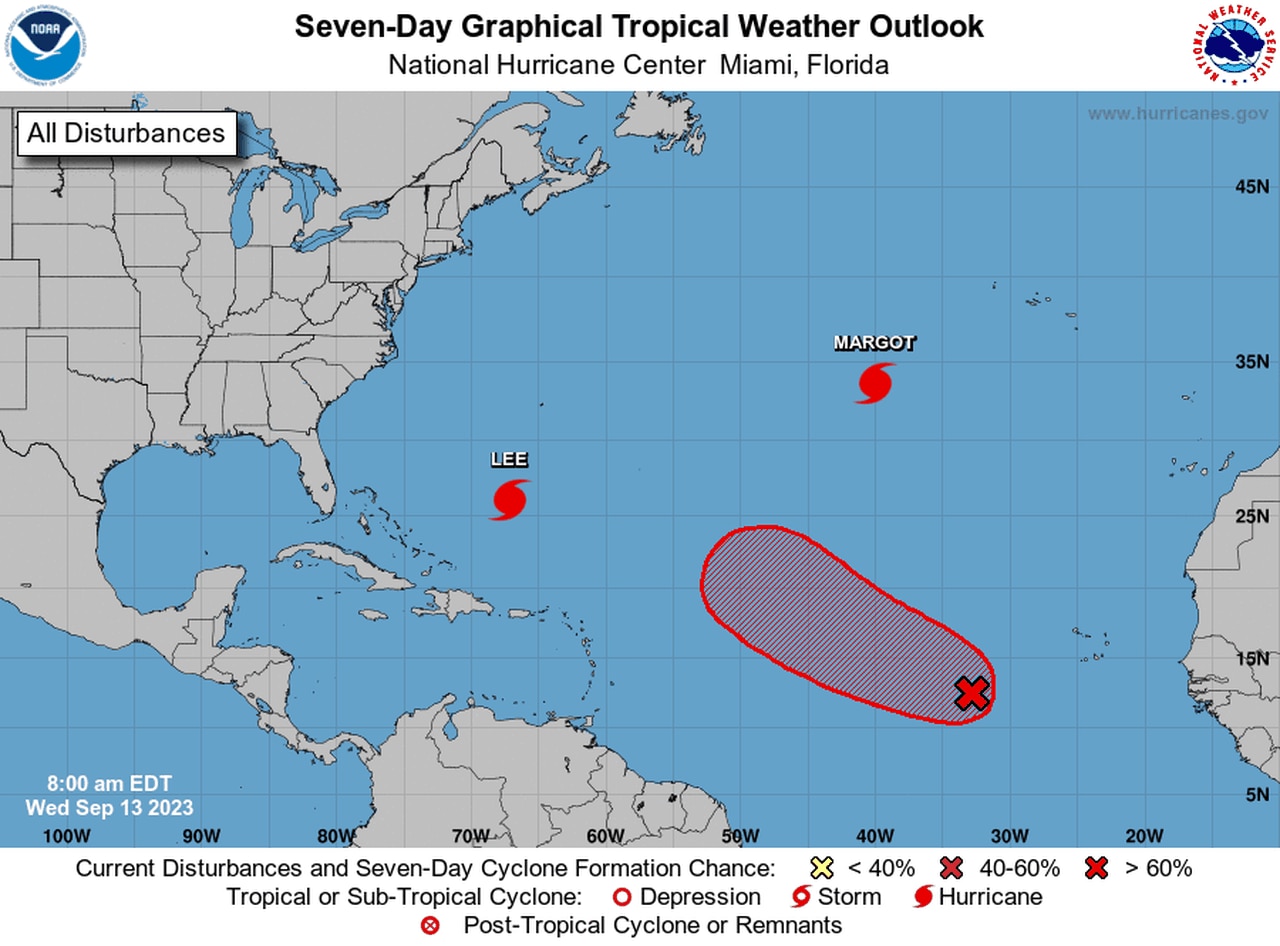
The hurricane center was also tracking Hurricane Margot in the central Atlantic on Wednesday.
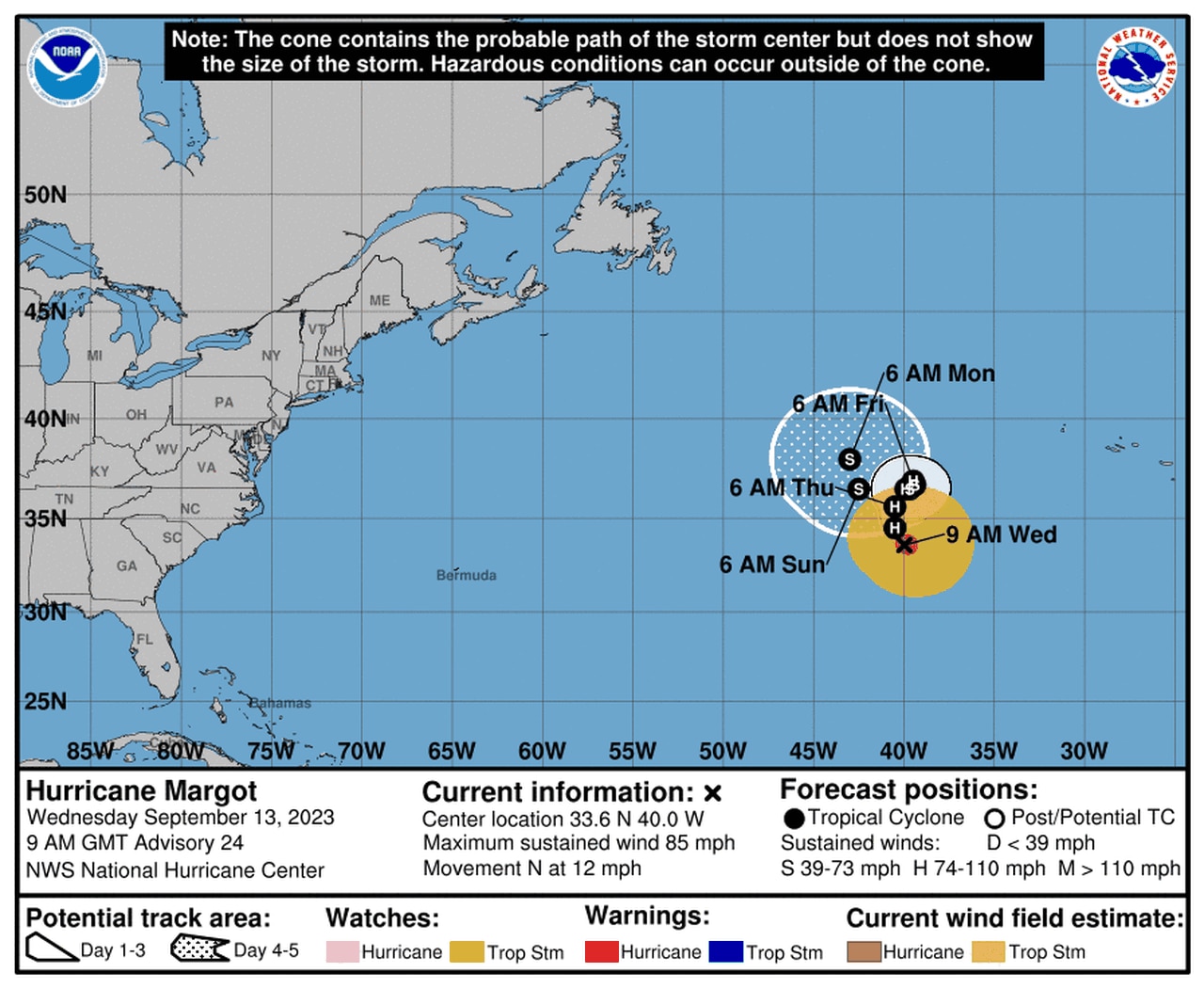
Margot had 85 mph winds on Wednesday, making it a Category 1 hurricane. Margot is no threat to land.
Forecasters think Margot will slow down and could stall or meander within weak steering currents into the weekend over the open Atlantic.
It’s expected to weaken over the next few days.
The hurricane center was also tracking a tropical wave in the central tropical Atlantic that could become a tropical depression this weekend. It’s expected to head to the west-northwest over the open Atlantic over the next few days and is no immediate threat to land.

There could be another tropical depression in the Atlantic by the weekend.
