Hurricane Lee path closing in on New England
Hurricane Lee was holding onto 85 mph winds on Friday morning as it continued on a path northward toward Canada and New England.
The National Hurricane Center said Lee was a huge storm and would bring tropical storm conditions to parts of coastal New England starting later this afternoon, which is a little sooner than expected.
On the forecast path Lee is expected to approach the coast of New England and Atlantic Canada today and Saturday. The hurricane center said Lee is then expected to turn toward the north-northeast and northeast and move across Atlantic Canada on Saturday night and Sunday.
As of 7 a.m. CDT Friday, the center of Hurricane Lee was located about 460 miles south-southeast of Nantucket, Mass., and was tracking northward at 16 mph.
Lee was a Category 1 hurricane on Friday. The hurricane center said Lee should maintain its strength through tonight. It will be moving into colder water on Saturday and that will cause it to transition to a post-tropical storm and weaken over the weekend.
However, forecasters cautioned that Lee is expected to be “a large and dangerous storm when it reaches eastern New England and Atlantic Canada.”
A hurricane watch remained in effect from Petit Manan Point, Maine, to the U.S./Canada border and for New Brunswick, Canada from the U.S border to Point Lepreau, including Grand Manan Island, as well as Nova Scotia from Digby to Medway Harbour.
A tropical storm warning continued for Bermuda as well as along the U.S. coast from Westport, Mass., northward to the U.S./Canada border; Martha’s Vineyard; Nantucket; New Brunswick from the U.S./Canada border to Fort Lawrence, including Grand Manan Island and Nova Scotia from Fort Lawrence to Point Tupper.
Lee will continue to churn up rough seas and cause potentially deadly rip currents along the U.S. East Coast through the weekend.
The hurricane could also bring 1 to 4 inches of rain to parts of eastern New England and Atlantic Canada.
ELSWHERE IN THE TROPICS
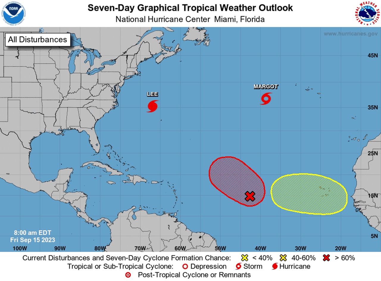
The hurricane center was tracking Lee, Tropical Storm Margot and two tropical waves on Friday.
The hurricane center continued to track Margot, which has weakened to a tropical storm in the central Atlantic and was no direct threat to land.
The next potential storm was far to the south of Margot and could become a tropical depression soon as it heads generally to the northwest. It’s too soon to say if that system could affect the U.S. or Bermuda, but hurricane watchers were keeping a close eye on it on Friday.
Another tropical wave was expected to move off Africa’s west coast next week and will also be tracked for potential development.
The Atlantic hurricane season is still in full swing and won’t end until Nov. 30.
