Hurricane Idalia: Will it affect Alabama?
Hurricane Idalia was on a path for landfall on Florida’s Big Bend.
The National Hurricane Center is expecting Idalia to become a Category 3 (or possibly stronger) storm by late tonight or early Wednesday — just before it makes landfall on Florida’s Gulf Coast on Wednesday morning.
No part of Alabama is in the forecast cone, and the center of the storm is expected to move to the east of the state, according to forecasters.
But the eastern part of the state — especially southeast Alabama — will be close enough to feel some of the effects.
Winds will definitely be breezy, and rain could be heavy at times, but the worst winds from Idalia are expected to be confined to Florida and Georgia and not Alabama, according to National Weather Service forecasts.
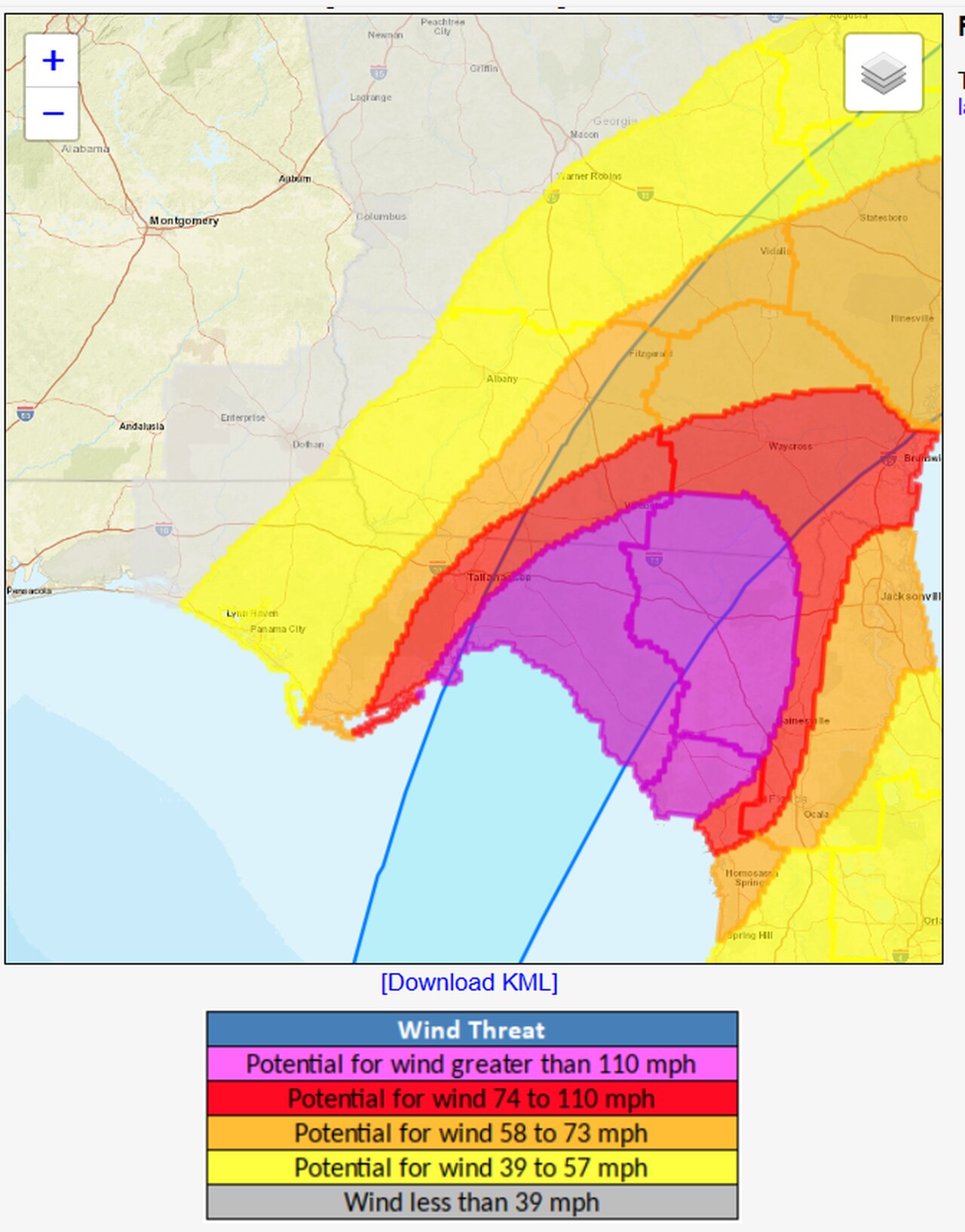
Here’s the wind outlook:
Southeast Alabama is expected to avoid the worst of Idalia’s winds as of Tuesday night.
This map shows that only extreme southeast Alabama has the potential to see winds of 39 mph to 57 mph. The rest of southeast Alabama is expected to have winds of less than 39 mph.
Southeast Alabama could see some heavy rain, however. This map shows that the southeast corner of the state, around the Dothan area, has the potential to see moderate flooding rain:
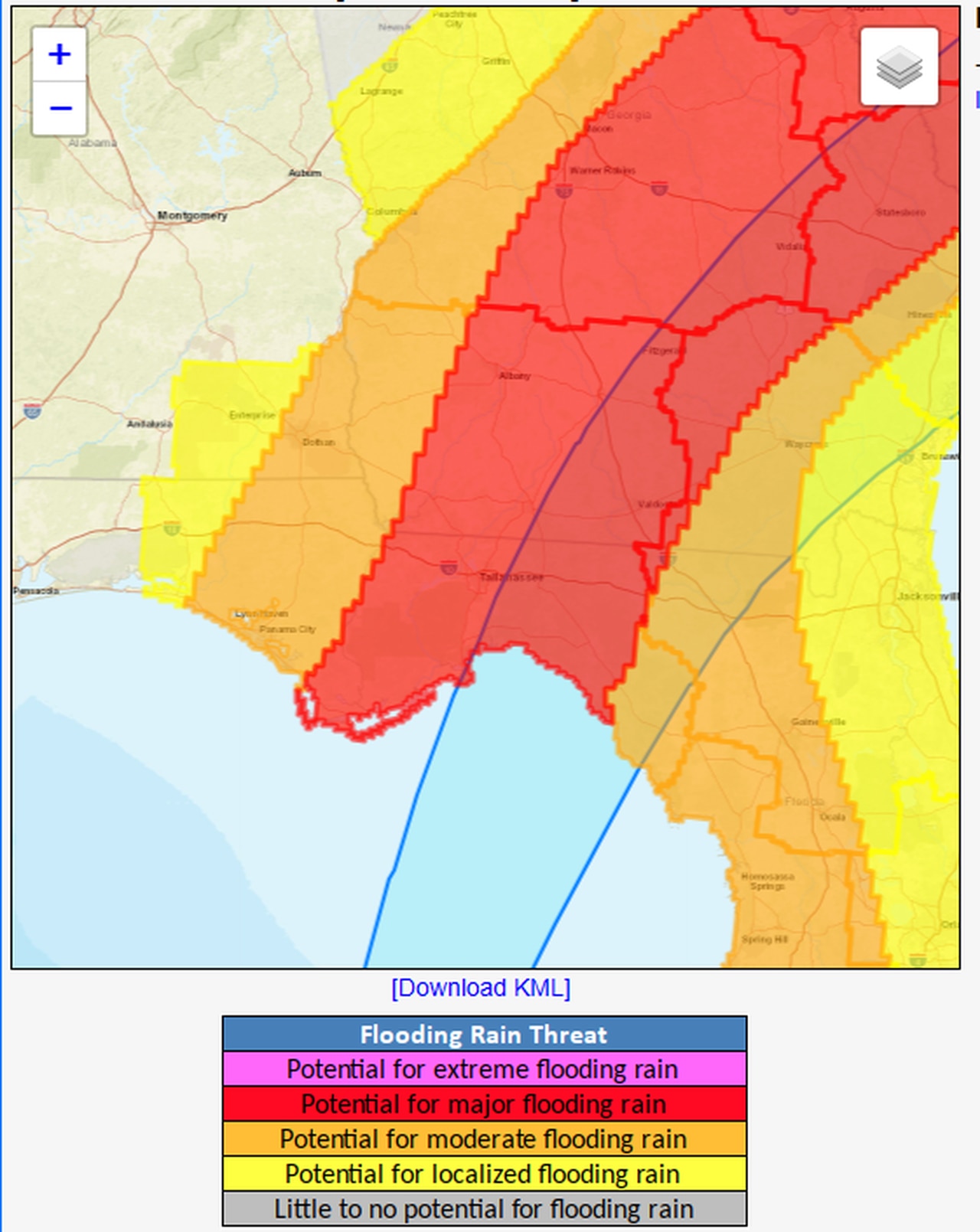
A look at the flood risk from Idalia.
Coastal Alabama — or southwest Alabama — will have to be on alert for rip currents and rough seas. There will be a high risk for rip currents through Thursday night, and there is also a high surf warning that will be in effect from 1 a.m. Wednesday until 1 a.m. Thursday. The weather service said seas could be 8 to 10 feet as Idalia draws closer.
The National Weather Service in Mobile said beachgoers should stay out of the water for the next few days until seas lower.
The weather service in Birmingham was expecting areas in the southeast part of central Alabama to have increased rain chances tonight through Wednesday, and winds could be breezy at times. The highest gusts are expected to be lower than 30 mph, however.
Alabama could also get some rain and storms from Idalia as it passes to the east, but the risk for tornadoes is expected to stay on the northern and eastern side of the center of circulation.