Huntsville is repaving 108 streets: Is yours on the list?
Politics aside, perhaps nothing unites like repaving roads. Potholes are not liberal or conservative and everyone loves a repaved road – especially when it’s a road they frequently travel.
And while road maintenance has always been a priority for Huntsville leaders, that priority has gotten even higher in recent years and culminating with a record $19.5 million allocated for road work in the city’s 2023 budget.
Related: Huntsville city council’s top budget request: More money for roads
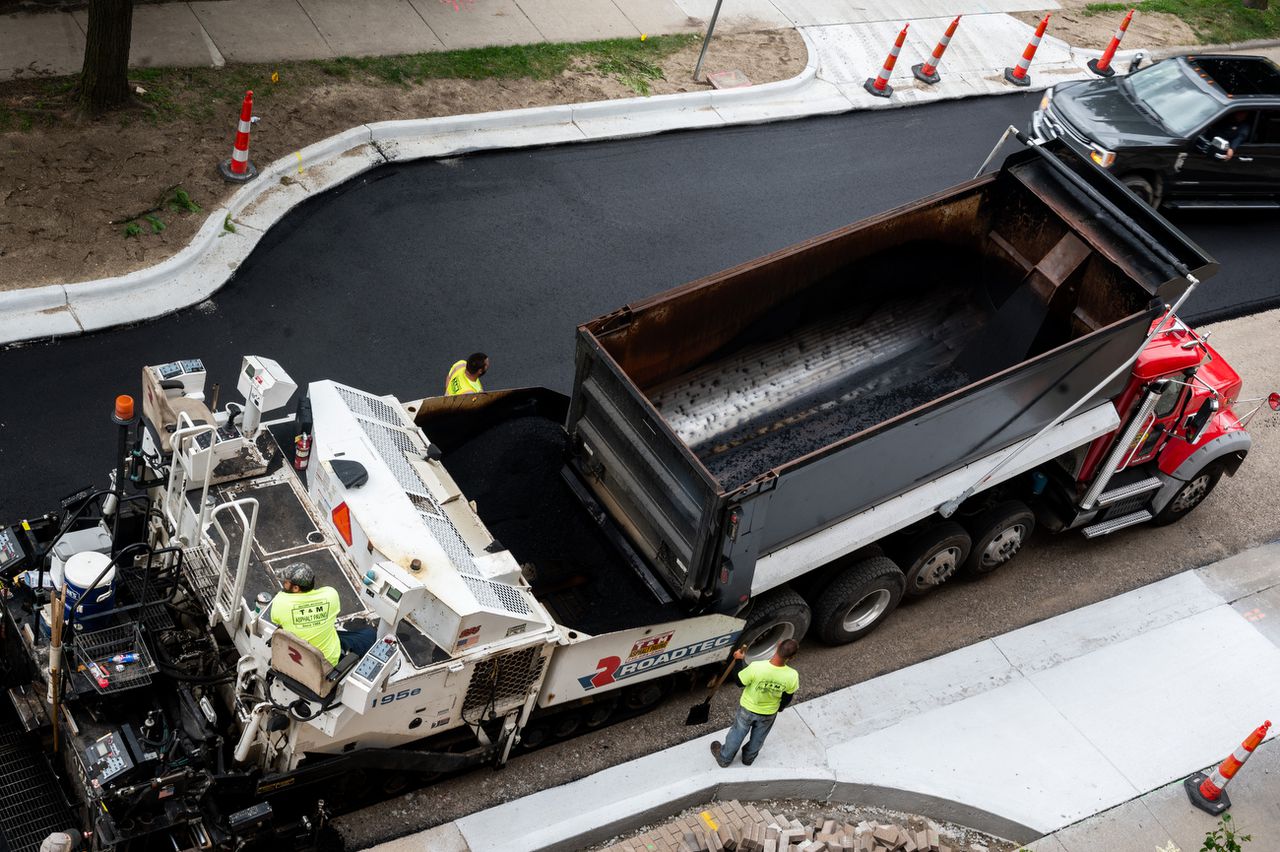
And now it’s time for the city to start spending some of that money. The city council last week approved a $8.99 million contract with SJ&L General Contractors to resurface 108 residential streets across the city.
The roads were chosen through a continuous process of evaluating the quality of each road. City leaders have also said that road resurfacing is a project that can only go as quickly as the contractors hired to do the job. The contract for the latest project calls for all resurfacing to be done within a year.
Here is the list of roads included in the contract:
District 1
Argyle Road from Mastin Lake Road to Merry Oaks Drive (distance of 1,125 feet)
Beard Street from Poplar Avenue to Beard Street (2,510 feet and includes Sitka Court, Attu Court and Tundra Court)
Blue Spring Circle from Blue Spring Road to cul-de-sac (370 feet)
Boswell Drive (3,900 feet)
Bridge Road from Mountain Park Circle to Blue Spring Road (1,650 feet)
Chalmers Avenue from Reynolds Drive to Kavanaugh Drive (1,000 feet)
Colfax Road from Winchester Road to Matic Road (2,800 feet)
Crossover Lane from Fortune Drive to Higdon Road (400 feet)
Crouse Drive from end of street to Matic Road (1,050 feet)
Delaware Boulevard from Meridian Street to North Plymouth Road (600 feet)
Delaware Circle (500 feet)
Iris Lane from Lantana Way to East Arbor Drive (550 feet)
North Helena Drive from West Helena Drive to East Helena Drive (650 feet)
Offutt Circle from Stringfield Road to cul-de-sac (600 feet)
Skylab Drive from Von Braun Drive to Nick Fitcheard Road (1,650 feet)
Treymore Avenue from Mastin Lake Road to Countess Street (1,200 feet)
Yeager Court from Skylab Drive to cul-de-sac (600 feet)
District 2
Bankhill Circle from cul-de-sac to Ada Drive (509 feet)
Birchwood Drive from end of street to Dellbrook Drive (1,500 feet)
Chapman Avenue from Gladstone Drive to Maysville Road (1,630 feet)
Christian Lane from Gladstone Drive to Quietdale Drive (1,680 feet)
Cottage Street from end of street to Barrell Avenue (870 feet)
Dotson Drive from Drake Avenue to Toney Drive (2,700 feet including dead end on south side of Toney Drive)
Dug Hill Road from third city limit sign to second city limit sign (2,400 feet)
Dug Hill Road from first city limit sign to city limits (7,100 feet)
Goldsmith Street from Pratt Avenue to McCullough Avenue (1,130 feet)
Greenslope Trail from end of street to Spicewood Trail (1,650 feet)
Joseph Circle (980 feet)
King Avenue from Meridian Street to Cottage Street (450 feet)
Lenlock Circle from end of street to Lenlock Drive (570 feet)
McClung Drive from California Street to Owens Drive (3,640 feet)
Melbourne Avenue from Bide-A-Wee Drive to Peck Road (2,270 feet)
Noble Circle from end of street to Noble Drive (330 feet)
Oakwood Avenue from Andrew Jackson Way to Maysville Road (3,780 feet)
Pale Dawn Place from cul-de-sac to Carrington Boulevard (4,800 feet)
Pettus Circle from end of street to Pettus Drive (360 feet)
Preston Ridge Drive from end of street to Broad Armstrong Drive (2,100 feet)
Red Mile Court from end of street to Calumet Drive (470 feet)
Sandusky Street from Gaslight Way to Darlington Road (1,450 feet)
Slalom Run from Barefoot Circle to Terry Drake Road (1,500 feet)
Springhouse Road from end of street to Carl T. Jones Drive (4,160 feet)
District 3
Andromedea Road from Chicamauga Trail to end of street (400 feet)
Ben Giles Drive from Memorial Parkway to end of street (416 feet)
Blackbird Drive from Skylark Drive to end of street (1,020 feet)
Bleu Drive from Shades Road to Todd Mill Road (750 feet)
Boulevard South from Benaroya Lane to end of street (1,400 feet)
Cap Adkins from Hobbs Island Road to Hegla Burrow Road (8,650 feet)
Chimney Hollow Trail from Astalot Drive to end of street (950 feet)
Colchester Avenue from Saint Alban Boulevard to end of street (550 feet)
Earlwood Drive from Southhurst Drive to end of street (1,000 feet)
East Tupelo Drive from Jessamine Lane to end of street (600 feet)
Ells Road from Yorkshire Drive to Oak Dairy Lane (3,550 feet)
Ensley Drive (3,300 feet)
Epping Place from Greentree Trail to end of street (160 feet)
Hearthstone Circle from Wynterhall Road to cul-de-sac (200 feet)
Kingston Court from Mathis Drive to end of street (250 feet)
Lantern Walk SE from Wynterhall Road to Chaney Thompson Road (1,200 feet)
Marinawoods Drive from Memorial Parkway to Hobbs Road (1,280 feet)
Mohican Drive from Chicamauga Trail to end of street (175 feet)
Seasons Court from Wynsom Drive to end of street (240 feet)
Sutton Road from U.S. 431 to Old Big Cove Road (2,700 feet)
Thornmor Drive (875 feet)
Valley Lane from Weatherly Road to end of street (2,100 feet)
Villaret Drive from Southpark Boulevard to end of street (7,000 feet)
Weatherly Road from Bailey Cove Road to Valley Lane (2,900 feet)
District 4
Avery Avenue from Binderton Place to McCalley Place (830 feet)
Arthur Street from Karter Street to Saundralane Drive (1,570 feet)
Billie Watkins Street from Marsheutz Avenue to Bob Wallace Avenue (1,360 feet)
Brickell Road from end of street to Holmes Avenue (2,260 feet)
Brown Street from end of street to Clinton Avenue (760 feet)
Central Avenue from Whitesburg Drive to California Street (700 feet)
Clayrest Drive from end of street to Henderson Road (1,200 feet)
Dyshell Drive from Judith Lane to Jordan Lane (770 feet)
Fairacres Road from Hale Drive to Bob Wallace Avenue (4,250 feet)
Foster Avenue from Eunice Street to Penny Street (720 feet)
Gleneagles Drive from Balmoral Drive to end of street (605 feet)
Hermitage Wood Drive from Marsh Avenue to end of street (1,000 feet)
Hillcrest Court (608 feet)
Hunt Drive from Brickell Road to Speake Road (1,235 feet)
Langford Avenue from Jackson Street to Brown Street (1,200 feet)
Lilac Circle from end of street to Buttercup Drive (630 feet)
McClung Drive from Adams Street to California Street (2,000 feet)
North Rose Drive from Ninth Avenue to Pine Avenue (1,550 feet)
Oak Glen Terrace from Squaw Valley Drive to end of street (450 feet)
Pepperwood Circle from Eagletree Lane to cul-de-sac (338 feet)
Rainey Drive from Crestwood Drive to end of street (150 feet)
Roland Road from Newby Road to First Street (755 feet)
Tulip Lane from end of street to Lilac Circle (210 feet)
Westbury Drive from Chadwell Road to Whitesburg Drive (2,030 feet)
West Ferry Way from Leeman Ferry Road to end of street (733 feet)
West Oak Way (600 feet and includes both cul-de-sacs)
Woodridge Street from Westbury Drive to Jones Valley Drive (1,787 feet)
District 5
Bristol Court from Barren Fork Boulevard to end of street (170 feet)
Cotton Row from Sparkman Drive to end of street (1,840 feet)
Daugette Drive from Dailey Terrace to Calvert Road (1,850 feet)
Deer Bridge Drive from Willow Bluff Drive to end of street (800 feet)
Evangel Drive from University Drive to Executive Drive (1,350 feet)
Foxcroft Terrace from Shellbrook Drive to cul-de-sac (170 feet)
Heathland Drive from University Drive to cul-de-sac (1,400 feet)
Hollyknoll Place from Shellbrook Drive to cul-de-sac (160 feet)
Kendall Terrace from Daugette Drive to Rutledge Drive (600 feet)
Laracy Drive (1,470 feet)
Priscilla Lane from Pamela Drive to end of street (880 feet)