How cold was it Sunday morning? A warmup starts today
Alabama woke up to another frigid morning on Sunday, but this could be the coldest morning the state will experience for a while.
Temperatures bottomed out well below freezing on Sunday morning across the state. One of the lowest temperatures reported to the National Weather Service was 9 degrees in Haleyville.
But cold even reached down into south Alabama, with Mobile and Dothan both reaching the low 20s overnight.
The National Weather Service in Huntsville warned that roads were still icy and travel still hazardous in many spots in north Alabama, which still has not had a chance to rise above freezing in many spots. But that could change later today.
Here are some unofficial low temperatures from midnight until 6 a.m. Sunday from the National Weather Service:
Alexander City: 16 degrees
Anniston: 13 degrees
Auburn: 15 degrees
Birmingham: 11 degrees
Decatur: 10 degrees
Demopolis: 17 degrees
Dothan: 22 degrees
Eufaula: 18 degrees
Evergreen: 20 degrees
Gadsden: 10 degrees
Haleyville: 9 degrees
Huntsville: 11 degrees
Mobile: 24 degrees
Montgomery: 18 degrees
Muscle Shoals: 12 degrees
Ozark: 22 degrees
Prattville: 17 degrees
Sylacauga: 14 degrees
Talladega: 11 degrees
Troy: 20 degrees
Tuscaloosa: 15 degrees
The chance for a thaw in much of north Alabama should arrive today, with the beginnings of a warmup that will put the state back into the 60s and 70s in the next few days.
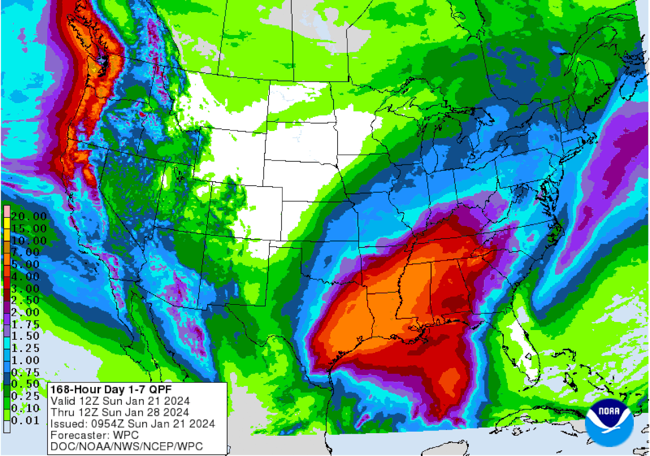
The warmer weather will also bring good rain chances along with it, and much of the state has the potential to see several inches of rain — possibly 4 or even 5 inches in some spots — through the week, according to forecasters.
Here’s the seven-day precipitation outlook from the Weather Prediction Center:
Here is the outlook for precipitation for the next week. Three to 4 inches of rain — or maybe more — will be possible next week in parts of Alabama.WPC
So far no severe weather is expected.
Sunday will be slightly warmer, with highs expected to still only reach the 30s in north Alabama. However, many areas are forecast to finally rise above the freezing point. (Sunday’s forecast highs are at the top of this post.)
Tonight into Monday morning will be cold, but not nearly as cold as the past few nights.
Here are the forecast lows for Sunday night into Monday morning:
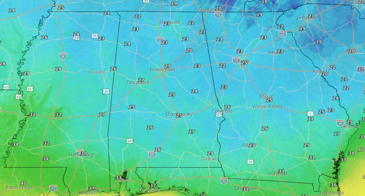
Here are the low temperatures expected from Sunday night into Monday morning.NWS
The warmup really gets going on Monday, with highs in the upper 40s and 50s expected statewide. South Alabama will be near the 60s.
Monday’s highs:
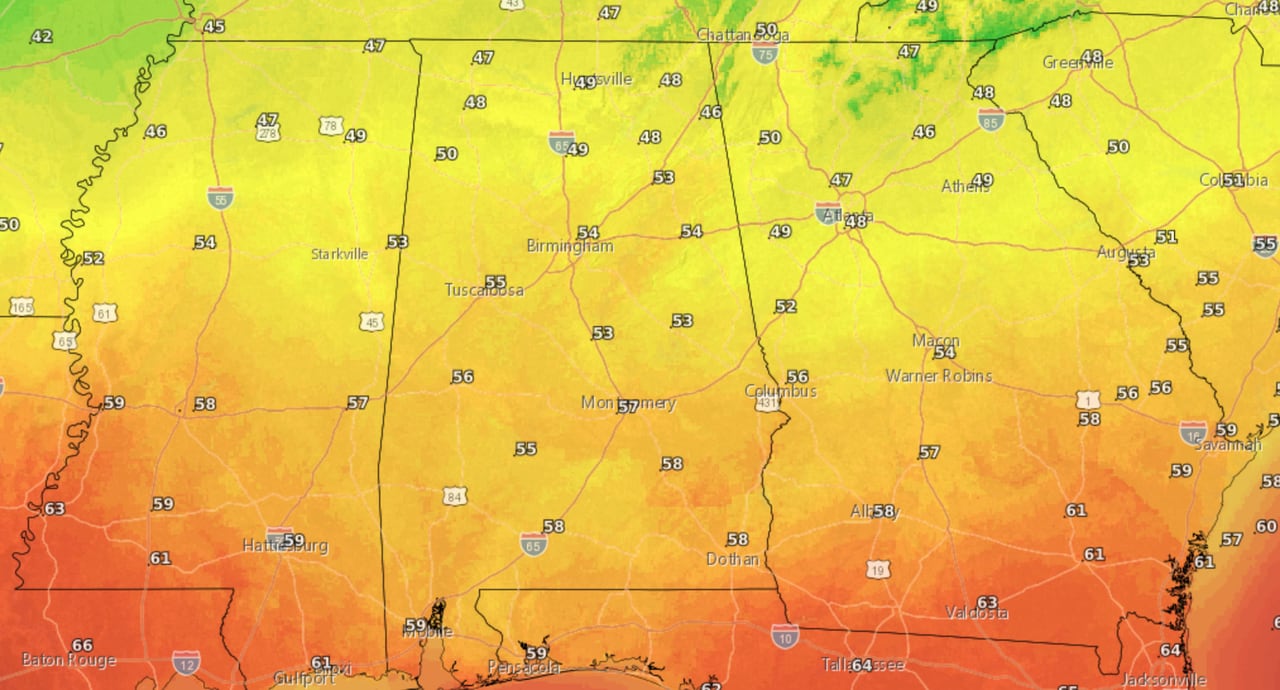
Here are the forecast highs for Monday.NWS
The warmer temperatures will really be noticeable Monday night into Tuesday morning, only reaching the upper 30s and 40s (with some possible 50s in south Alabama):
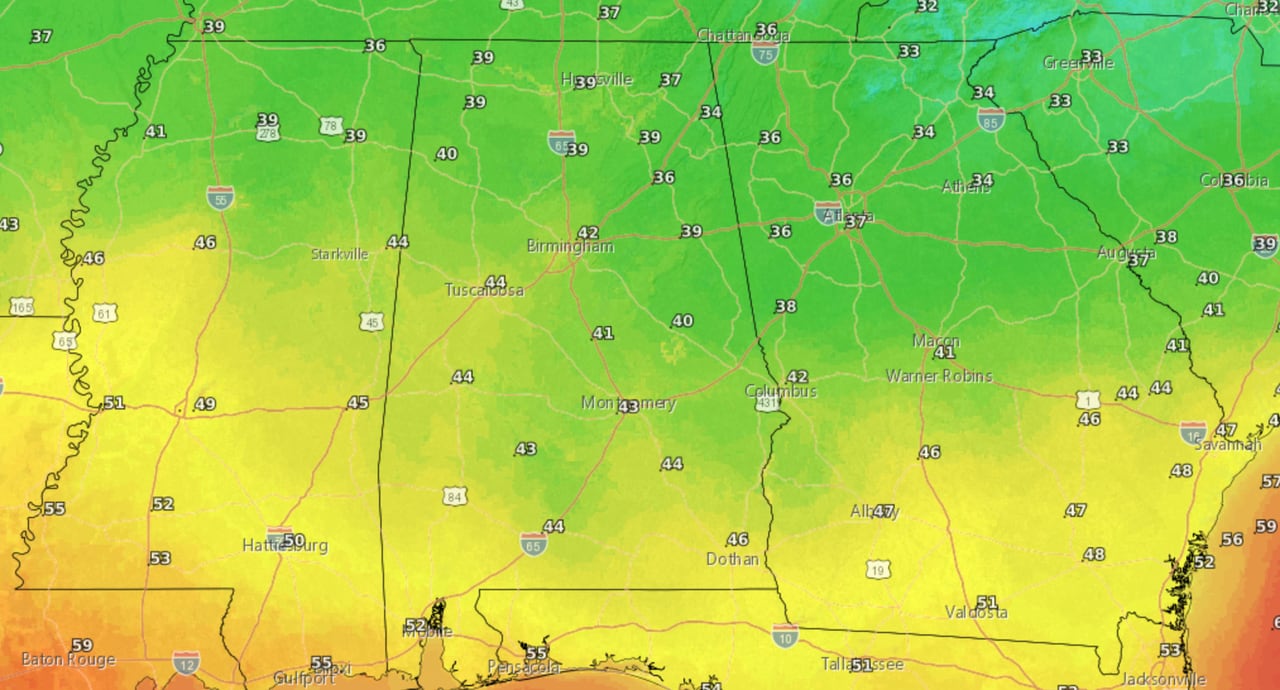
Here are lows expected from Monday night into Tuesday morning.NWS
Some of the warmest temperatures of the week will arrive by Wednesday, with highs reaching the 60s and 70s:
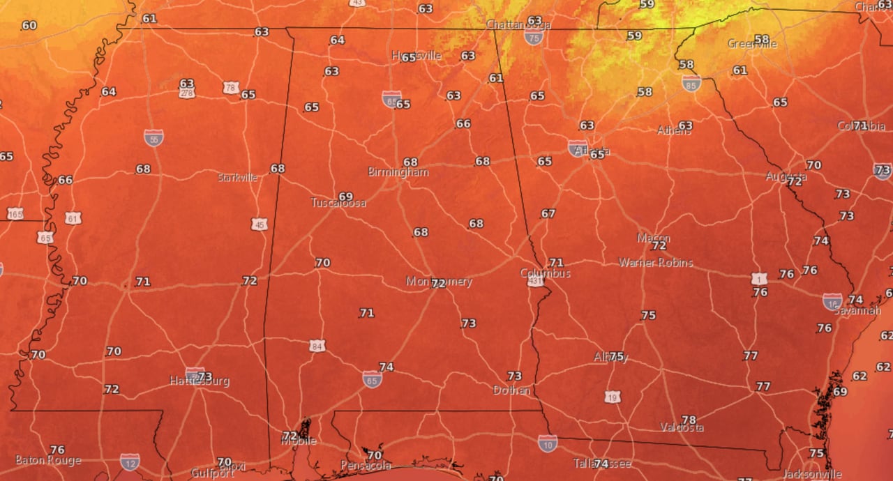
Here are Wednesday’s forecast high temperatures.NWS
The warmer weather is expected to last into Friday, according to the weather service.