How cold was it last night? One more frigid night ahead
Alabama woke up to very cold temperatures on Saturday morning, and more are on the way tonight.
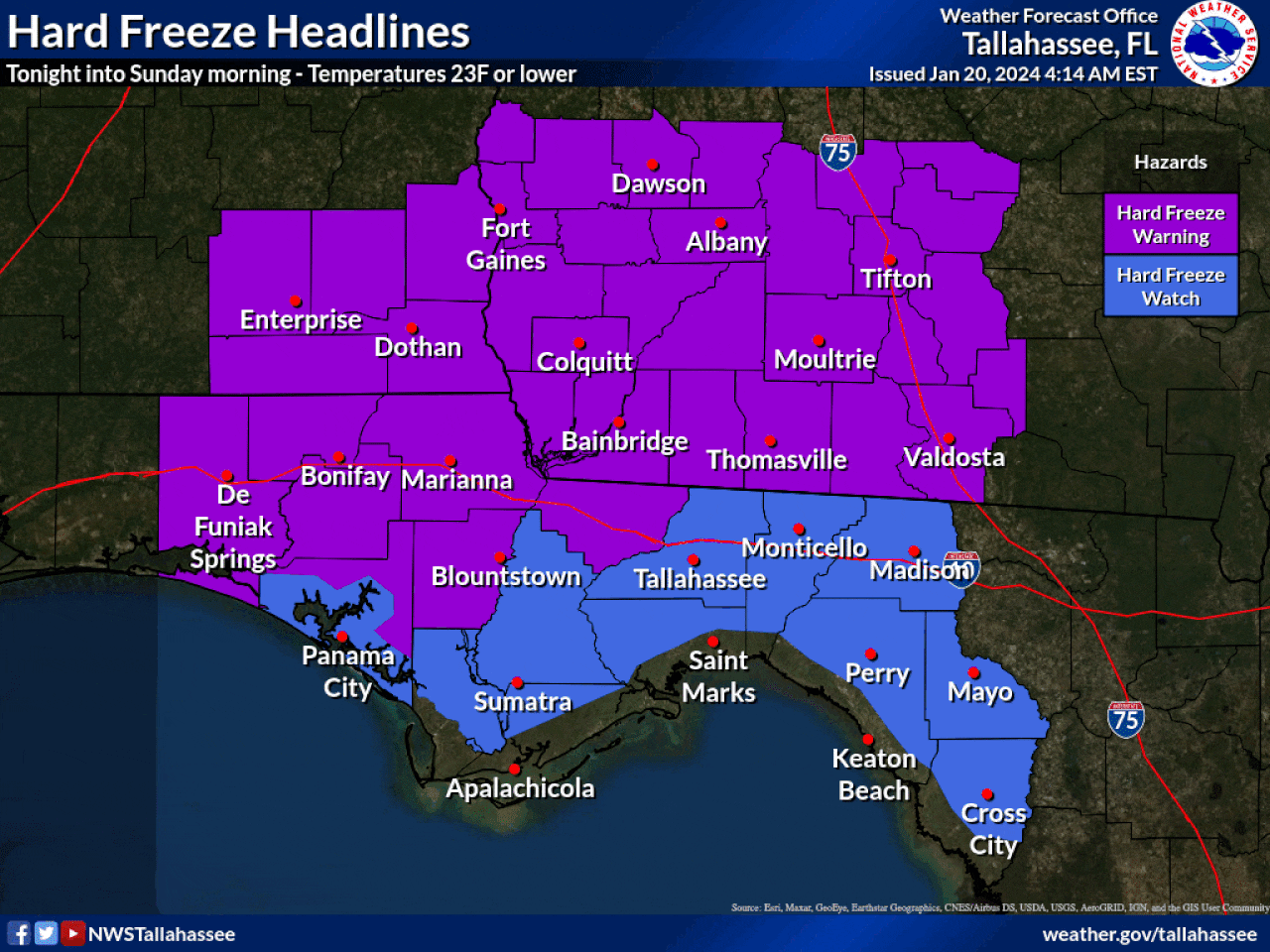
Much of the state will be under hard freeze warnings and wind chill advisories into Sunday, according to the National Weather Service.
As of 6 a.m. Saturday it was frigid across the state — yet not quite as cold as the single-digit temperatures parts of the state experienced on Wednesday.
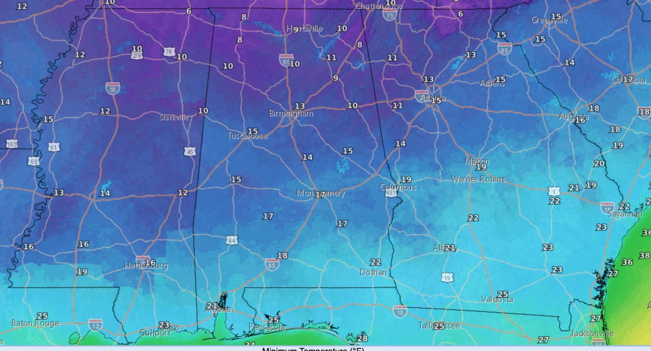
However, tonight promises to very, very cold again, according to weather service forecasts. Lows overnight could fall into the single digits in north Alabama, with temperatures in the teens possible for much of central Alabama and part of south Alabama. Wind chills for a good part of the state will be at zero or below.
Here are the forecast low temperatures for tonight into Sunday morning:
Here are the forecast overnight low temperatures.NWS
Just how cold was it overnight?
Here are some unofficial low temperatures from National Weather Service observations (from midnight until 6 a.m. Saturday. (There’s the possibility the temperature could still drop a bit this morning):
Alexander City: 21 degrees
Anniston: 19 degrees
Auburn: 21 degrees
Birmingham: 18 degrees
Decatur: 14 degrees
Demopolis: 21 degrees
Dothan: 28 degrees
Eufaula: 27 degrees
Evergreen: 26 degrees
Gadsden: 17 degrees
Greenville: 22 degrees
Haleyville: 12 degrees
Huntsville: 14 degrees
Mobile: 28 degrees
Montgomery: 23 degrees
Muscle Shoals: 14 degrees
Ozark: 28 degrees
Selma: 22 degrees
Sylacauga: 19 degrees
Talladega: 18 degrees
Troy: 27 degrees
Tuscaloosa: 19 degrees
But relief from the cold is coming. The weather service thinks temperatures will warm up some on Sunday. There will be another cold night on Sunday night into Monday, though not as cold as this weekend.
Lows on Sunday night into Monday morning will be mostly in the 20s across Alabama:
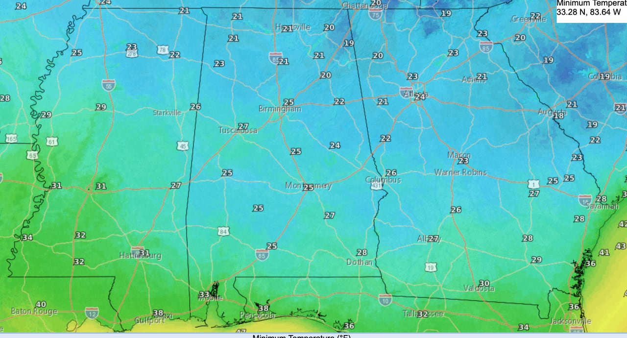
Overnight lows from Sunday night into Monday morning.NWS
By Monday temperatures begin to warm up in earnest. Here are Monday’s highs:
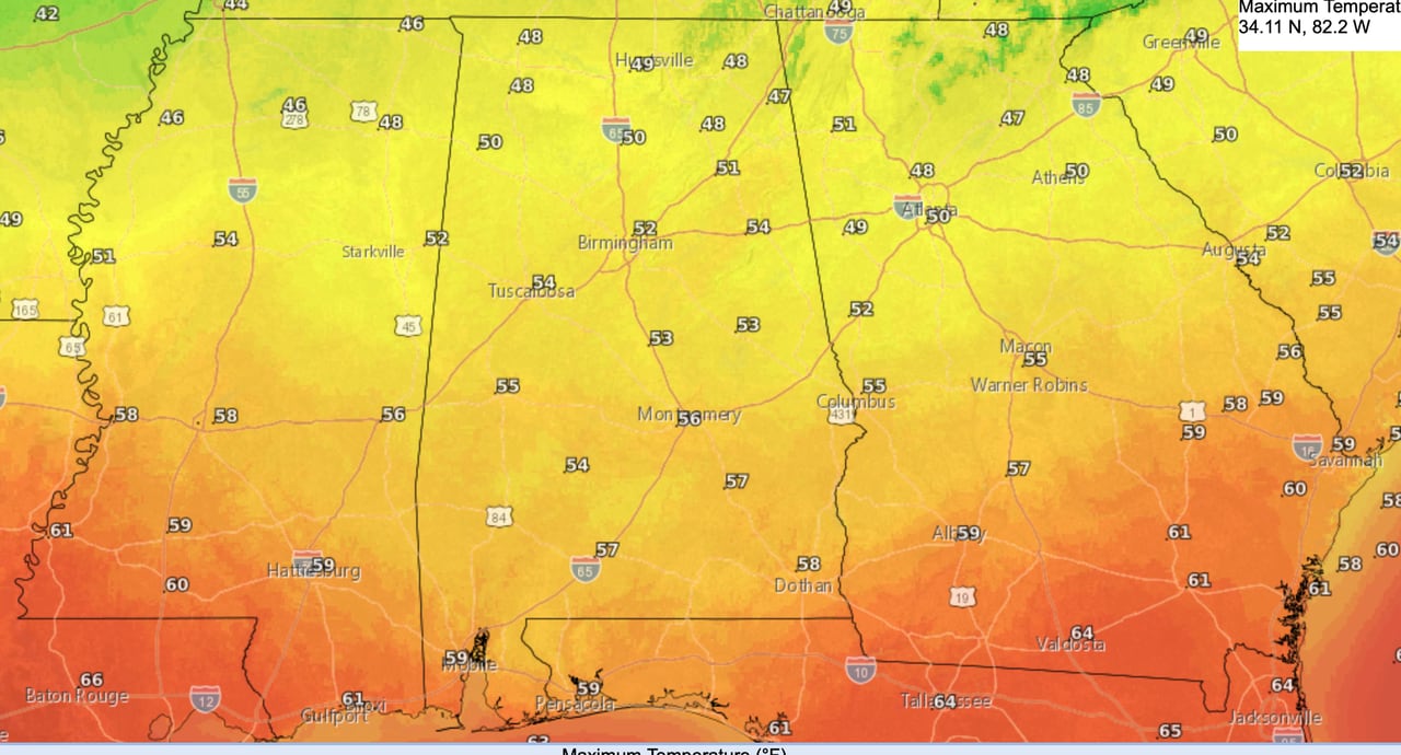
Forecast highs for Monday.NWS
By Tuesday much of Alabama will have highs in the 60s. Here’s the high temperature forecast for Tuesday:
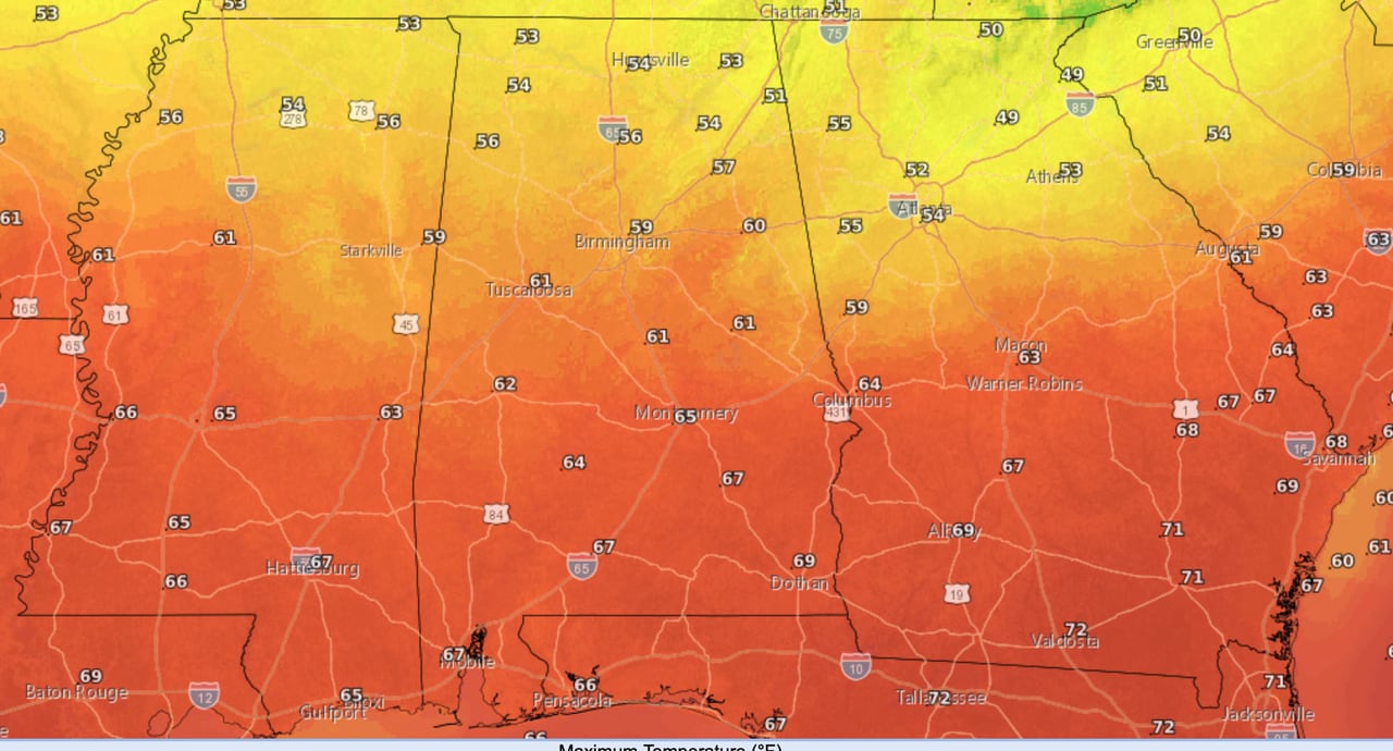
Much of Alabama will have temperatures in the 60s by Tuesday. The forecast is above.NWS
Low temperatures by Tuesday will only fall into the 40s across Alabama, according to the weather service.
By Wednesday all of Alabama is forecast to have highs in the 60s and even 70s for south Alabama:
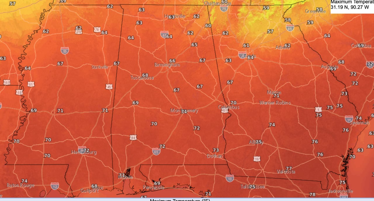
Highs in the 60s and 70s are expected by Wednesday.NWS
Highs in the 60s and 70s will be the story through at least the end of the work week.
With the warmer weather will come increased chances for rain. The weather service said rain chances will increase on Tuesday and last through at least Friday.
Multiple rounds of rain will be possible, along with some thunderstorms. However, the Storm Prediction Center is not forecasting any severe weather for Alabama next week so far.
However, there could be enough rain to lead to some flooding concerns. The weather service said 2 to 5 inches of rain will be possible next week.
Here’s the seven-day precipitation outlook from NOAA’s Weather Prediction Center:
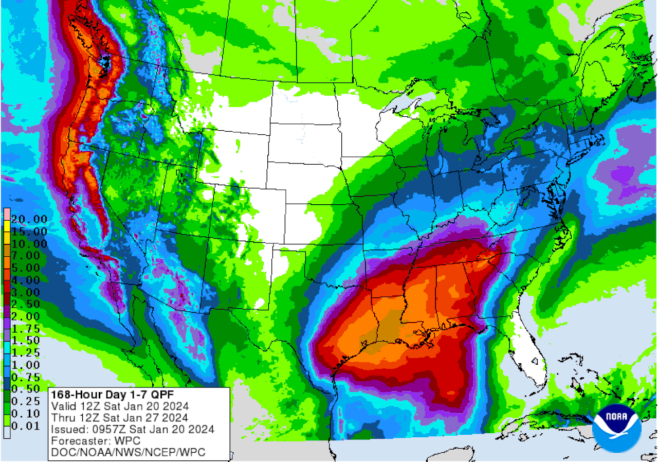
All of Alabama could see several inches of rain through the next seven days, with the bulk of it coming from Tuesday until Friday next week.WPC
Here’s a look at what the National Weather Service offices across the state were expecting on Saturday:
NORTH ALABAMA
CENTRAL ALABAMA
SOUTH ALABAMA
Southeast Alabama outlookNWS