Here comes the rain: Several inches in the forecast
Rain was in the forecast on Wednesday across Alabama, and it could add up to several inches by Saturday.
Rain was expected to spread across Alabama today, and it could be heavy at times through Thursday.
The National Weather Service has expanded flood watches to include more of the state. Those will go into effect at noon today and last into Thursday.
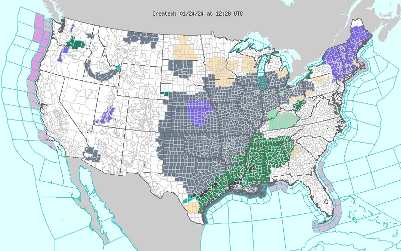
Here is a look at the flood watches covering Alabama on Wednesday (in green):
Much of Alabama will be under flood watches through Thursday. The counties in the watches are in green.NWS
Rain and thunderstorms will be possible in multiple rounds through Saturday. Some areas could get up 5 or 6 inches, which could cause flash flooding.
A few strong storms will also be possible in south Alabama. NOAA’s Storm Prediction Center has a Level 1 out of 5 severe weather risk in place for parts of south Alabama both today and on Thursday. No severe weather is expected in the rest of Alabama today and Thursday.
A Level 1 risk means that isolated severe storms will be possible.
Today’s severe weather outlook:
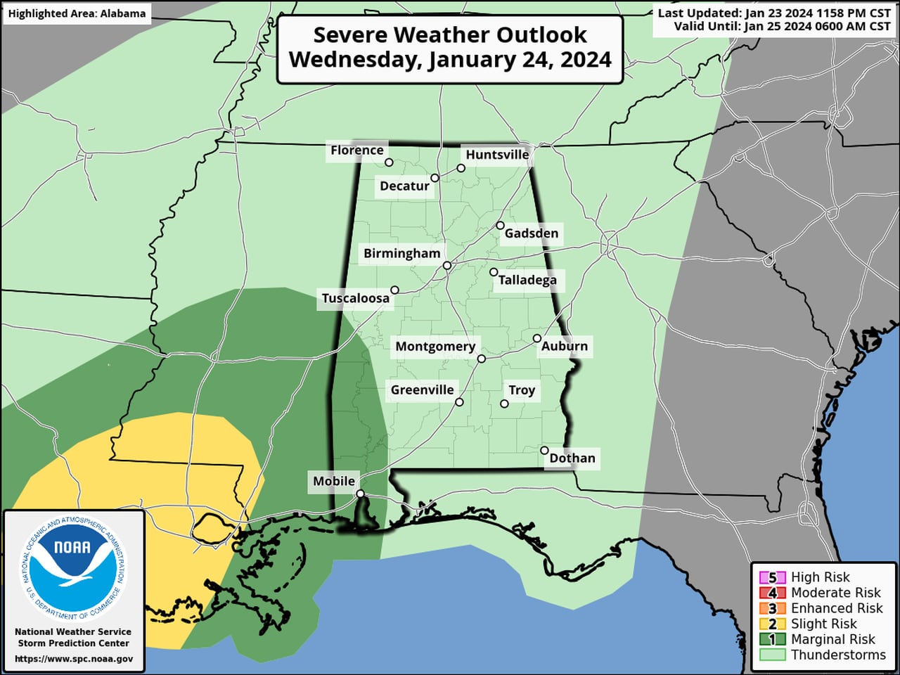
Isolated severe storms will be possible on Wednesday in the areas in dark green.SPC
Thursday’s severe weather outlook:
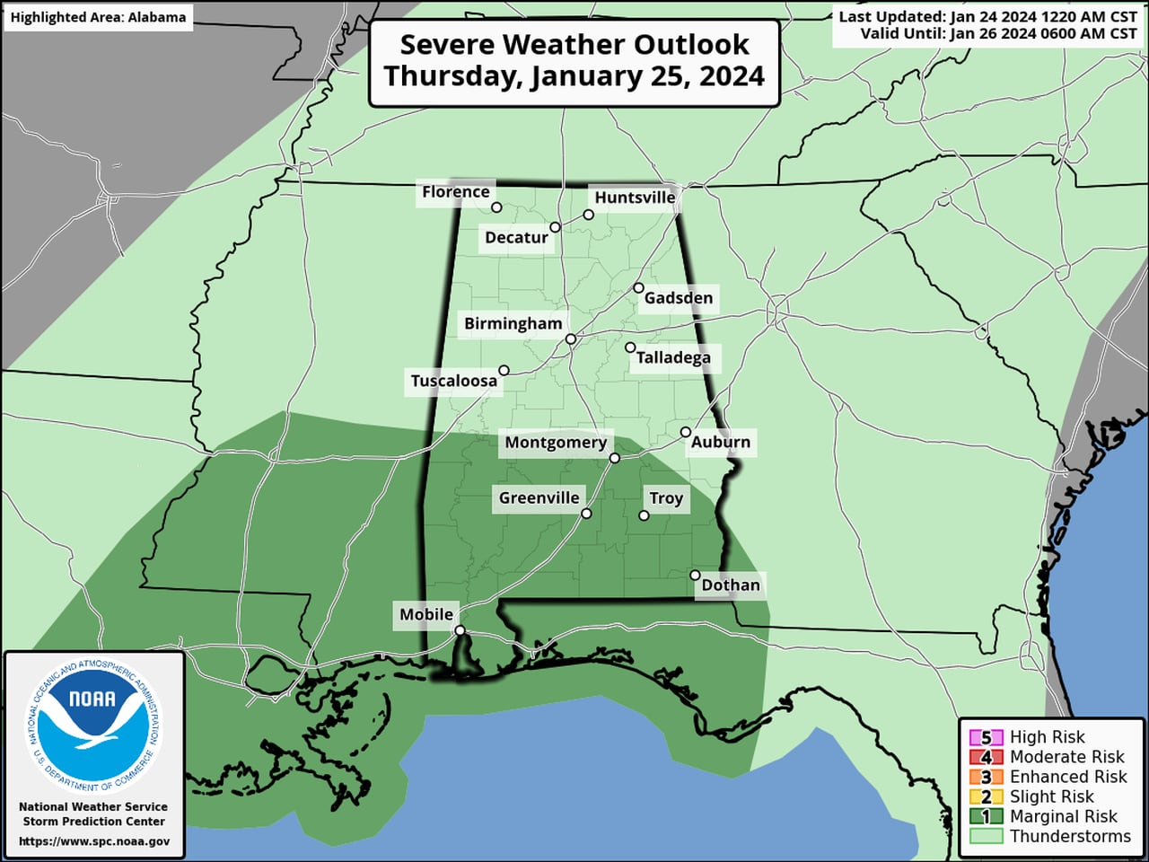
All of south Alabama will have a Level 1 severe weather risk on Thursday.SPC
The weather service in Mobile said it was a low-end severe weather risk both days, but a few storms could have damaging winds and possibly a tornado.
The SPC has also added a severe weather risk for parts of Alabama for Saturday:
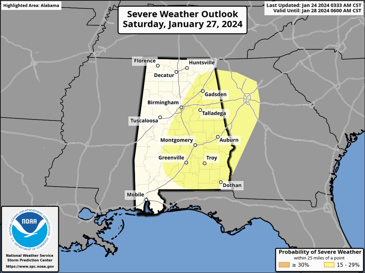
A risk for severe weather has been added to the forecast for Alabama for Saturday.SPC
The rain will make the biggest impact over the next few days. The weather service continued to urge Alabamians to not drive across flooded roads and be very wary of flooding overnight, when it can be harder to spot.
Here’s a look at what the National Weather Service is expecting across Alabama: