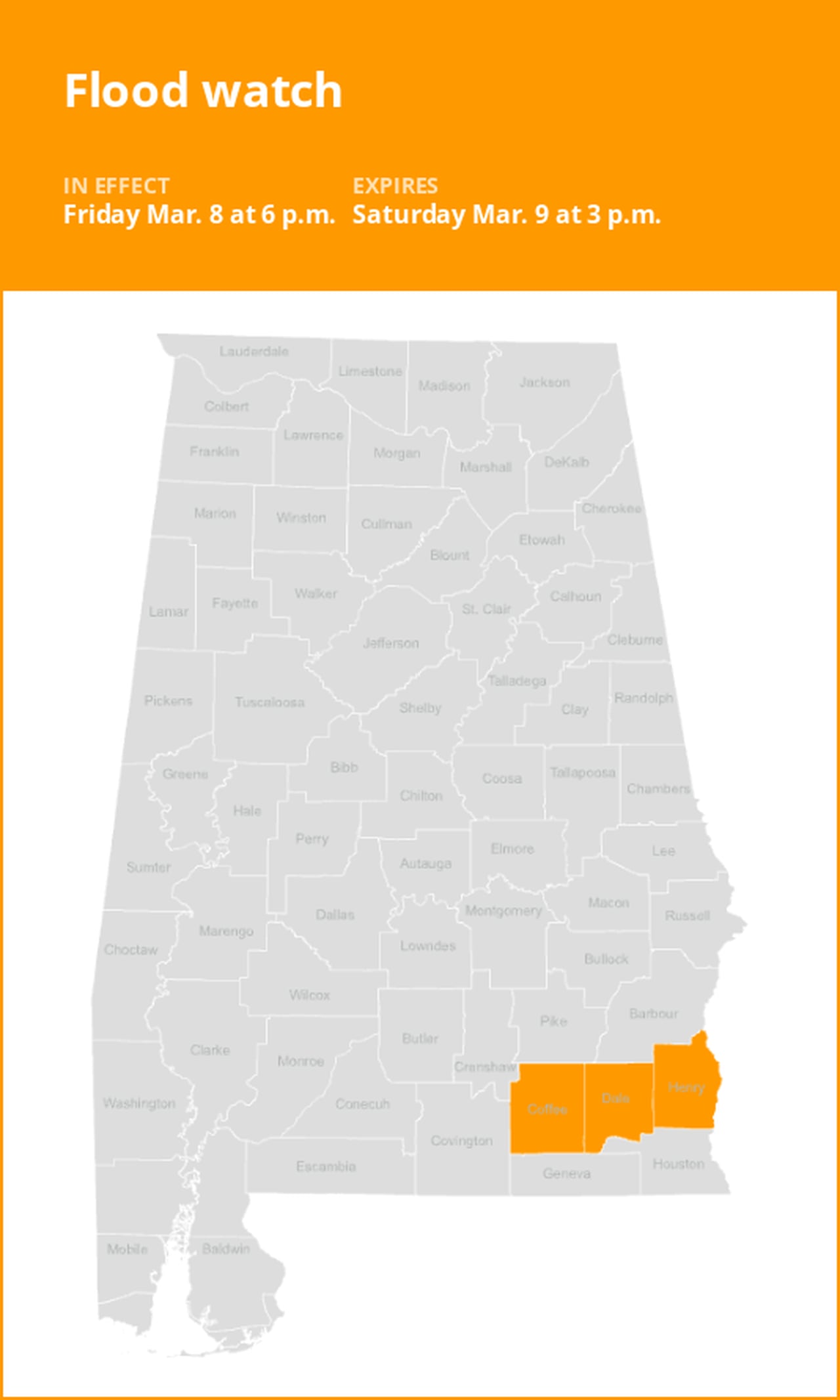
Flood watch for Southeast Alabama until Saturday afternoon
The National Weather Service issued a flood watch at 2:03 a.m. on Friday valid from 6 p.m. until Saturday 3 p.m. for Coffee, Dale and Henry counties.
The weather service comments, “Flooding caused by excessive rainfall is possible.”
“Excessive runoff may result in flooding of rivers, creeks, streams, and other low-lying and flood-prone locations. Flooding may occur in poor drainage and urban areas,” explains the weather service. “You should monitor later forecasts and be alert for possible Flood Warnings. Those living in areas prone to flooding should be prepared to take action should flooding develop.”
Understanding the differences between advisories, watches, and warnings
- Flash flood warning: Take action!
A flash flood warning is issued when a flash flood is either imminent or already occurring. In flood-prone areas, it’s crucial to move immediately to higher ground. A flash flood is a sudden and violent inundation that can develop within minutes to hours, and it can even happen in areas not currently experiencing rainfall.
- Flood warning: Take action!
A flood warning is declared when flooding is on the verge of happening or is already underway.
- Flood advisory: Be aware:
A flood advisory is issued when flooding is not expected to be bad enough to issue a warning. However, it may cause significant inconvenience, and if caution is not exercised, it could lead to situations that may threaten life and/or property.
- Flood watch: Be prepared:
A flood watch is issued when conditions are favorable for flooding. It doesn’t guarantee that flooding will occur, but it signifies that the possibility exists.
Weather service flood safety guidelines: Weathering the storm
Floods can pose a significant threat, especially if you live in a flood-prone area or find yourself camping in a low-lying region. To ensure your safety, the weather service offers essential flood safety guidelines:
1. Seek higher ground:
- If you reside in a flood-prone region or are camping in low-lying terrain, the first step to safety is relocating to higher ground.
2. Follow evacuation orders:
- If local authorities issue an evacuation order, heed it promptly. Prior to leaving, secure your home by locking it.
3. Disconnect utilities and appliances:
- If time allows, disconnect your utilities and appliances. This reduces the risk of electrical hazards during flooding.
4. Avoid basements and submerged areas:
- Avoid basements or rooms submerged in water with electrical outlets or cords. Preventing electrical accidents is crucial.
5. Evacuate promptly for safety:
- If you notice sparks or hear buzzing, crackling, snapping, or popping noises, evacuate immediately. Avoid any water that may be charged with electricity.
6. Refrain from walking in floodwaters:
- Never attempt to walk through floodwaters. Even just 6 inches of swiftly moving water can forcefully knock you off your feet.
7. Seek high ground if trapped:
- In the event you become trapped by moving water, make your way to the highest point available and contact emergency services by calling 911.
During heavy rainfall, there is a risk of flooding, especially in low-lying and flood-prone areas. Remember to never drive through water on the road, even if it seems shallow. According to the NWS, as little as 12 inches of rapidly flowing water can carry away most cars. Stay safe by being prepared and informed.
Mastering wet roads: Safety tips for heavy rainfall
When heavy rain sets in, the risk of flooding and hazardous driving conditions rises. Whether it’s prolonged rainfall or rapid runoff, being prepared is essential. Here are some valuable safety tips from the weather service to ensure you stay safe in heavy rain:
Beware of swollen waterways:
- During heavy rain, avoid parking or walking near culverts or drainage ditches, where swift-moving water can pose a serious risk.
Maintain safe driving distances:
- The two-second rule for following distance is your ally in heavy rain. Extend it to four seconds to ensure safe spacing in adverse conditions.
Slow down and drive with care:
- On wet roads, reducing your speed is crucial. Ease off the gas pedal gradually and avoid abrupt braking to prevent skidding.
Choose your lane wisely:
- Stay toward the middle lanes – water tends to pool in the outside lanes.
Prioritize visibility:
- Turn on your headlights and be careful of other vehicles to the rear and in blind spot areas as they are especially difficult to see through rain-spattered windows.
Watch out for slippery roads:
- The initial half-hour of rain is when roads are slickest due to a mixture of rain, grime, and oil. Exercise heightened caution during this period.
Keep a safe distance from large vehicles:
- Large trucks and buses can reduce your visibility with tire spray. Avoid tailgating and pass them swiftly and safely.
Mind your windshield wipers:
- Overloaded wiper blades can hinder visibility. If rain severely limits your sight, pull over and wait for conditions to improve. Seek refuge at rest areas or protected spots.
- If the roadside is your only option, pull off as far as possible, preferably past the end of a guard rail, and wait until the storm passes. Keep your headlights on and turn on emergency flashers to alert other drivers of your position.
By following these safety measures, you can significantly reduce risks and ensure your well-being when heavy rain pours down. Stay informed about weather conditions and heed advice from local authorities to make your journey safe and sound.
Advance Local Weather Alerts is a service provided by United Robots, which uses machine learning to compile the latest data from the National Weather Service.