Flash flooding a concern in parts of Alabama today
Slow-moving storms have dropped tons of rain on parts of Alabama as of Thursday morning — and more is in the forecast for the rest of the day.
Sumter County in west Alabama has been particularly hard-hit, with numerous reports of flooded roads and some water rescues, according to reports to the National Weather Service.
The weather service said 8 to 9 inches of rain has fallen in that area as of Thursday morning.
That rain has caused flash flooding in numerous areas, and a flash flood warning will be in effect for southwestern Sumter County until noon. The weather service said an additional 1 to 2 inches of rain will be possible this morning.
The Alabama Law Enforcement Agency has reported that parts of the southbound lanes of Interstate 59 near Mile Marker 5 in Sumter County have flooded, and ALEA troopers are working on traffic control.
The weather service also said that some roads had become impassable in Livingston and there have been water rescues due to flooding in York.
The weather service said “this kind of flooding is rare for that part of central Alabama, but highlights the intensity and persistence of the rainfall thus far.”
More rain will be possible through the day as a slow-moving area of storms progresses eastward across the state. A flood watch for several central Alabama counties will be in effect until 7 p.m. Thursday.
The weather service noted that an extremely moist airmass is in place over parts of the state which has led to high rainfall rates so far today. Storms are also moving slowly, intensifying the effects of the heavy rain.
The counties in the flood watch are Pickens, Tuscaloosa, Sumter, Greene, Hale, Perry, Bibb, Chilton, Marengo and Dallas.
The weather service said: “Take extra caution if you must travel through this region, especially in Sumter county, and make sure to turn around if you encounter any flooded roadways!”
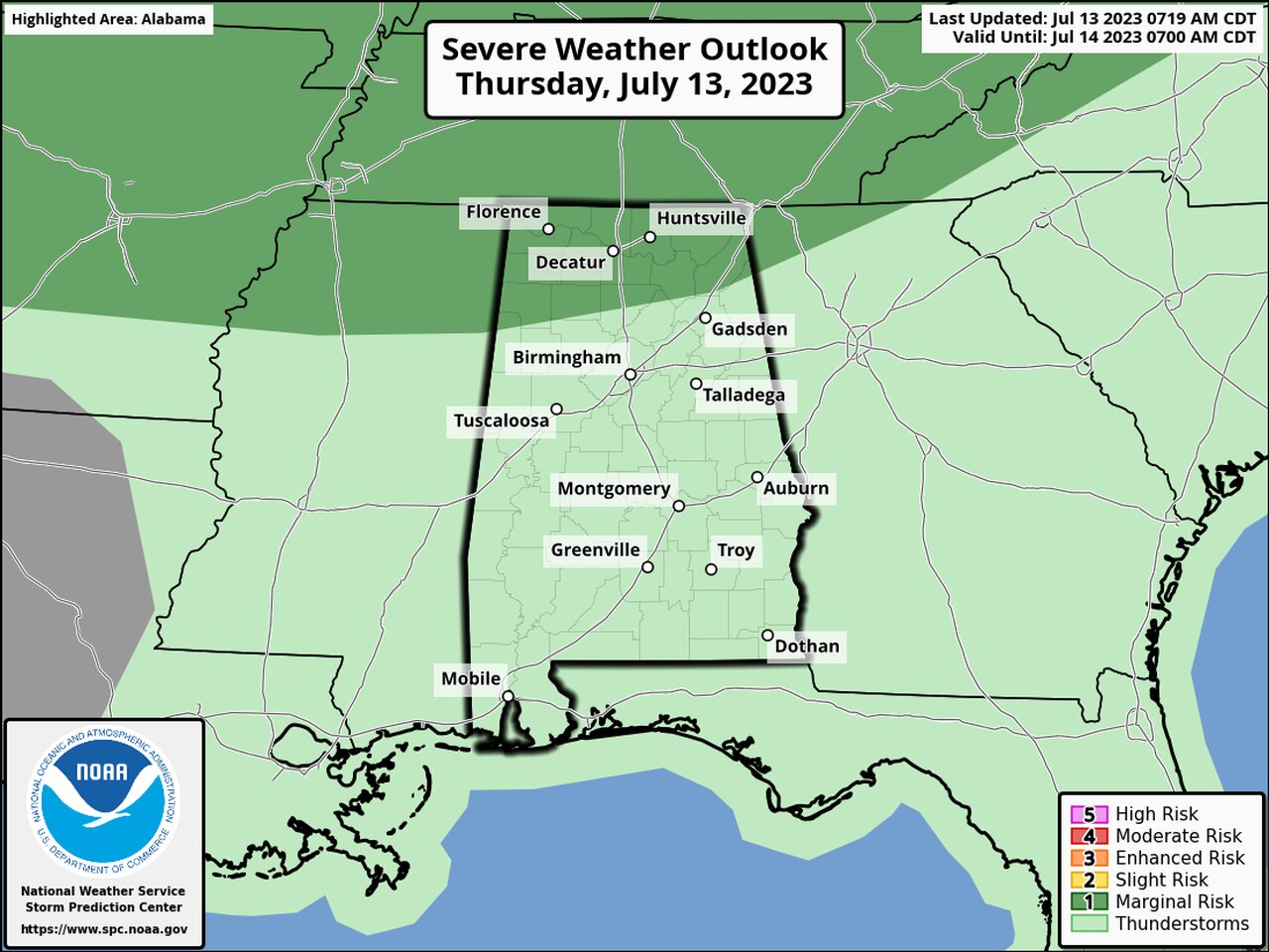
There is also a low-end chance for a few severe storms today in north Alabama.
NOAA’s Storm Prediction Center has included north Alabama in a Level 1 out of 5 risk for severe weather today. A Level 1 risk means that isolated severe storms will be possible.
Areas in dark green have a Level 1 severe weather risk for Thursday.
The most likely time for stronger storms will be this afternoon and evening, according to the National Weather Service in Huntsville.
Forecasters said damaging wind gusts and quarter-size hail will be possible with the strongest storms this afternoon.