Enhanced risk for severe weather Sunday for Alabama
Severe weather will again be part of the weather story for Sunday in Alabama.
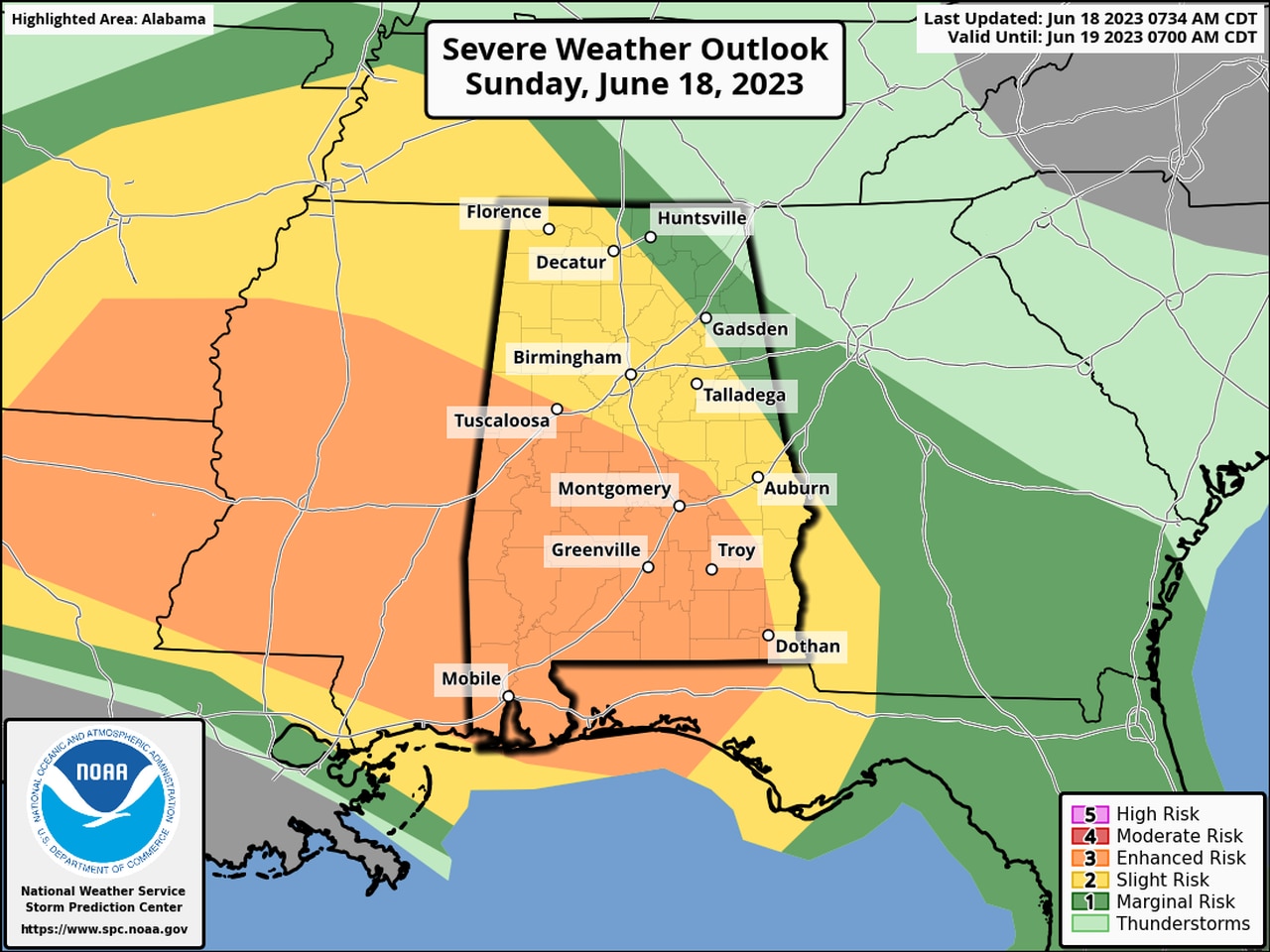
Parts of south and west Alabama have a Level 3 out of 5 risk for severe storms today, but the rest of the state could have to deal with severe weather as well in several waves — from this morning through the overnight hours.
A Level 3 (enhanced) risk means that numerous severe storms will be possible.
Storms expected to arrive later this evening and tonight could be the most potent round, according to the National Weather Service.
There will also be risks for severe storms in parts of Alabama on Monday and now Tuesday.
A severe thunderstorm watch is in effect for southwest Alabama until noon Sunday:
The Storm Prediction Center said storms could have wind gusts up to 70 mph and large hail up to 1.5 inches.
Forecasters said long-lived clusters of storms are expected to remain intense as they track to the southeast toward the coast.
Here’s a look at the radar from Sunday morning:
The Alabama counties in the watch are Baldwin, Choctaw, Clarke, Conecuh, Escambia, Mobile, Monroe and Washington.
The National Weather Service said damaging winds and large hail will be the primary threats with any stronger storm in the state today.
Rain and storms were also moving through parts of north and central Alabama on Sunday morning:
Today’s storms could bring more heavy rain along with them, and a flood watch continues for the southern part of the state until Monday. Two to 4 inches of additional rain will be possible in the watch area through Monday morning.
The weather service said that after these severe thunderstorms diminish late tonight and into early Monday morning, additional severe thunderstorms are possible Monday afternoon and evening, though coverage and intensity is expected to be less.