Enhanced risk for severe weather in Alabama on Monday
Another round of severe weather is expected in Alabama on Monday, and this one has the potential to be even more intense than storms over the past few days.
The National Weather Service said storms today could have wind gusts as high as 70 mph, which is more than enough to take down trees and knock out power. Hail, lightning and heavy rain will also be possible, according to forecasters. The risk for a tornado is low to zero.
Storms on Sunday prompted numerous reports of downed trees and power outages across parts of north and central Alabama.
Severe weather will be possible as soon as late morning today but will be more likely starting this afternoon and evening, according to the weather service.
NOAA’s Storm Prediction Center has expanded a Level 3 out of 5 risk for severe weather to cover parts of north and central Alabama on Monday. A Level 3 risk means that “numerous” severe storms will be possible.
Other areas in north and central Alabama will have a Level 2 risk today and could have scattered severe storms.
The rest of central and part of south Alabama will have a Level 1 risk today, which means that isolated severe storms will be possible.
This isn’t the last round of severe weather expected this week in Alabama. The Storm Prediction Center has added storms to the forecast for Tuesday and Wednesday for parts of the state.
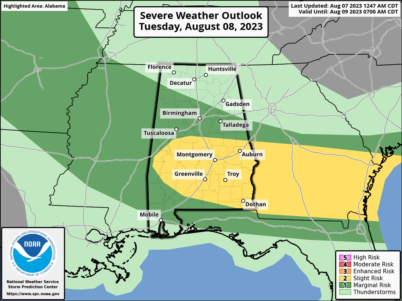
Here’s the forecast for Tuesday:
More severe storms are expected on Tuesday in Alabama. The areas in yellow will have a Level 2 risk and areas in dark green will have a Level 1 risk.
Here’s the outlook for Wednesday:
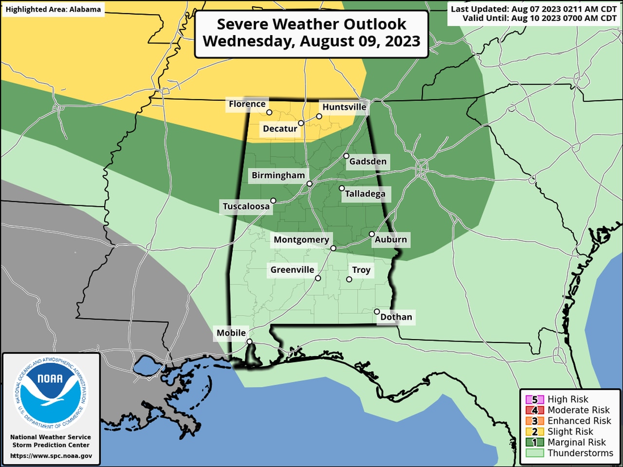
Another round of severe storms will be possible for north and north-central Alabama on Wednesday.
Areas that don’t get storms are expected to be extremely hot today, and heat advisories and excessive heat warnings will be in effect for the southern two-thirds of the state.
More heat advisories will also be in effect on Tuesday.
Here’s a look at timing for today’s storms from the weather service offices:
NORTH ALABAMA
North Alabama could see storms first today, with severe weather possible as soon as 10 a.m.
Storms are expected to exit the region later this afternoon.
CENTRAL ALABAMA
Storms could affect central Alabama by 2 p.m. and drop southward through the evening hours.
SOUTH ALABAMA
Storms could affect southeast Alabama starting late this afternoon. Southwest Alabama is not included in Monday’s severe weather risk.
However, severe weather could affect southwest Alabama on Tuesday: