Enhanced risk for severe weather Friday in Alabama
Another round of severe weather is in the forecast for Alabama on Friday. And the whole state has the potential to see strong storms this time.
Tornadoes, including a few strong ones, damaging winds, hail and heavy rain will all be possible.
It is also expected to be windy again, both near and away from storms, and wind advisories will be in effect on Friday for nearly the entire state.
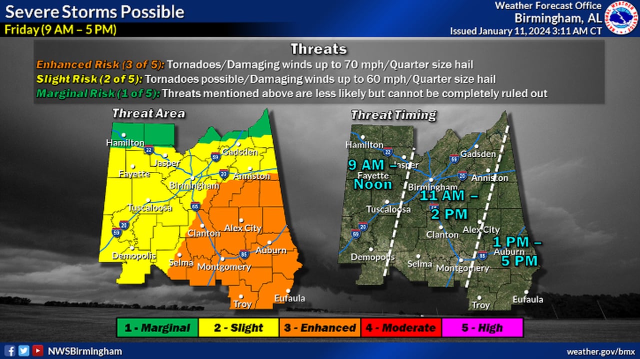
NOAA’s Storm Prediction Center is maintaining a Level 3 out of 5 or enhanced risk for severe weather for a large part of east, central and south Alabama on Friday. A Level 3 risk means that “numerous” severe storms are expected.
A large part of central and south Alabama also will have a Level 2 severe weather risk on Friday, which means that scattered severe storms will be possible.
And north Alabama will have a Level 1 risk and could have to deal with isolated severe storms.
This round of storms will happen during the day, for a change.
The National Weather Service thinks the first storms could affect Alabama as early as 7 a.m., and the threat will shift eastward through the morning and into the afternoon.
The weather service was thinking the hours from noon until 5 p.m. will feature the highest potential for severe weather in Alabama.
Here’s a look at timing and potential impacts from the weather service for the different regions of Alabama:
NORTH ALABAMA
CENTRAL ALABAMA
Strong to severe storms could start to affect central Alabama by 7 a.m. on Friday, according to forecasters.NWS
SOUTH ALABAMA
The storms likely will have moved out of the state by Friday night.
Much colder air will move into Alabama in waves over the weekend, and next week will bring the coldest air of the winter to Alabama by Monday and Tuesday.
An Arctic front is expected pass through Sunday into Monday, and it will bring the potential for winter precipitation to Alabama.
The time to watch will be Sunday night into Monday night. It could come in the form of snow or freezing rain, forecasters said. Stay tuned to the evolving forecast on that weather system.