Cold is coming: Freeze watch issued for part of Alabama
Spring is going to take a break for a bit across Alabama in the coming days.
Temperatures could drop to the freezing mark, or below, on Monday and Tuesday nights in parts of the state.
The National Weather Service in Huntsville has issued a freeze watch for all of north Alabama starting early Tuesday morning, and the weather service in Birmingham also has one for all of central Alabama as well.
Temperatures on Monday night into Tuesday morning will be in the 30s all the way into south Alabama. The Monday night-Tuesday morning forecast is at the top of this post.
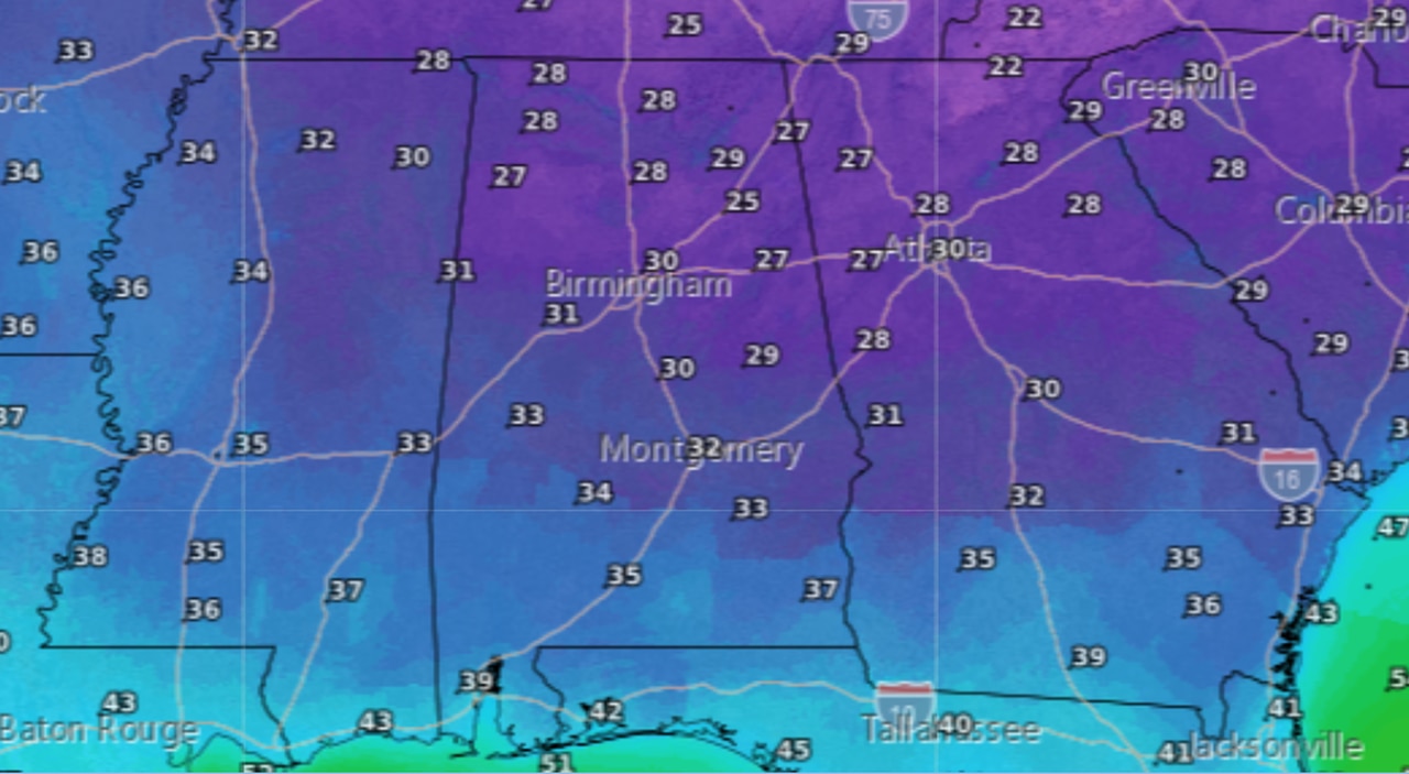
Tuesday night into Wednesday morning could even be a degree or two colder. Below is the overnight low temperature forecast for Tuesday night into Wednesday morning:
It could be a bit colder on Tuesday night into Wednesday morning for Alabama.
The north Alabama freeze watch will be in effect from 1 a.m. until 9 a.m. Tuesday for Lauderdale, Colbert, Franklin, Lawrence, Limestone, Madison, Morgan, Marshall, Jackson, DeKalb and Cullman counties.
The weather service said temperatures could fall as low as 29 degrees by Tuesday morning across the region.
The freeze watch for central Alabama will be in effect from 1 a.m. Tuesday until 8 a.m. Wednesday for Marion, Lamar, Fayette, Winston, Walker, Blount, Etowah, Calhoun, Cherokee, Cleburne, Pickens, Tuscaloosa, Jefferson, Shelby, St. Clair, Talladega, Clay, Randolph, Sumter, Greene, Hale, Perry, Bibb, Chilton, Coosa, Tallapoosa, Chambers, Marengo, Dallas, Autauga, Lowndes, Elmore, Montgomery, Macon, Bullock, Lee, Russell, Pike and Barbour counties.
Forecasters said unseasonably cooler air will begin to spread into Alabama in the wake of a cold front. Temperatures tonight will be cooler, but the brunt of the colder air won’t be felt until Monday night.
Remember to protect pets and any sensitive plants that may feel the brunt of the cold.