Baseball-size hail possible in Alabama storms today
Yet another round of severe weather looks likely in Alabama today — and this one could be the big one.
It could also bring hail the size of baseballs along with it.
That’s according to the National Weather Service. The weather service and NOAA’s Storm Prediction Center have added a Level 4 out of 5 risk for severe weather for the southern part of the state today.
But no one can let their guard down — the whole state is under some sort of severe weather risk today and could face the prospect of large hail, damaging winds and flooding rain.
The area with the highest probability for severe weather will be in south-central and south Alabama today. A Level 4 (or moderate) risk is not used all that much, and it’s not used hardly ever in Alabama in June, when storms are typical but widespread severe storms are not.
A moderate risk means numerous severe storms will be “likely,” according to the Storm Prediction Center.
So today’s weather is something to pay attention to.
But storms won’t just be possible today. There will be risks of severe weather tomorrow, Friday and possibly on Sunday as multiple weather systems move through the state.
Today’s storms — especially later this afternoon and tonight — could bring hurricane-force wind gusts, hail as large as baseballs, copious amounts of lightning and flooding rain.
The weather service added that a tornado also can’t be ruled out across the southern part of the state.
The potential for flooding is high enough that a flood watch has been issued for most of the southern half of the state (the counties in green below):
The Alabama counties in green are under a flood watch today.
Rain and storms were ongoing across parts of central Alabama on Wednesday morning. There have been several severe thunderstorm warnings issued overnight, and some of those have had hail up to the size of ping-pong balls.
Those storms will continue to have the potential to become strong to severe through the morning as they push to the east, according to the weather service.
But another round of storms is expected later today, and it’s that round that will bring the risk for the large hail, hurricane-force winds and possibly a tornado, according to the weather service.
Additional rounds of storms will be possible on Thursday for the southern part of Alabama, and the Storm Prediction Center has added a Level 2 risk for that area.
Here is Thursday’s outlook:
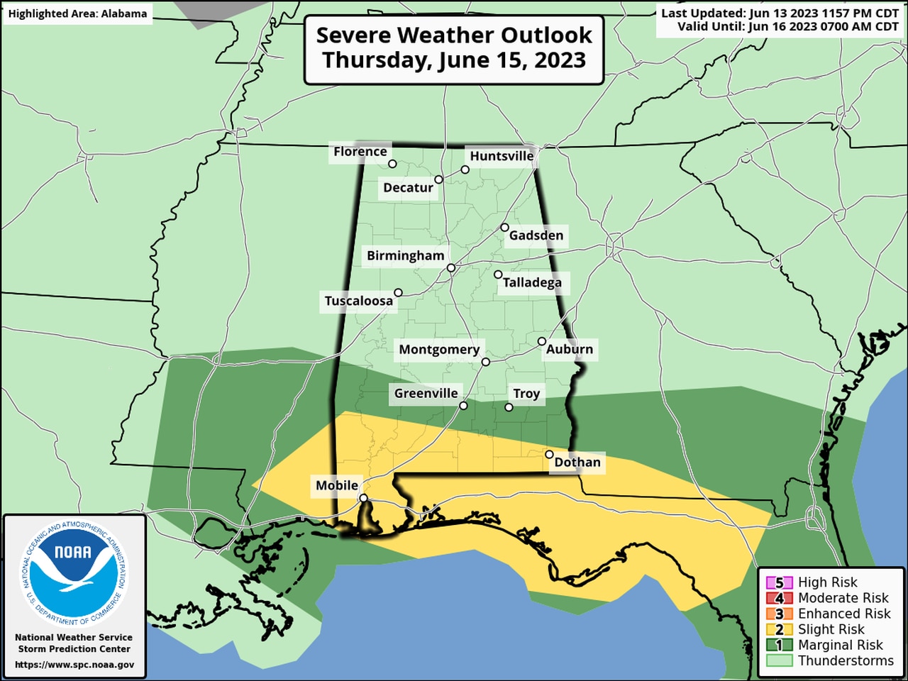
South Alabama could face more severe storms on Thursday as well.
Another stormy day will be possible on Friday, and the SPC has added a large part of Alabama to a Level 1 severe weather risk, which means that isolated severe storms will be possible.
Here’s the forecast for Friday:
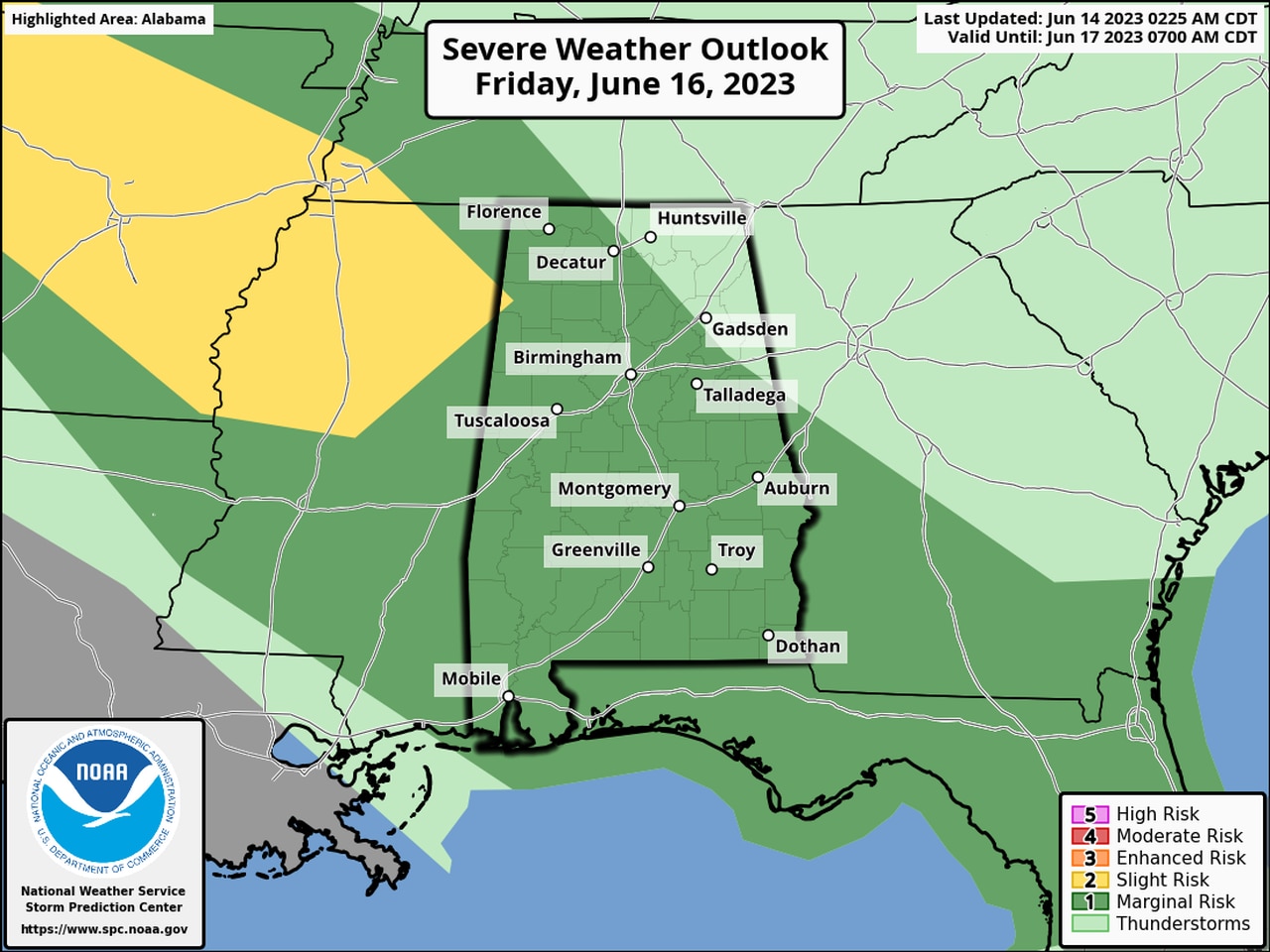
There will be a Level 1 severe weather risk for much of Alabama on Friday.
Saturday doesn’t have a severe weather risk in the forecast, at least so far, but the SPC has added one for north Alabama for Sunday.
Here’s Sunday’s long-range outlook:
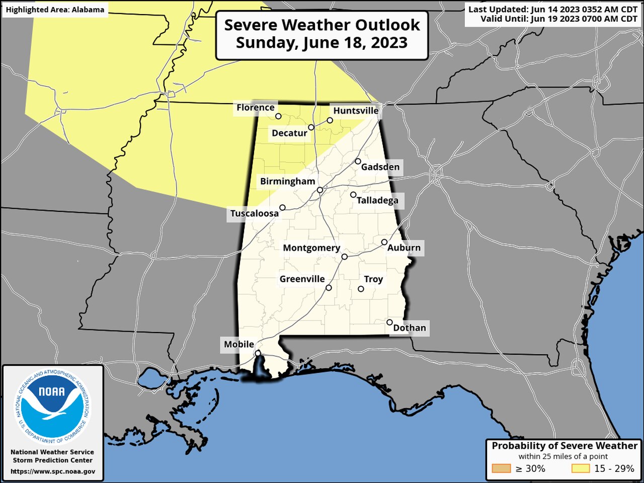
Storms will also be possible on Sunday.
Here is what the state’s weather service offices are saying about today’s severe weather potential:
NORTH ALABAMA
SOUTH ALABAMA
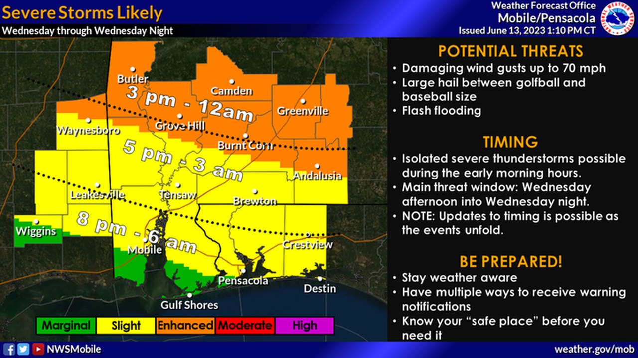
Here’s a look at timing for south Alabama today.