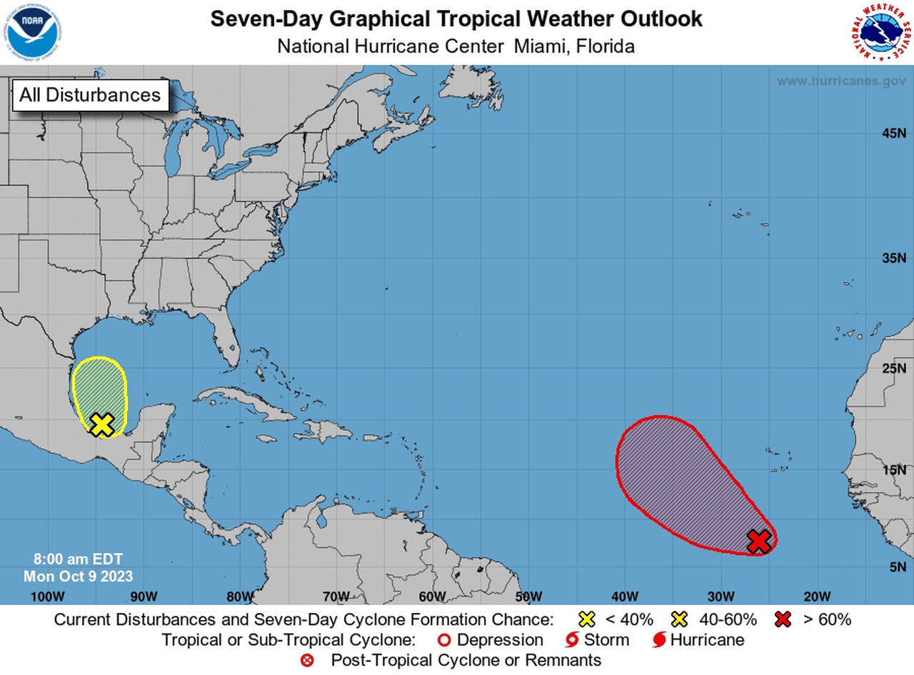
Any tropical trouble expected in the Gulf this week?
The Gulf of Mexico has been rather quiet during the heart of the Atlantic hurricane season, but will that change this week?
It’s possible, but not likely, according to the National Hurricane Center.
Forecasters at the hurricane center have added an area to watch in the southern Gulf that has a low probability of development — only 20 percent as of Monday morning.
The hurricane center said rain and storms have developed along with a small area of low pressure in the southwestern Gulf. Forecasters said environmental conditions appeared only marginally favorable for development while the system tracks northward this week.
The disturbance is expected to merge with a front over the western Gulf of Mexico by midweek.
While the disturbance has a low chance of developing into a tropical storm it could still bring rain — much-needed rain at that — to parts of the Gulf Coast.
The National Weather Service in Mobile said right now it appears the best chance for rain for the Gulf Coast will come Wednesday night into Thursday as the area of low pressure moves eastward across the Gulf south of the coast.
Forecasters said multiple rounds of rain could be possible during that time.
Depending on the track of the low, it could end up being windy along the coast from Wednesday night into Thursday, according to the weather service.
Forecasters also plan to raise the risk of rip currents to high starting on Wednesday night and through the end of the week.
That’s not the only thing being watched in the tropical Atlantic.
The hurricane center was also tracking a tropical wave south of the Cabo Verde Islands in the eastern Atlantic that could become a tropical depression in a few days.
It is forecast to tack a west-northwest or northwest track this week.
The Atlantic hurricane season is still going and won’t end until Nov. 30.
