Alabama weather live updates: More storms possible overnight
Alabama isn’t done with severe weather just yet.
The National Weather Service is warning that another round of strong to severe storms will be possible starting late tonight across Alabama.
See also:
Storm damage photos: Boats sink, trees slam into houses
Schools delay opening, switch to virtual due to severe weather Wednesday, Jan. 4
Storms could enter west Alabama by 10 p.m. and track eastward through early Wednesday morning.
Tornadoes, damaging winds and heavy rain will again be possible with the strongest storms, forecasters said.
Updates start here:
6 p.m.
The National Weather Service in Tallahassee, which also monitors the weather in southeast Alabama, said those in that corner of the state should expect Round 2 of storms starting around 5 a.m. CST.
That will be the last part of the state to experience Round 2. Storms are expected to start earlier in the rest of the state.
5:35 p.m.
Round 1 of severe weather was still ongoing late Tuesday evening in eastern and southern Alabama.
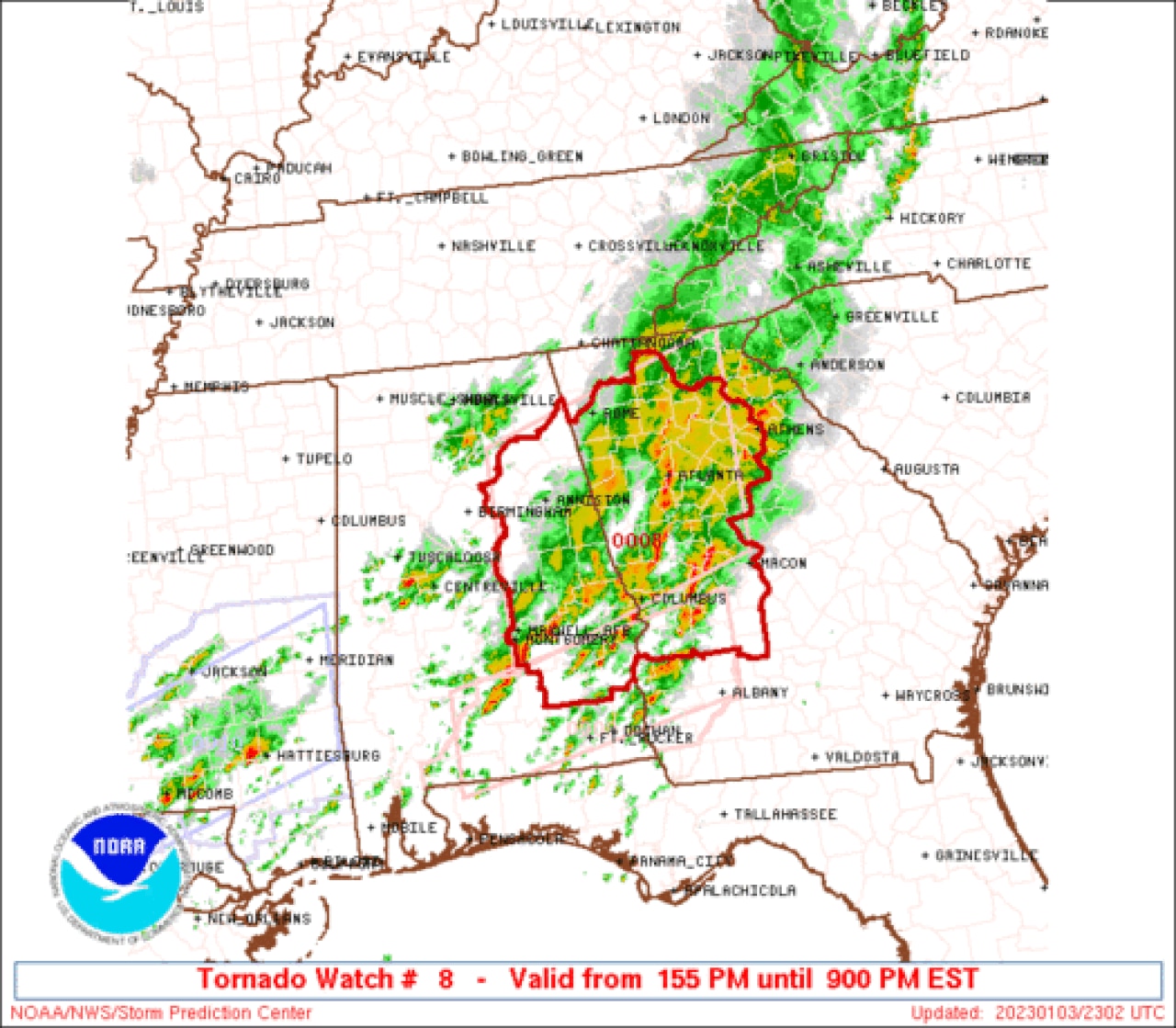
One tornado watch was allowed to expire at 5 p.m., but there are two other tornado watches that affect the state, and both expire at 8 p.m. (if not canceled sooner).
Watch No. 1 will be in effect for parts of east-central Alabama:
A tornado watch will be in effect for east-central Alabama until 8 p.m. CST.
The counties in that watch as of 5 p.m. are: Barbour, Bullock, Chambers, Lee, Macon, Montgomery, Pike and Russell.
Tornado watch No. 2 affects south and east Alabama:
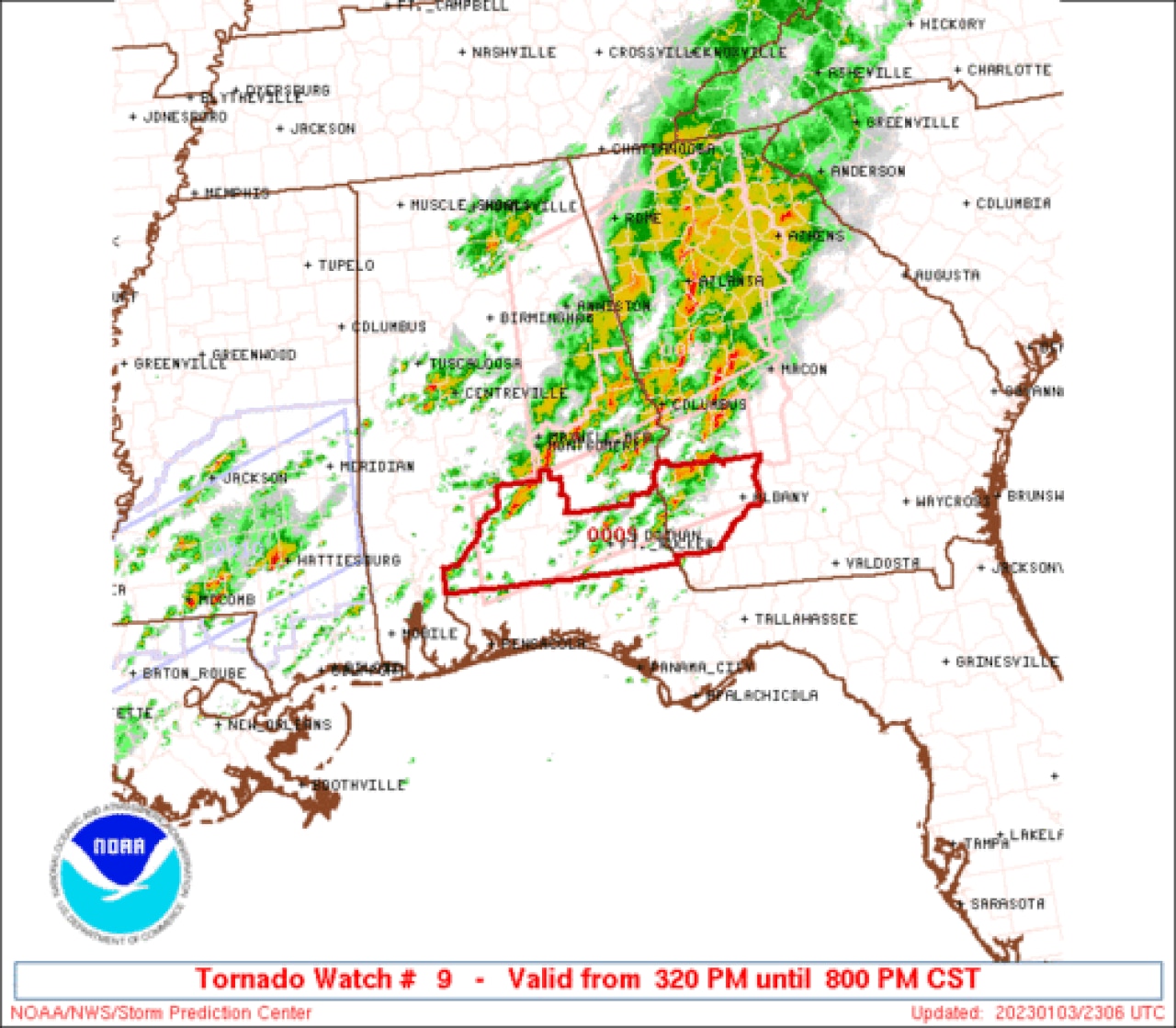
A tornado watch will be in effect for south and east Alabama until 8 p.m. CST.
The counties in that watch as of 5 p.m. are: Butler, Conecuh, Covington, Crenshaw, Escambia, Coffee, Dale, Geneva, Henry and Houston.
Another round of storms were forming in parts of Mississippi on Tuesday evening, and those are expected to move into Alabama later tonight, according to the National Weather Service.
Forecasters warned Alabamians not to let their guard down overnight and make sure they have a way to get severe weather warnings — even if they are asleep.
5:30 p.m.
Here’s a situation overview for central Alabama from the National Weather Service:
5:26 p.m.
Here’s a very early look at storm reports from earlier Tuesday:
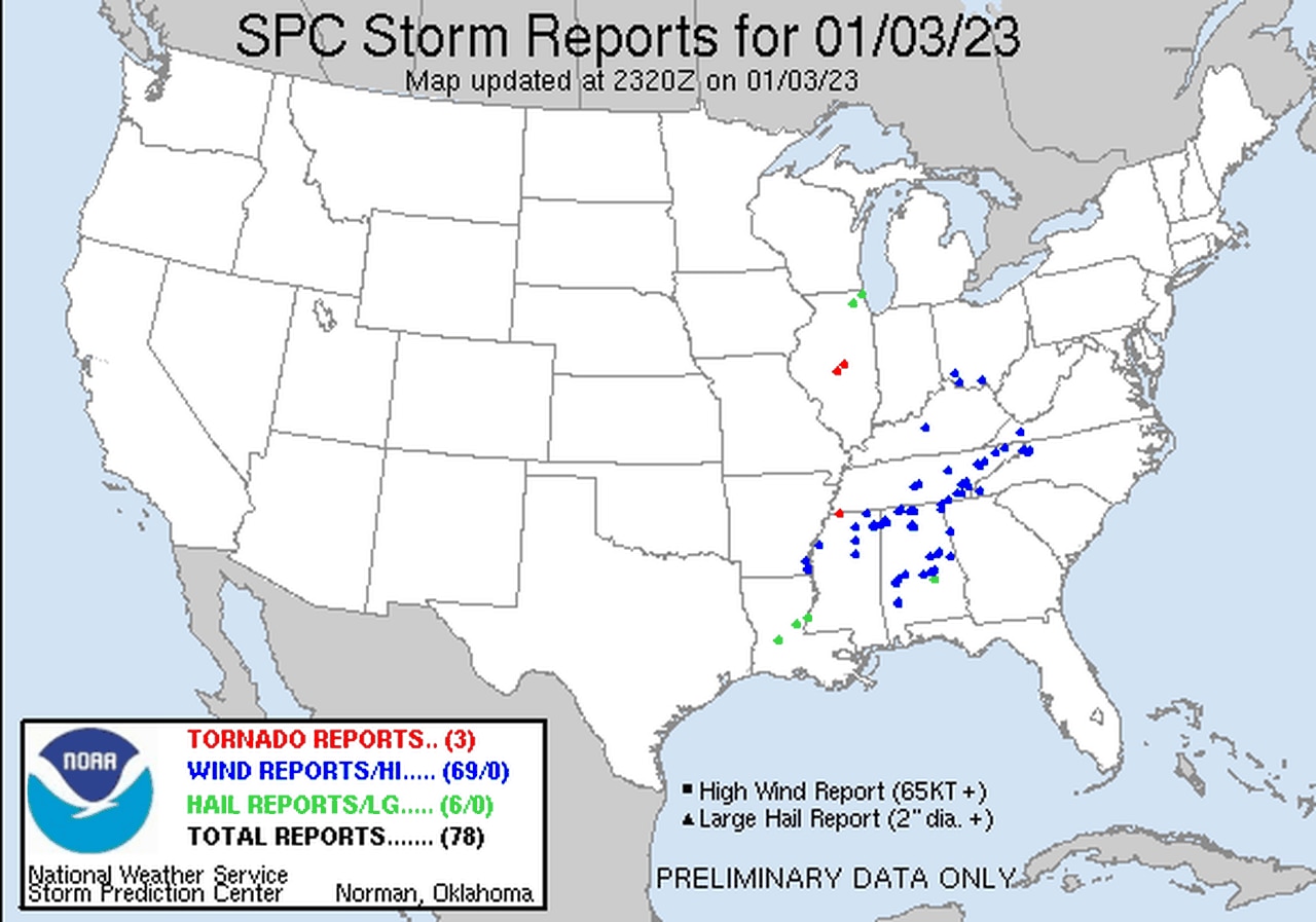
Alabama has had multiple reports of wind damage with Tuesday’s first round of storms.
Expect there to be tornado reports added to that list from storms earlier today. The National Weather Service in Birmingham has already planned to do storm surveys on Wednesday for several areas in central Alabama:
5:20 p.m.
There were record highs in several Alabama cities on Tuesday. For north Alabama, Huntsville’s high of 72 degrees has tied the record for Jan. 3. Muscle Shoals had a high of 73 degrees, which also tied its record high.
For central Alabama: Anniston tied its record high of 74 degrees (last reached in 2005). Montgomery hit 78 degrees, also tying its record high, last reached in 2005. Tuscaloosa’s high of 75 degrees tied its record high, last set in 1950.
For south Alabama: Mobile’s high was 79 degrees, tying the record last set in 1989.
5:17 p.m.
An update from earlier from the National Weather Service in Mobile:
5:15 p.m.
Here’s a look at timing for Round 2 of storms tonight for north Alabama: