Alabama severe weather risk increases for Tuesday
The risk for severe weather on Tuesday has increased for Alabama.
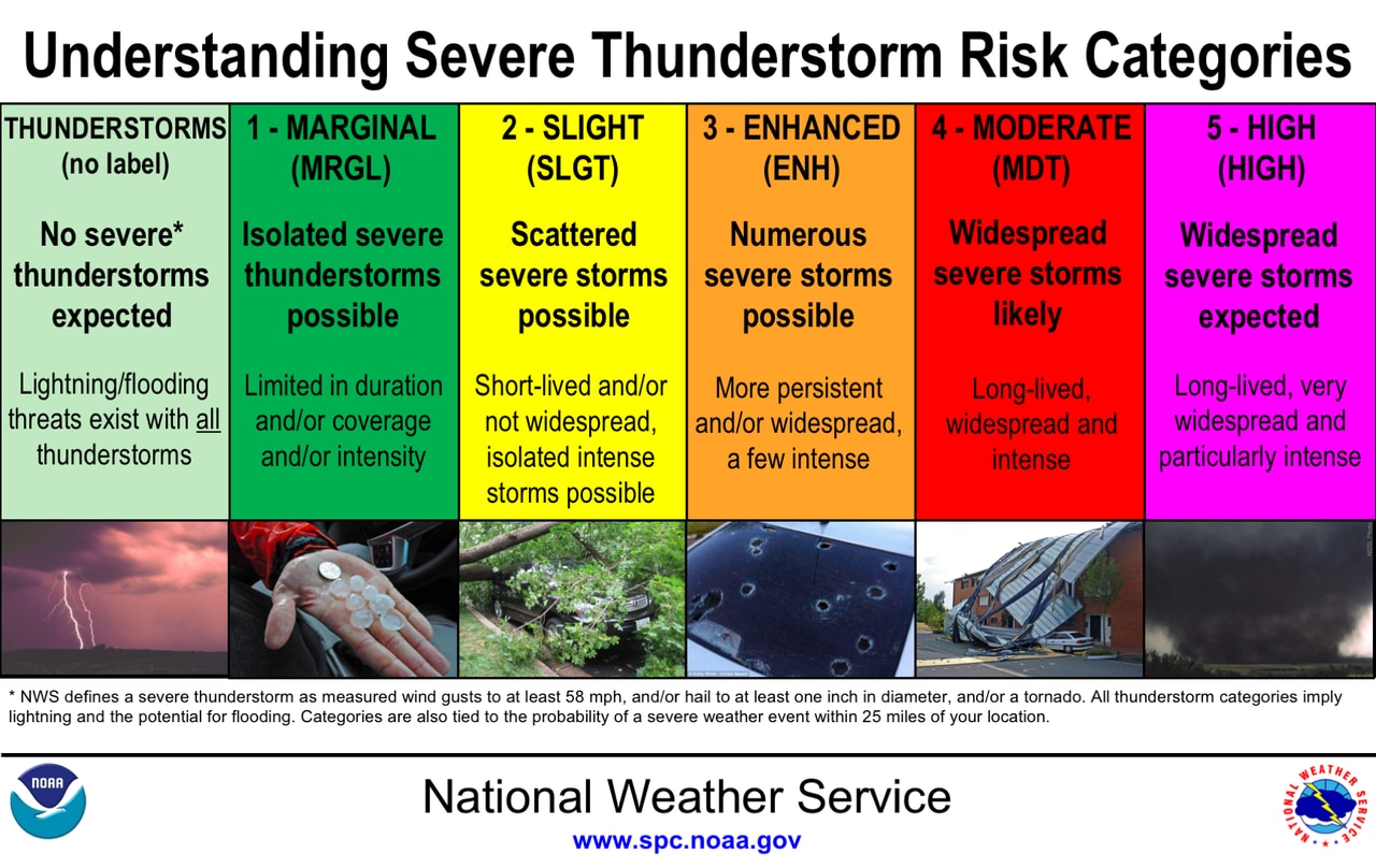
NOAA’s Storm Prediction Center has added a Level 3 out of 5 risk for severe storms for part of south and south-central Alabama for Tuesday.
A Level 3 or enhanced risk means that numerous severe storms will be possible.
Nearly all of the rest of the state has a Level 2 risk, which means scattered severe storms will be possible.
The southeastern corner of the state has a Level 1 or marginal risk and could see isolated severe storms.
Here is how the Storm Prediction Center ranks severe weather risks.
All forms of severe weather will be on the table for this go-around, including tornadoes, damaging winds, hail and flooding rain, according to the National Weather Service.
The weather service added that a strong tornado (EF-2 or stronger) can’t be ruled out.
This map from the SPC shows the areas that have an increased potential for tornadoes:
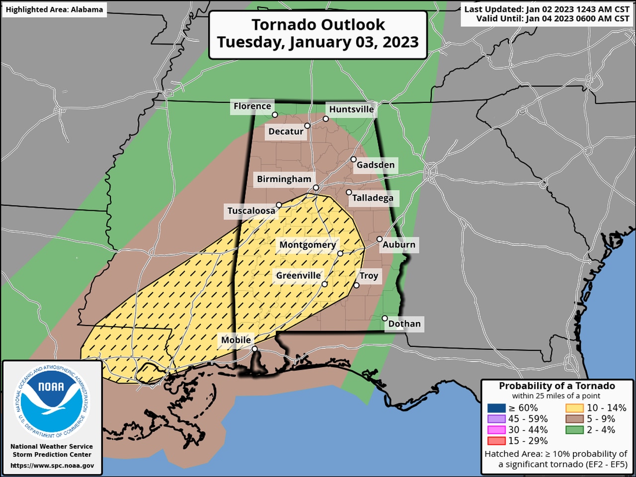
This map shows where the potential for a tornado will be higher on Tuesday. The areas in yellow will have the most favorable conditions, though tornadoes aren’t guaranteed.
There could be several rounds of storms on Tuesday, according to forecasters.
Rain and storms will be possible starting today, but no severe weather is expected in Alabama.
That changes starting on Tuesday morning, when storms are expected to develop and move into the state from the west ahead of a cold front.
Storms will be possible from late Tuesday morning into the overnight hours. However, the most likely time for severe weather will come during the afternoon hours.
The threat for flooding has lessened some, but will still be possible. Forecasters said 1 to 2 inches of rain will be possible, and areas that get multiple storms may have to watch out for localized flooding.
The rain could linger into Wednesday before moving out of Alabama.
Drier weather and cooler temperatures are expected to take over starting on Thursday. Highs will only reach the 40s and 50s in most of the state through Friday, but warmer temperatures will arrive by next weekend.