Alabama faces statewide Level 3 severe weather risk Friday: What to know
More severe weather is in the forecast for Alabama, this time on Friday. And all of the state could have to deal with storms this time.
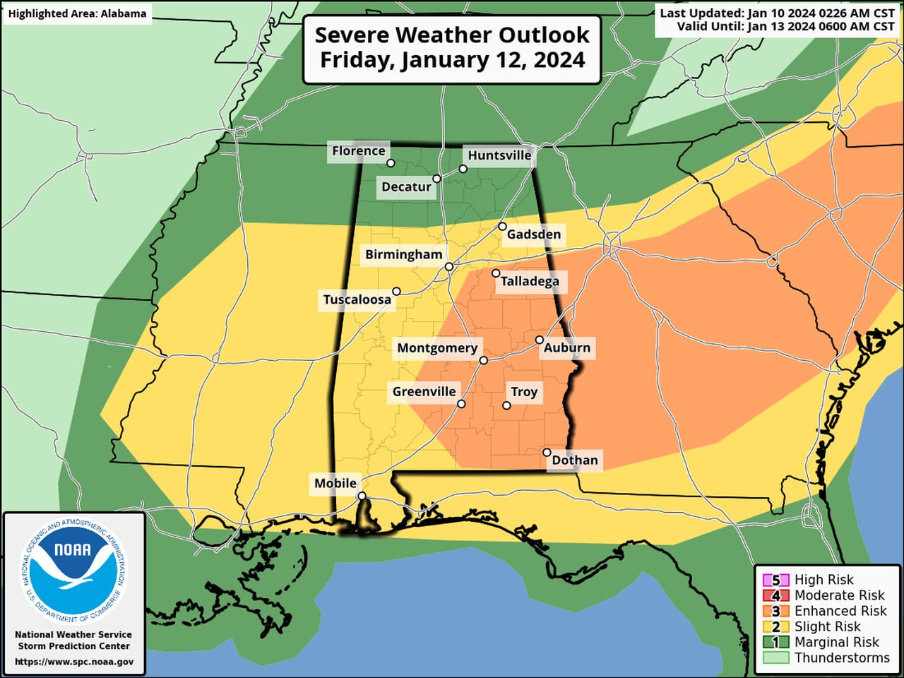
NOAA’s Storm Prediction Center has added a Level 3 out of 5 risk for severe weather for part of the state on Friday. A Level 3 or enhanced risk means that numerous severe storms will be possible.
Tornadoes, damaging winds and heavy rain will again all be possible. Forecasters also think it could again be windy even away from storms, and parts of the state will likely be placed under wind advisories
Parts of south Alabama had a Level 3 risk on Monday and Tuesday and had several tornado-warned storms move through. The National Weather Service offices in both Mobile and Tallahassee, Fla., said they were planning storm damage surveys for several spots in south Alabama today. Those surveys will determine if tornadoes touched down, and the intensity of those storms.
Areas in south and east Alabama are included in Friday’s Level 3 severe weather risk area, including places like Montgomery, Auburn, Dothan, Talladega, Greenville and Troy.
Other areas in south, central and north Alabama will have a Level 2 risk on Friday, which means that scattered severe storms will be possible. The rest of north Alabama will have a Level 1 risk, which means that isolated severe storms will be possible.
The National Weather Service thinks that Friday’s storms will be possible starting early Friday morning and could be an issue into the afternoon.
Storms are expected to move out of Alabama by Friday night, and much colder air will move into the state following the passage of a cold front. That could set the stage for the potential for wintry precipitation Sunday night into Monday. So far forecasters are thinking amounts will be light, but stay tuned in case that changes.