Alabama could flirt with record highs next week
Did you put the shorts away? You might be able to bring them back out for a few days next week.
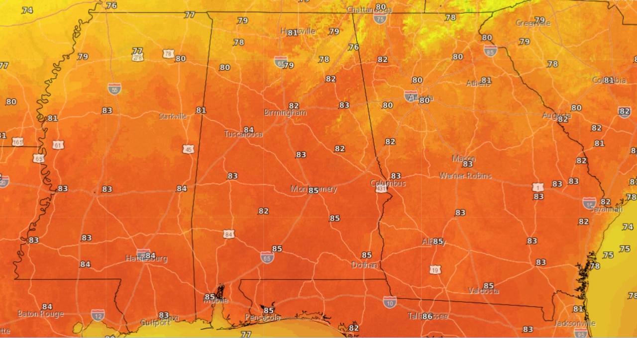
The National Weather Service said that record high temperatures are not out of the question during the early part of next week, when temperatures could make it into the 80s — even the mid-80s — for some.
According to the weather service average highs for this time of year range from the mid-60s to the mid-70s.
A weather system moving through today (Saturday) will bring scattered rain, a storm or two, but not cooler temperatures in its wake, according to forecasters.
After today a ridge of high pressure will dominate Alabama’s weather, taking temperatures up a notch or two.
Expect highs to go up by a degree or two on Monday and Tuesday.
Monday could be one of the warmest days next week. So what are the record highs for Monday, Nov. 8?
Anniston: 84 degrees (2005)
Birmingham: 84 degrees (2005)
Cullman: 79 degrees (2005)
Dothan: 85 degrees (1986)
Greenville: 87 degrees (1986)
Highland Home: 80 degrees (2016)
Huntsville: 83 degrees (2005)
Mobile: 83 degrees (2005)
Montgomery: 87 degrees (1986)
Muscle Shoals: 84 degrees (2005)
Russellville: 82 degrees (2005)
Tuscaloosa: 86 degrees (2005)
The warmer weather won’t last forever. The weather service is expecting another weather system to move into Alabama possibly by the end of the week, and it could bring temperatures back to seasonal levels by next weekend.