A few strong storms possible Wednesday and Thursday
Another cold front could bring the potential for a few strong storms to parts of Alabama on Wednesday and Thursday.
NOAA’s Storm Prediction Center has expanded a Level 1 of of 5 risk for severe weather to include more of north and parts of central and west Alabama on Wednesday and into Thursday.
A Level 1 risk (or marginal risk) means that isolated severe storms will be possible.
The National Weather Service said the strongest storms could bring damaging wind gusts and heavy rain. A brief tornado will also be possible.
The weather service said severe storms aren’t a sure thing with this system, but it bears watching.
The front is expected to push a squall line of storms into the state starting late Wednesday. However, the weather service said it’s unclear how strong the storms will be.
The weather service also said it could be windy even away from storms, and it could be windy enough for wind advisories for parts of the state on Wednesday. Gusts up to 35 mph could be possible, forecasters said.
Rain was moving across parts of Alabama on Tuesday morning, but no severe weather is expected today, forecasters said.
That could change starting late Wednesday as the cold front approaches Alabama. And the chance for storms could last into Thursday as well.
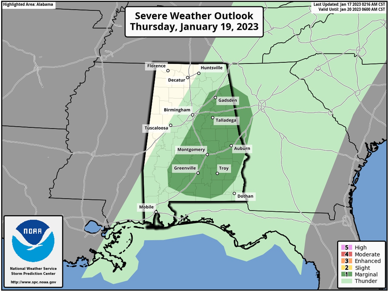
The Storm Prediction Center has added a Level 1 risk for severe weather for Thursday for parts of east and central Alabama as the front continues to push through the state.
Here is Thursday’s severe weather outlook:
The chance for a few severe storms could linger into Thursday for the areas in dark green.
Storms are expected to clear out of Alabama by late Thursday, and drier weather is expected on Friday. However, rain chances will again be part of the forecast starting on Saturday. As of now, no severe weather is expected this weekend.
