A few strong storms possible tonight in Alabama
Rain and storms are still expected to affect Alabama starting tonight and into Thursday, but the chances for severe weather have decreased for part of the state.
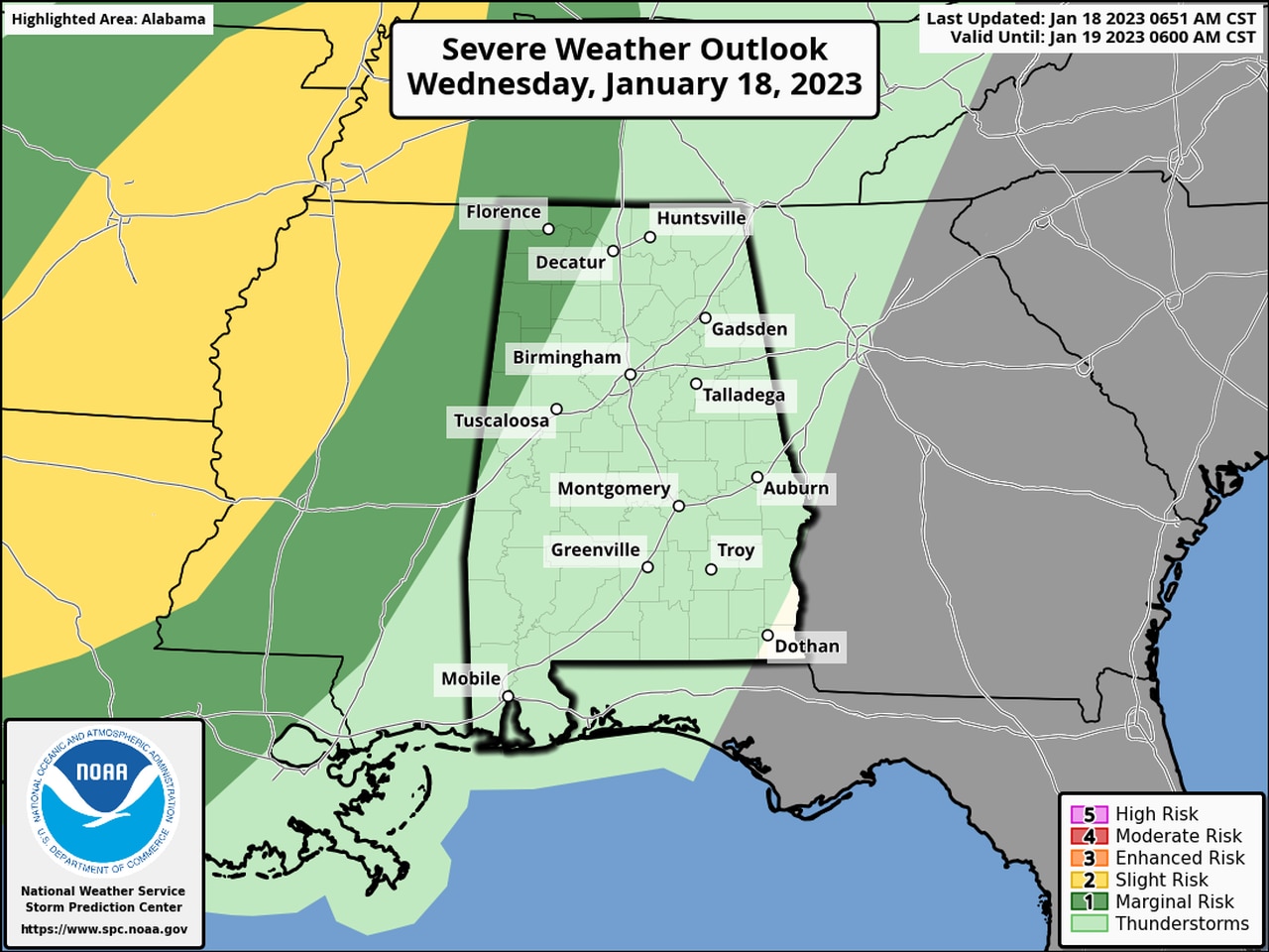
NOAA’s Storm Prediction Center has pulled back on the Level 1 out of 5 risk area for Alabama for today, now confining it to the northwest part of the state. (On Monday much of north and part of central Alabama were in the Level 1 risk area.)
But there still could be a severe storm or two in northwest Alabama starting later tonight.
A Level 1 risk, also called a marginal risk, means that isolated severe storms will be possible.
The strongest storms could spawn a brief tornado and cause damaging wind gusts, according to the National Weather Service. However, the National Weather Service in Huntsville said the tornado risk was on the low side.
Rain and storms are expected to move into the state later tonight ahead of a cold front. Forecast models suggest conditions at that time won’t be as favorable (and they were on the marginal side to begin with) for severe storms over most of the state.
The exception will be the northwest, which could still see a severe storm or two. According to the weather service the most likely time for any stronger storm to affect Alabama could be from 9 p.m. until 3 a.m.
The storms are expected to weaken as they push southward and eastward through the nighttime hours.
The rain and storms are expected to move out of Alabama during the day on Thursday, and drier conditions are in the forecast for Friday before rain returns to the state on Saturday.
No severe weather is expected over the weekend.