A few strong storms possible Monday in Alabama
Parts of Alabama could see a few severe storms today, and a tornado watch will be in effect for part of south Alabama until 9 a.m.
And few more storms may be possible later today in other parts of Alabama today as an area of low pressure swings across the state, according to forecasters.
Parts of Alabama had to deal with severe storms overnight, but as of 7 a.m. there have been no tornado warnings in the state.
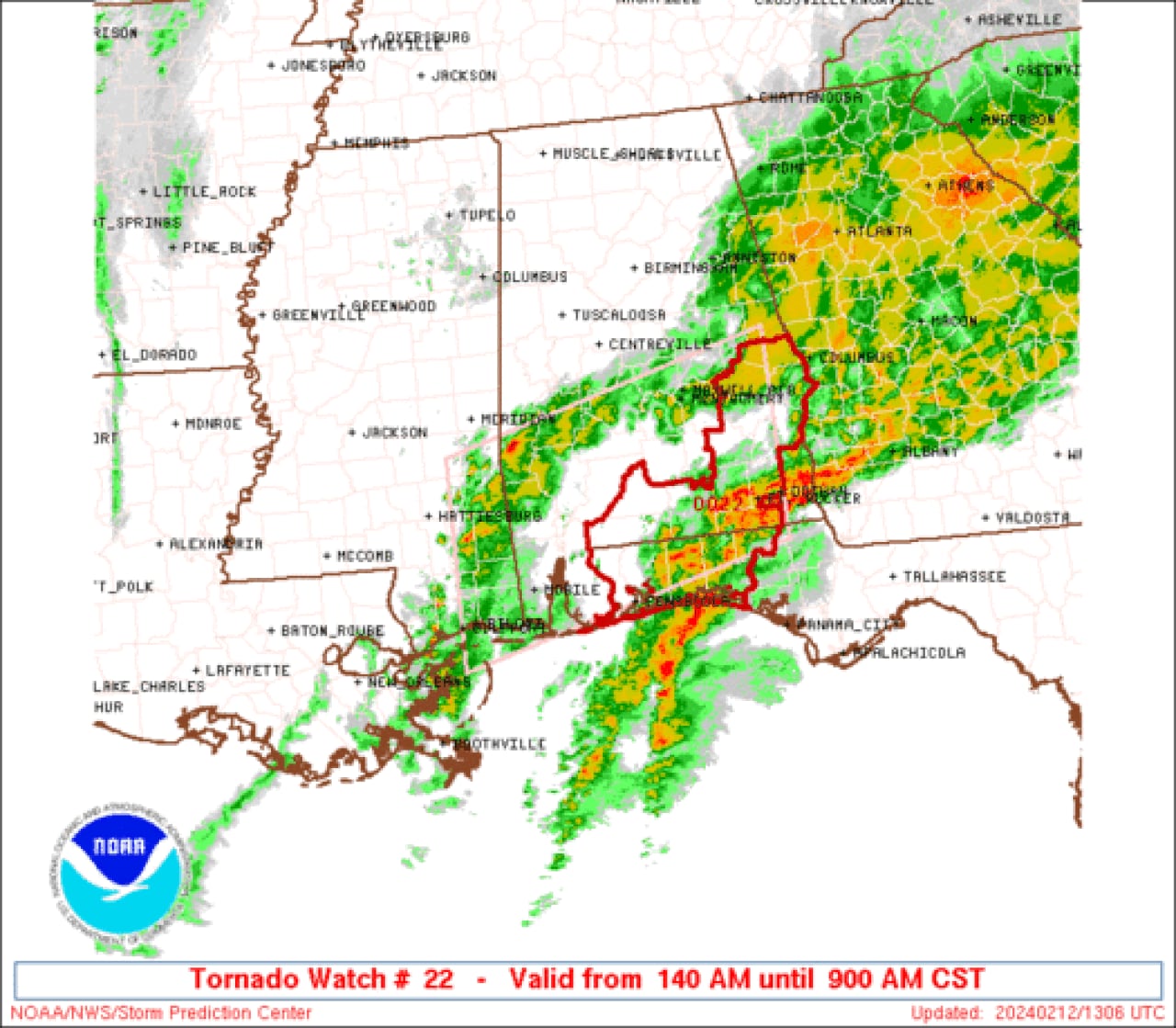
Here’s a look at the watch as of 7 a.m.:
A tornado watch remains in effect for several Alabama counties until 9 a.m. Monday.SPC
Heavy rain has been ongoing across parts of south-central Alabama, and several areas are under flash flood warnings, according to the National Weather Service.
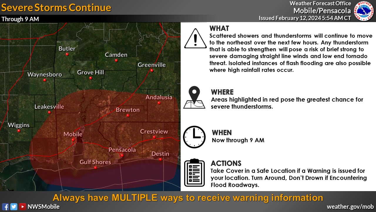
The weather service said it will be watching areas closer to the coast for potential severe storms this morning:

Severe storms will be possible across parts of south Alabama on Monday morning.NWS
Much of the rain and storms had moved out of parts of north and west Alabama on Monday morning, but there is the potential the state could see a few more storms later this morning into the afternoon as an area of low pressure moves through, according to the weather service.
The weather service said if there is enough instability in the atmosphere when that happens it could cause a few stronger storms.
Rain is expected to linger across parts of the state today and even into tonight. That could transition to a few snow flurries just over the state line in Tennessee, but the weather service doesn’t think they will affect Alabama.
Drier and cooler weather is expected after today through the work week, and the next chance for rain is expected to arrive next weekend.
Here’s a look the forecast for Alabama by region:
NORTH ALABAMA
CENTRAL ALABAMA
SOUTH ALABAMA
