A few snow flurries possible Friday in north Alabama
If you’re lucky you may spot a snowflake or two today if you’re in north Alabama.
The National Weather Service said a few flurries will be possible today in north and parts of north-central Alabama.
No accumulations or impacts are expected, forecasters said, with warmer ground temperatures and lighter precipitation amounts expected to keep anything frozen from hanging around.
Temperatures across Alabama were mostly above freezing early Friday morning.
The weather service in Huntsville was tracking light precipitation on radar Friday morning:
The weather service said a few flurries will be possible through the afternoon hours.
Areas north of Interstate 22 and east of I-20 will be more likely to see any snowflakes, the weather service said.
Precipitation amounts will likely be lighter than previously expected.
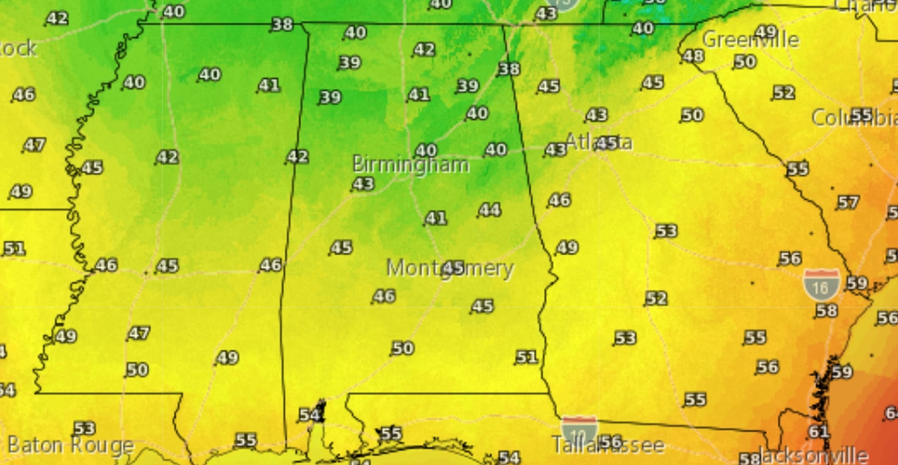
Cold temperatures will be the story today, with highs not expected to make it out of the 30s in parts of north Alabama and only 40s expected through central Alabama. South Alabama will reach the 50s.
Here’s the high temperature forecast for Friday:
A big change in temperatures will be felt today across Alabama.
Lows tonight into Saturday morning will fall below freezing for much of Alabama:
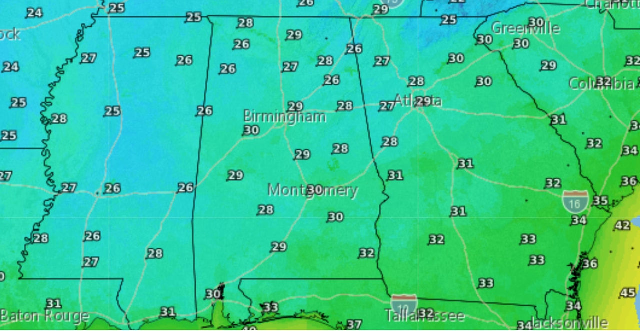
Temperatures will fall below freezing across much of Alabama tonight into Saturday morning.
Temperatures will warm some over the weekend, with the next chance of rain expected on Monday.
No severe weather is expected, however.