A few severe storms possible Saturday in Alabama
Strong to severe storms will be possible in Alabama on Saturday.
The strongest storms could have damaging wind gusts capable of toppling trees and power lines, a tornado and heavy rain.
A flood watch continues for central Alabama through today, and some spots could get up to an additional 1.5 inches of rain.
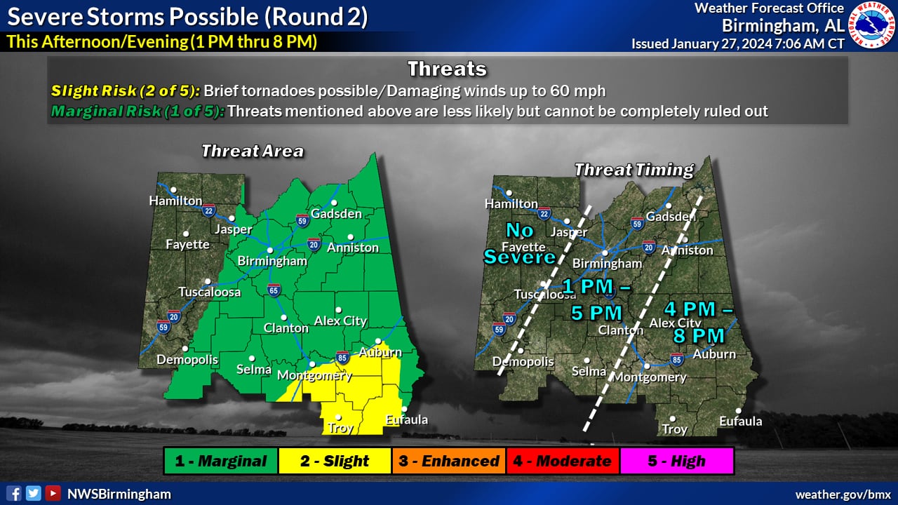
NOAA’s Storm Prediction Center has included parts of central and south Alabama in a Level 2 out of 5 risk for severe weather today. A Level 2 risk means that scattered severe storms will be possible.
Most of the rest of Alabama has a Level 1 risk, which means that isolated severe storms will be possible.
Rain and sub-severe storms were moving across Alabama on Saturday morning. That is Round 1 of what could be two rounds of storms today.
Another round of rain will be possible this afternoon, and this one has the potential to bring stronger storms, according to the National Weather Service.
But.
Forecasters said the intensity of Round 2 will hinge on whether the sun can peek out and the atmosphere “recover” from the morning’s activity. If temperatures can warm up and clouds can break up, then the chances for stronger storms will increase.
If the clouds hang tough, then the chances for storms will decrease.
Forecasters are more confident about the prospect of more rain, however. The weather service said up to an additional 1.5 inches will be possible in parts of the state today.
Here’s what the National Weather Service offices across the state were thinking as of Saturday:
NORTH ALABAMA
CENTRAL ALABAMA
There could be a few stronger storms across central Alabama this afternoon.NWS
SOUTH ALABAMA
There is no other severe weather in the forecast for Alabama after today.
Drier and cooler weather is expected in Alabama starting on Sunday. The weather service is forecasting temperatures to moderate some during the first part of next week.
