Enhanced risk for severe weather tonight in part of Alabama
Severe weather will be possible across parts of south Alabama starting later tonight.
Tornadoes — including a few strong ones — damaging winds and heavy rain will also be possible ahead of a cold front.
The most likely time for severe storms, according to the National Weather Service, will start around 11 p.m. in southwest Alabama and move east of the Interstate 65 corridor in south Alabama after midnight.
It will also be very windy apart from the storms. Wind advisories have been issued for the entire state, and southwest Alabama is under a rarely-used high wind watch.
Winds in southwest Alabama could gust as high as 50 mph later today, the National Weather Service said. The rest of the state could see gusts as high as 40 mph.
Winds that strong will be capable of knocking down tree limbs — and power lines.
The National Weather Service warned those in south Alabama to get prepared now for what could be coming later today:
“There is potential for numerous trees to come down across the area, along with downed power lines and power loss. Given the nocturnal nature of this system and the higher potential for power loss before the approaching severe weather, it is critical that you have MULTIPLE ways to receive warnings that will wake you up. Ensure that at least two ways are battery powered and the batteries are charged including phones and weather radios.”
Rain and storms will be possible through the day today, according to forecasters, but the threat for severe weather won’t likely begin until later tonight. And storms are expected to last into Wednesday in east Alabama.
NOAA’s Storm Prediction Center is maintaining a Level 3 out of 5 — or enhanced risk — for severe weather today for the southwest part of the state, including Mobile.
A Level 3 risk means that numerous severe storms will be possible.
Areas to the north and east of the Level 3 risk area, including spots like Andalusia, Monroeville and Evergreen, will have a Level 2 risk. A Level 2 risk means scattered severe storms will be possible.
Farther north, into parts of central Alabama, will be Level 1 risk for isolated severe storms. Areas with a Level 1 risk include Tuscaloosa, Montgomery, Troy and Dothan.
All of Alabama will see rain later today, and maybe a few storms. But the northern part of the state is not expected to have to deal with severe weather.
The National Weather Service will be watching a warm front and a cold front today. Both are key players in who gets severe weather and who doesn’t.
The warm front is expected to lift northward from the Gulf and into south Alabama today. The weather service is expecting the warm front to stall out somewhere across south or south-central Alabama.
Areas south of that warm front will be in an area more favorable for severe storms.
Areas to the north of the front will not likely see severe weather.
Storms could also form along the warm front as it pushes northward today, forecasters said.
Then, later tonight, a cold front will approach Alabama from the west. A line of storms is expected to arrive ahead of it, and those storms are the ones capable of severe weather, forecasters said.
The line is expected to push across the state from west to east.
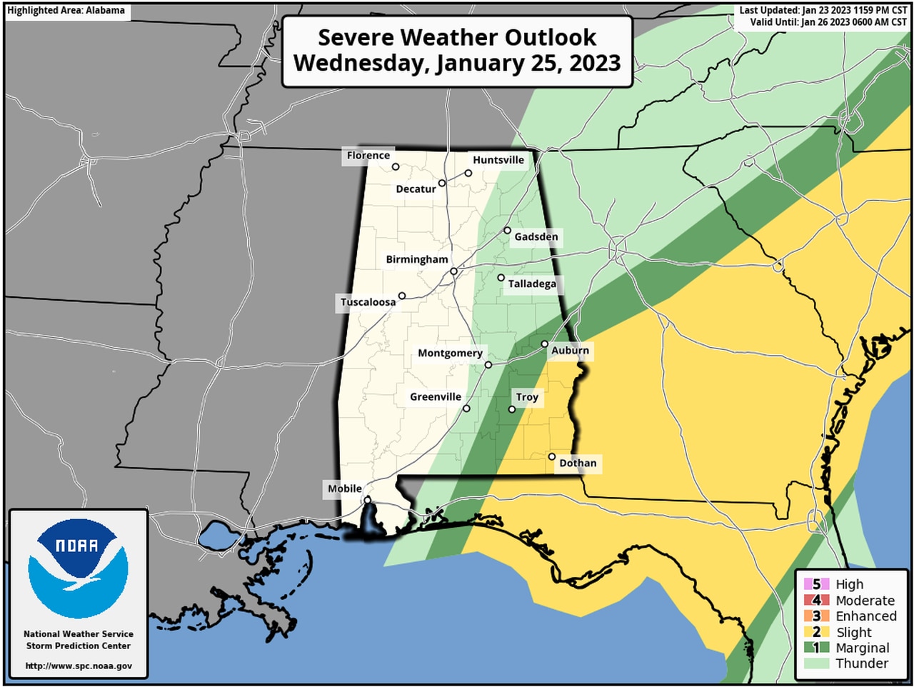
Parts of eastern Alabama will face the threat for severe storms into the day on Wednesday.
The Storm Prediction Center has added a Level 2 out of 5 risk for severe storms for the southeast corner of Alabama for Wednesday as the line continues to advance eastward.
Here is Wednesday’s severe weather outlook:
A Level 2 risk for severe storms will last into the day on Wednesday for southeast Alabama.
The storms are expected to move out of Alabama on Wednesday, and drier and cooler weather is expected statewide starting on Thursday and lasting into the weekend.
Watches and advisories:
* High wind watch: From Tuesday afternoon into Tuesday night. Counties included are Choctaw, Washington, Clarke Wilcox, Monroe, Conecuh, Butler, Crenshaw, Escambia, Covington, Mobile and Baldwin.
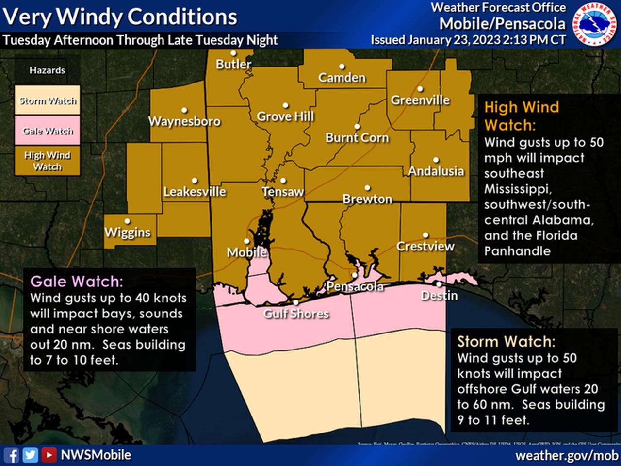
All of southwest Alabama will be under a high wind watch starting later today.
The weather service in Mobile said southeast winds of 20 to 30 mph will be possible starting Tuesday afternoon, becoming southwest 25 to 35 mph Tuesday night. Gusts up to 50 mph possible.
* High rip current risk: Along Alabama beaches through Wednesday afternoon.
* Coastal flood advisory: For Mobile and Baldwin counties from 9 p.m. Tuesday until 9 a.m. Wednesday.
* High surf warning: For Mobile and Baldwin counties from 9 p.m. Tuesday until noon Wednesday.
* Wind advisory: Includes all of central Alabama from 9 p.m. Tuesday until 3 p.m. Wednesday. Sustained winds 15 to 25 mph with gusts up to 40 mph are expected.
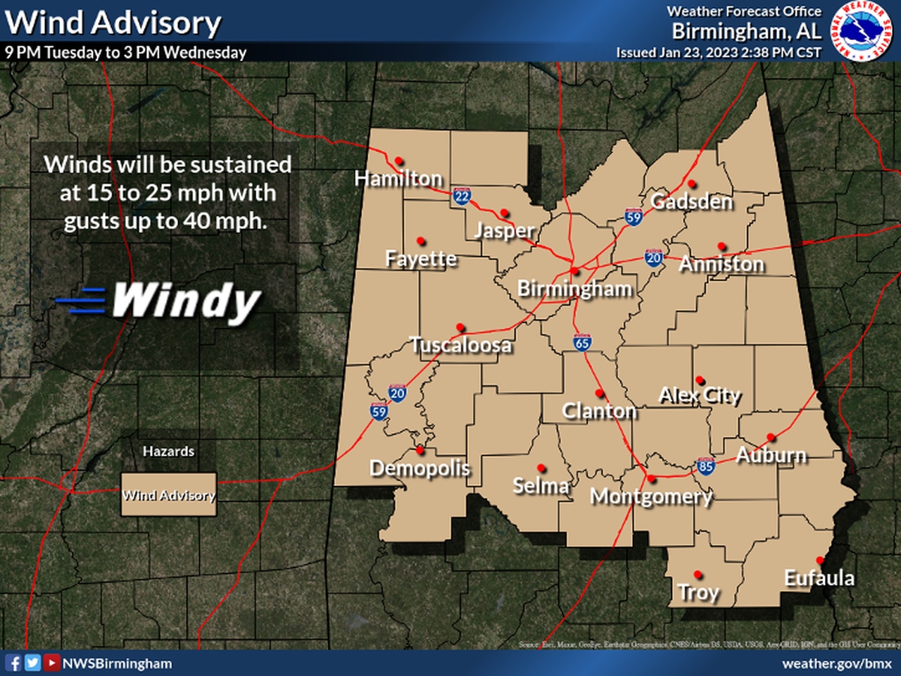
All of central Alabama will be under a wind advisory on Tuesday.
* Wind advisory: For southeast Alabama (Coffee, Dale, Geneva, Henry and Houston counties) from midnight until noon Wednesday. South winds 20 to 30 mph with gusts up to 40 mph expected.
* Wind advisory: For all of north Alabama from 9 p.m. today until 3 p.m. Wednesday. South winds 20 to 30 mph with gusts of 40 mph or greater expected. Gusts to around 50 mph possible in the higher elevations.
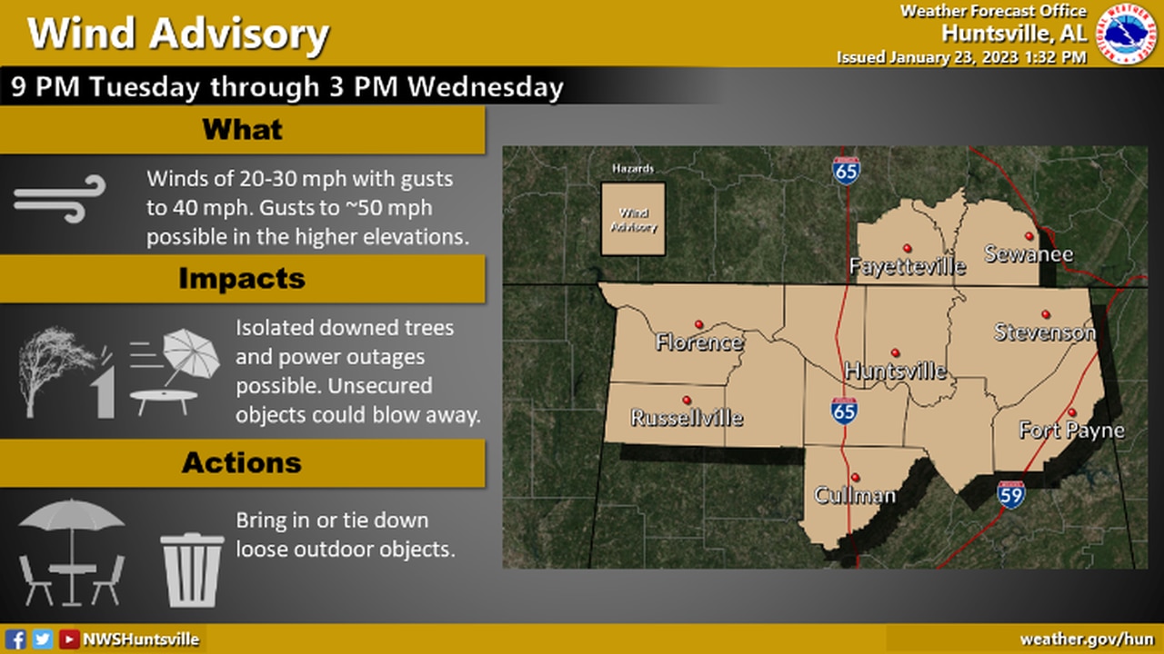
A wind advisory will be in effect for all of north Alabama on Tuesday.