Up to 6 inches of rain possible in Alabama this week
The forecast for rain across Alabama is holding steady, with up to 6 inches possible in parts of the state through this weekend.
Rain is expected across the state in multiple rounds starting today, and flood watches will go into effect on Wednesday for parts of north and central Alabama.
Forecasters think the heaviest rain will be possible on Wednesday and Thursday.
The weather service urged Alabamians not to drive across flooded roadways, and emphasized that flooding may be particularly dangerous during the overnight hours when it is harder to see.
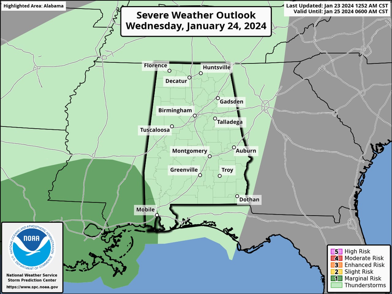
In addition, parts of southwest and south Alabama will have a low-end risk for isolated severe storms. NOAA’s Storm Prediction Center has added a Level 1 out of 5 risk for severe weather for parts of south Alabama on both Wednesday and Thursday.
Thunderstorms will be possible for the rest of Alabama as well, but severe weather isn’t likely.
Here’s what to expect in your region of Alabama this week:
NORTH ALABAMA
* A flood watch for all of north Alabama will be in effect from Wednesday afternoon through Thursday evening. The counties in the watch are Colbert, Cullman, DeKalb, Franklin, Jackson, Lauderdale, Lawrence, Limestone, Madison, Marshall and Morgan.
The National Weather Service in Huntsville said between 2.5-3.5 inches of rain are expected across the region on Wednesday and Thursday, along with locally higher totals.
Rain will be possible in multiple rounds through Saturday.
CENTRAL ALABAMA
* A flood watch will be in effect from Wednesday afternoon through Thursday evening for Bibb, Blount, Calhoun, Cherokee, Etowah, Fayette, Greene, Hale, Jefferson, Lamar, Marion, Pickens, Shelby, St. Clair, Sumter, Talladega, Tuscaloosa, Walker and Winston counties.
The National Weather Service in Birmingham said the heaviest rain and storms are expected to move into central Alabama Wednesday afternoon and persist through Thursday evening. Two to 4 inches of rain will be possible, with locally higher amounts.
SOUTH ALABAMA
No flood watches have been issued for south Alabama, but rain is expected across the area through the rest of the week.
The National Weather Service in Mobile said scattered showers will be possible today, and they could become more widespread by tonight into Wednesday morning.
The weather service in Tallahassee, Fla., which covers southeast Alabama, said scattered rain will be possible starting today, with higher rain chances will arriving in southeast Alabama on Thursday and into Thursday night.
Heavy rain and flash flooding will be possible for areas that get repeated rounds of rain and storms. The weather service said 1 to 2 inches of rain will be possible through Wednesday afternoon in southwest Alabama, with rain amounts likely decreasing in the eastern parts of south Alabama.
There will also be the potential for strong storms. There will be a Level 1 out of 5 risk for isolated severe storms for parts of south Alabama on Wednesday and Thursday.
Here is the severe weather outlook for Wednesday:
A small part of southwest Alabama will have a Level 1 severe weather risk on Thursday.SPC
Here is the outlook for Thursday:
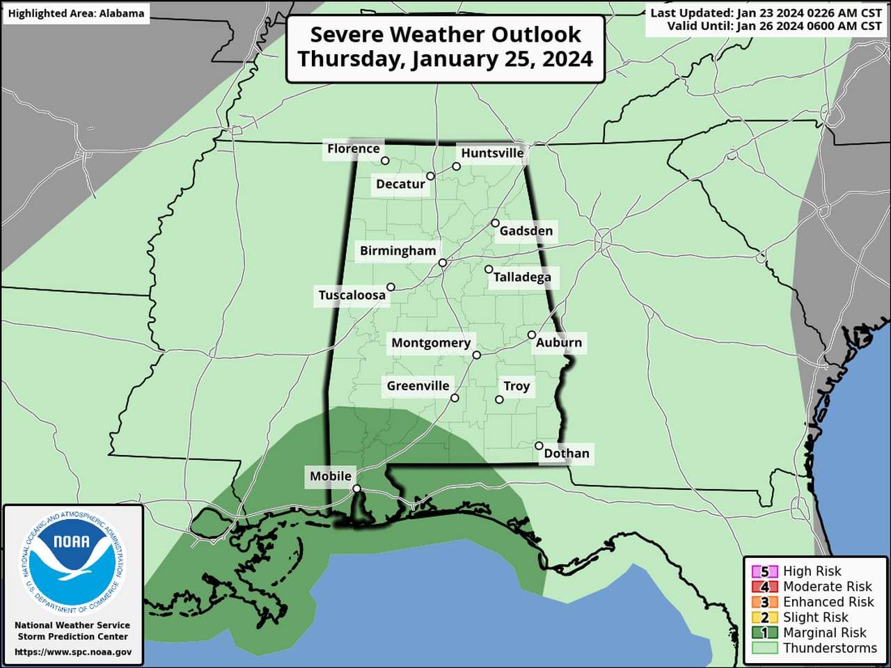
More of south Alabama will have a Level 1 severe weather risk on Thursday.SPC
The weather service in Mobile said the overall severe weather threat is on the low side, but damaging winds and a tornado could be possible.