Hard freeze warning for Alabama until Wednesday morning
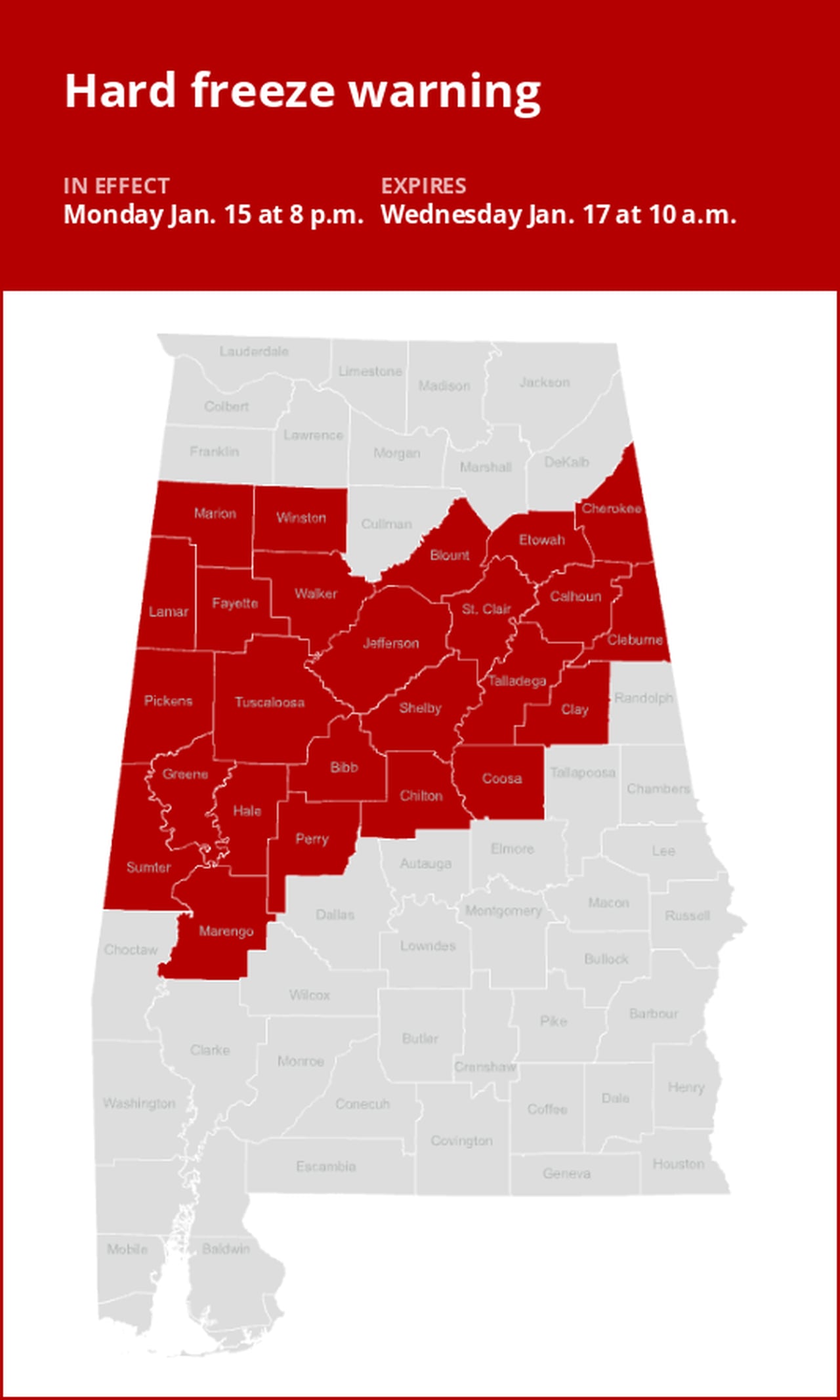
A hard freeze warning was issued by the National Weather Service on Monday at 4:32 a.m. valid from 8 p.m. until Wednesday 10 a.m. for Marion, Lamar, Fayette, Winston, Walker, Blount, Etowah, Calhoun, Cherokee, Cleburne, Pickens, Tuscaloosa, Jefferson, Shelby, St. Clair, Talladega, Clay, Sumter, Greene, Hale, Perry, Bibb, Chilton, Coosa and Marengo counties.
The weather service states, “Temperatures drop into the teens tonight, remain below freezing in many areas tomorrow, and drop into the single digits and teens Tuesday night.”
“Prolonged sub-freezing temperatures may cause pipes to burst. Bitterly cold temperatures and wind chills can result in hypothermia or frostbite. These conditions are life-threatening to those with prolonged exposure or without access to warmth,” says the weather service. “To prevent freezing and possible bursting of water pipes they should be wrapped, drained, or allowed to drip slowly. Those that have in-ground sprinkler systems should drain them and cover above-ground pipes to protect them from freezing.”
What to do if there is a hard freeze watch or warning
Hard freeze warnings are issued from May to October (but can be extended if necessary). A hard freeze warning is issued when temperatures are expected to be 28 degrees or less. If there is a potential for temperatures to fall into these thresholds, a hard freeze watch may be issued a few days ahead of time.
According to the weather service, if a hard freeze warning or watch is issued for your area, there is little you can do to protect plants. If you can move your sensitive plants inside, do so because the freeze will kill them.
Advance Local Weather Alerts is a service provided by United Robots, which uses machine learning to compile the latest data from the National Weather Service.