Snow in Alabama: Up to 4 inches possible in areas as winter storm threatens wind chills below zero
The coldest temperatures of the winter are on the way to Alabama, and there will likely be some snow and ice arriving along with them.
Some areas in Alabama could see 1-4 inches of snow, according to forecasters. Ice could also be an issue for parts of the state:
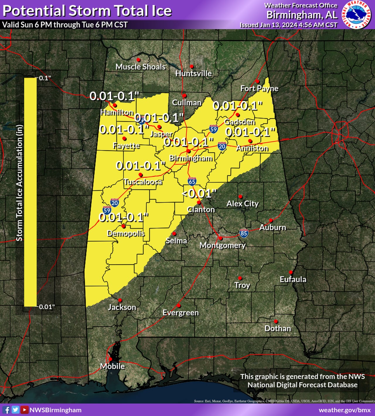
Here are the potential ice accumulations.NWS
The National Weather Service has issued a winter storm watch for several Alabama counties and is warning all of Alabama to be prepared for extreme cold through at least Wednesday.
Forecasters said confidence is increasing about the potential for accumulating snow in parts of north and north-central Alabama.
The area expected to see the most is northwest Alabama, according to forecasters.
The cold temperatures could make travel very difficult or impossible in areas that get frozen precipitation, the weather service said. And hazardous travel could last into Wednesday or Thursday in some areas that stay below freezing.
Those in north and central Alabama could experience wind chills below zero during that time, and low temperatures in the teens will be possible all the way into south Alabama.
The kind of cold that’s coming could result in hypothermia for those spending prolonged time outside, as well as burst pipes.
The coldest night is expected to be Tuesday into Wednesday morning, according to forecasters.
Here are the lows expected Tuesday into Wednesday:
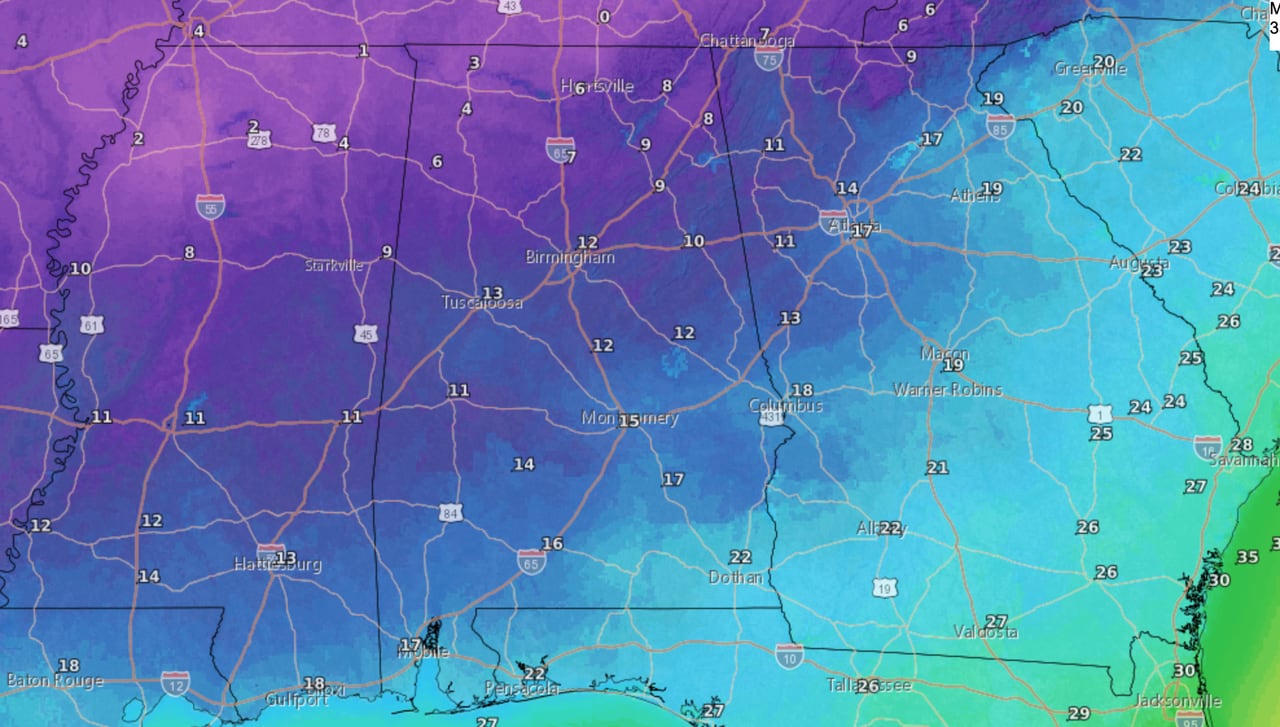
Temperatures will fall into the teens nearly statewide on Tuesday night into Wednesday morning.NWS
Here’s a look at what forecasters are expecting:
NORTH ALABAMA
A winter storm watch has been issued for the north Alabama counties of Lauderdale, Colbert, Franklin, Lawrence, Limestone, Madison and Jackson.
It will be in effect from late Sunday night through late Monday night.
The National Weather Service in Huntsville said north Alabama could see 1 to 4 inches of snow, with northwest Alabama expected to get the most.
CENTRAL ALABAMA
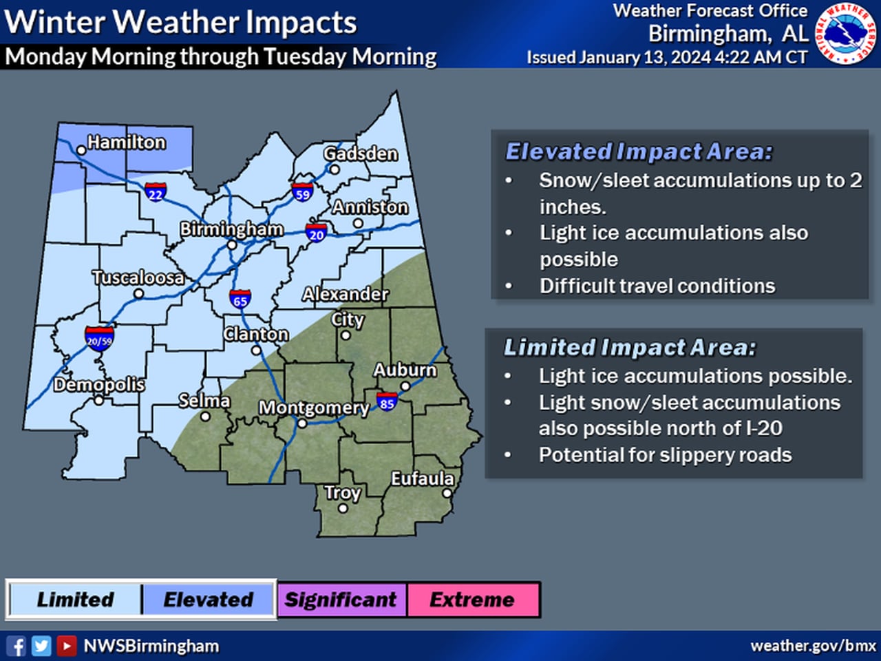
There will be the potential for snow and ice far into central Alabama, but the most accumulating snow will be in the northwest.NWS
A winter storm watch has also been issued for Marion and Winston counties in north-central Alabama. It will be in effect from Monday morning through late Monday night.
The weather service said accumulations of up to 2 inches of snow and a light glaze of ice will be possible.
The weather service added that winter weather advisories may be issued later for areas to the south, where travel could also become hazardous on Monday and Tuesday.
SOUTH ALABAMA
There will also be the potential for some light freezing rain in parts of southwest Alabama. The weather service said the time frame for any frozen precipitation will be late Monday night into Tuesday morning.
If there is frozen precipitation then roads could become slick.
PROLONGED TRAVEL HEADACHES?
Any winter precipitation that falls may be around for a while. High temperatures on Tuesday may not reach the freezing point for a large part of north and central Alabama, and some spots may not rise above 32 degrees until Wednesday afternoon or even Thursday.
Forecasters said there is another system expected to affect Alabama by Thursday night into Friday.
Forecast models are not in agreement on what temperatures will be like for that system, so it’s too soon to say if there will be any further winter weather concerns late next week.