Will Alabama get snow this weekend? Will it accumulate?
There’s lots of buzz is going around Alabama about the potential for wintry precipitation this weekend.
Will it snow? Will it stick? Will it accumulate?
The potential for snow in Alabama is always a tricky issue, especially with the setup that could present itself over the weekend.
It’s always a question of whether cold air will overlap with enough moisture to squeeze out a few snowflakes. Typically what happens is the rain is long gone before the cold arrives. Or there’s only a brief overlap — enough for a few flurries. But sometimes it can add up to more.
Will this be one of those times?
The National Weather Service has its primary attention on Friday’s potential for severe weather, which could bring tornadoes and straight-line winds back to the state starting in the morning and lasting into the afternoon.
Cold air is expected to filter into the state on the backside of that system, and there could be some snow flurries in north Alabama on Friday night, but it will be dry for the majority of the weekend.
The core of the speculation begins late Sunday into Monday, where there’s the potential for things to get interesting.
The weather service said an Arctic front, along with a very cold airmass, will be headed toward Alabama from the northwest this weekend.
It remains to be seen if that front will have any moisture to work with, and when it gets here.
The weather service said forecast models often struggle with shallow cold air masses in this part of the country, and different models are offering up different scenarios of what might happen.
So the weather service cautioned weather-watchers not to take any single model forecast to the bank, because it’s still too early to know how it will play out. Unfortunately, it looks likely to be a wait-and-see situation.
If Alabama gets precipitation, it could very well start out in the form of freezing rain or sleet. Then it could transition to some snow.
The weather service in Huntsville wasn’t ruling out the possibility of some light accumulations for north Alabama, but the weather service in Birmingham didn’t go that far just yet. And a few snowflakes might even be spotted into parts of southern Alabama, according to the weather service in Mobile.
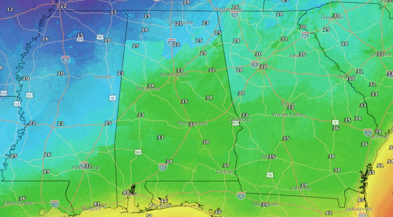
Lows from Sunday night into Monday morning will be on the cusp of the freezing point in a lot of areas except for north Alabama, which will be below freezing. Here’s the low-temperature forecast for that timeframe:
Here is the low temperature forecast for Sunday night into Monday morning.NWS
A secondary blast of cold air — really cold air — is expected to arrive behind the Arctic front.
The weather service added there there could be more light snow on Monday night into Tuesday, when even colder air is expected to be in place.
Forecasters said to keep an eye on the weekend forecast for changes, which are likely. Also be prepared because it’s going to get even colder next week, with low temperatures in the teens possible.
Here’s an early look at the low temperature forecast for Tuesday morning, Jan. 16:
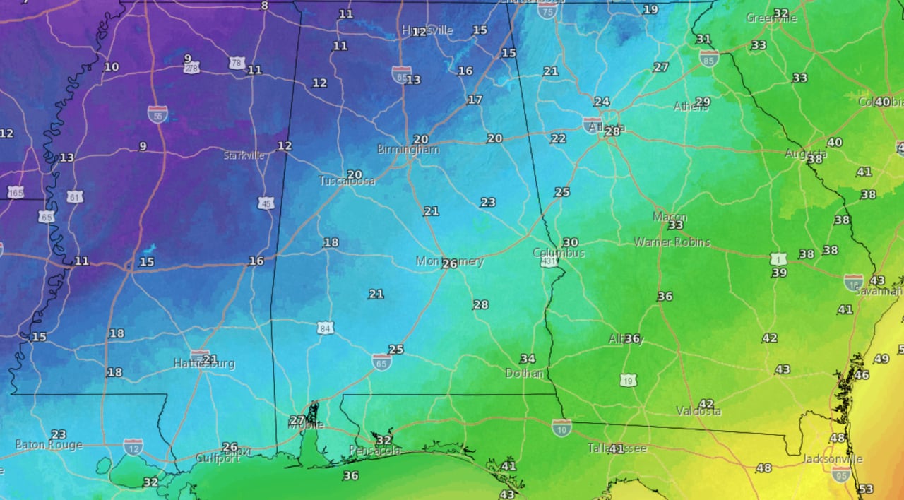
Really cold air will arrive in parts of Alabama on Monday. Here’s the low temperature forecast for Monday night into Tuesday morning.NWS