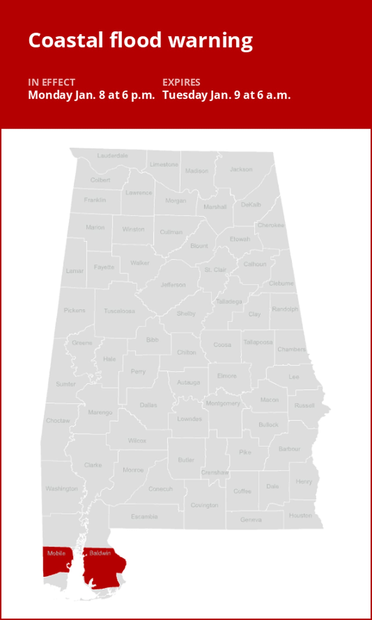
Mobile and Baldwin counties under a coastal flood warning until Tuesday morning
On Monday at 2:29 p.m. the National Weather Service issued a coastal flood warning valid from 6 p.m. until Tuesday 6 a.m. for Mobile and Baldwin counties.
The weather service describes, “Significant coastal flooding expected with tidal heights up to around 3 feet.”
“Numerous roads may be closed. low-lying property including homes, businesses, and some critical infrastructure will be inundated. Some shoreline erosion will occur,” adds the weather service. “Take the necessary actions to protect flood-prone property. If travel is required, do not drive around barricades or through water of unknown depth.”
Deciphering advisories, watches, and warnings: Understanding weather Alerts
- Flash flood warning: Take action!
A flash flood warning is issued when a flash flood is either imminent or already occurring. In flood-prone areas, it’s crucial to move immediately to higher ground. A flash flood is a sudden and violent inundation that can develop within minutes to hours, and it can even happen in areas not currently experiencing rainfall.
- Flood warning: Take action!
A flood warning is issued when flooding is imminent or occurring.
- Flood advisory: Be aware:
A flood advisory is released when flooding is not expected to reach a severity level necessitating a warning. Nonetheless, it can still cause considerable inconvenience and, without exercising caution, potentially lead to situations that threaten life and/or property.
- Flood watch: Be prepared:
A flood watch is issued when conditions are favorable for flooding. It does not mean flooding will occur, but it is possible.
Weather service flood safety guidelines: Weathering the storm
Floods can pose a significant threat, especially if you live in a flood-prone area or find yourself camping in a low-lying region. To ensure your safety, the weather service offers essential flood safety guidelines:
1. Move to higher ground:
- If you reside in a flood-prone region or are camping in low-lying terrain, the first step to safety is relocating to higher ground.
2. Adhere to evacuation orders:
- If local authorities issue an evacuation order, heed it promptly. Prior to leaving, secure your home by locking it.
3. Disconnect utilities and appliances:
- If time permits, disconnect your utilities and appliances. This precaution minimizes electrical hazards during flooding.
4. Steer clear of flooded basements and submerged areas:
- Steer clear of basements or rooms where water has submerged electrical outlets or cords. This helps prevent electrical accidents.
5. Evacuate promptly for safety:
- If you notice sparks or hear buzzing, crackling, snapping, or popping sounds, evacuate without delay. Do not enter water that may carry an electrical charge.
6. Refrain from walking in floodwaters:
- Never attempt to walk through floodwaters, even if they appear shallow. Just 6 inches of fast-moving water can forcefully sweep you off your feet.
7. Seek higher ground when trapped:
- Should you become trapped by moving water, reach the highest point possible and dial 911 to contact emergency services.
During heavy rainfall, the risk of flooding is heightened, especially in low-lying and flood-prone regions. Always remember never to drive through water on the road, no matter how shallow it appears. According to the weather service, as little as 12 inches of rapidly flowing water can carry away most vehicles. Stay safe by being prepared and informed.
Driving through downpours: Safety guidelines for wet roads
When heavy rain strikes, safety is paramount. Equip yourself with these guidelines from the weather service to navigate wet roads and avoid hazards:
Beware of swollen waterways:
- Avoid parking or walking in close proximity to culverts or drainage ditches, as the swiftly moving water during heavy rain can potentially carry you away.
Maintain safe driving distances:
- The two-second rule for following distance is your ally in heavy rain. Extend it to four seconds to ensure safe spacing in adverse conditions.
Slow down and stay cautious:
- On wet roads, reducing your speed is crucial. Ease off the gas pedal gradually and avoid abrupt braking to prevent skidding.
Choose your lane wisely:
- Stick to the middle lanes to minimize the risk of hydroplaning. Outer lanes are more prone to accumulating water.
Prioritize visibility:
- Turn on your headlights and be careful of other vehicles to the rear and in blind spot areas as they are especially difficult to see through rain-spattered windows.
Watch out for slippery roads:
- The first half-hour of rain is when roads are slickest due to a mix of rain, grime, and oil. Exercise heightened caution during this period.
Keep a safe distance from large vehicles:
- Large trucks and buses can reduce your visibility with tire spray. Avoid tailgating and pass them swiftly and safely.
Mind your windshield wipers:
- Overloaded wiper blades can hinder visibility. If rain severely limits your sight, pull over and wait for conditions to improve. Seek refuge at rest areas or protected spots.
- If the roadside is your only option, pull off as far as possible, preferably past the end of a guard rail, and wait until the storm passes. Keep your headlights on and turn on emergency flashers to alert other drivers of your position.
In the face of heavy rain, these precautions can make a significant difference in ensuring your safety on the road. Remember to stay informed about weather conditions and heed guidance from local authorities for a secure journey.
Advance Local Weather Alerts is a service provided by United Robots, which uses machine learning to compile the latest data from the National Weather Service.