Damage from high winds, severe weather possible, EMA warns: What time will storms arrive?
Rain and a few thunderstorms will move into south Alabama by early Monday afternoon with storms intensifying in the western sections of the state after midnight Tuesday and exiting the eastern sections by late Tuesday morning. Damaging wind gusts will be the main threat south of the Lamar County to Clanton and Auburn line, according to Jim Stefkovich, EMA meteorologist.
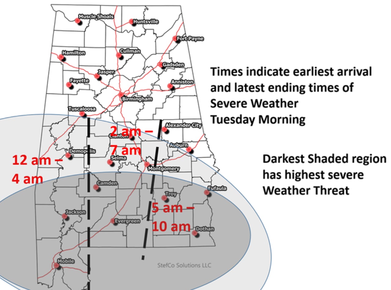
In addition to the possibility of damaging winds, there could be a few embedded tornadoes within the line of storms as well as a few supercells developing just ahead of the line south of the Livington/Montgomery/Auburn line – south of Highway 80/I-85. That same region faces the highest threat of severe weather, Stefkovich said.
Non-thunderstorm winds will be on the increase statewide beginning late Monday morning and continuing through the afternoon with gusts from 20-35 mph. By sunset, gusts will be from 25-45 mph and continue throughout the night. A few gusts could be near 50 mph, enough to down trees and potentially cause power outages.
Statewide rainfall of 2-4 inches of rain will fall and localized flash flooding is possible.
It will remain windy on Tuesday with gusts from 20-35 mph and a few gusts from 35-45 mph through Tuesday evening.
Showers will likely continue north of I-20 into very early Wednesday morning, with a changeover to snow flurries or light snow possible. No impacts will occur from any snowfall.
Timing of the storms
Storms will enter the southwestern half of the state around midnight Tuesday and last into 4 a.m. The southern central part of the state can expect storms to arrive around 2 a.m. Tuesday and lasting until 7 a.m. The storms will arrive in the southeastern part of the state around 5 a.m. and leave around 10 a.m. Wednesday.
The southern third of the state is under the greatest threat from the several weather.