Strong winds expected across Alabama starting Monday
A potent weather system has the potential to bring strong winds to Alabama from Monday afternoon into Tuesday morning — and not just to areas that could get severe storms.
The National Weather Service is warning that the winds could be strong enough to take down tree limbs and knock out power to areas across the state, including north and central Alabama.
Forecasters from the weather service office in Birmingham added that “these will be higher than your typical wind advisory with downed trees and power outages expected.”
The southern part of Alabama could also have to deal with severe storms and tornadoes from Monday night into Tuesday morning. The Storm Prediction Center has added a Level 3 out of 5 severe weather risk for southwest Alabama starting on Monday night. The National Weather Service warned those in the southern part of the state that a powerful squall line of storms could bring wide areas of wind damage along with it, and winds there could gust to more than 60 mph.
North and north-central Alabama are not expected to get severe storms, according to the latest outlooks from the SPC.
However, those areas won’t be immune from seeing high winds, storms and heavy rain, according to forecasters. Expect rain to reach west Alabama around sunset on Monday and spread eastward across the state through the night.
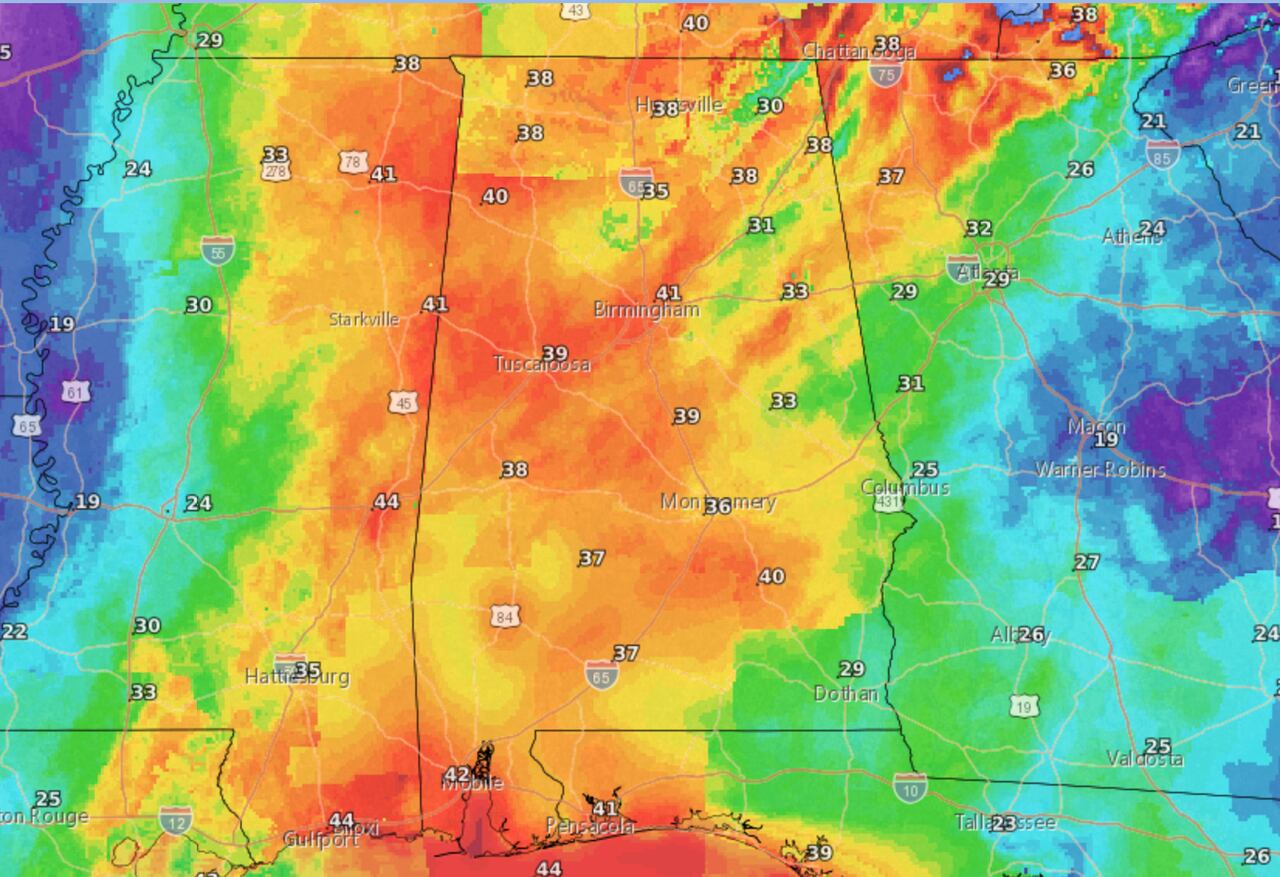
The weather service said those in north and central Alabama will have to deal with what are called gradient winds — non-thunderstorm winds — that could gust as high as 45 mph (and possibly higher in elevated terrain).
Gradient winds are produced by the proximity of two storm systems, in this case a powerful area of low pressure to the west of Alabama and an area of high pressure to the east.
Winds around the area of low pressure rotate counter-clockwise, and winds around areas of high pressure move clockwise, setting up an area of friction in between. Areas sandwiched between the two systems can experience strong winds that are completely separate from any severe weather.
Winds could begin to increase in Alabama starting on Monday afternoon, according to the weather service in Huntsville.
Forecasters estimate winds could be sustained at 20-30 mph and could gust as high as 50 mph through early Tuesday morning. Areas in south Alabama, especially near the coast, could see winds even higher. Gale conditions are expected over the Gulf, and there will be a high risk for rip currents as well as the potential for coastal flooding, according to the weather service.
Heavy rain is also a possibility, with the northern half of the state potentially seeing 2 to 4 inches through Tuesday morning, the weather service said.
The winds could briefly back off during the day on Tuesday but could increase again by Tuesday evening on the back side of the storm system, forecasters said. However those winds aren’t expected to be as high.