Two chances for severe weather for south Alabama
Severe storms will be possible in south Alabama on Friday, and then again on Monday night into Tuesday morning. The risk for Monday could prove to be more significant, according to forecasters.
Tornadoes, damaging winds and heavy rain will be possible, both on Friday and Monday into Tuesday, according to the National Weather Service.
Those in south Alabama are urged to make sure they have several reliable ways to get severe weather warnings — especially if they come during the overnight hours.
NOAA’s Storm Prediction Center has included southwest Alabama in a Level 1 out of 5 (marginal) risk for severe weather on Friday.
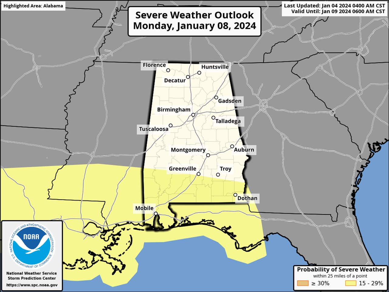
Then there could be a more robust chance for storms on Monday night into Tuesday morning — and that could affect more of south Alabama. Here is the severe weather outlook for Monday:
Much of south Alabama could be at risk of seeing severe weather on Monday.SPC
Here’s the outlook for Tuesday:
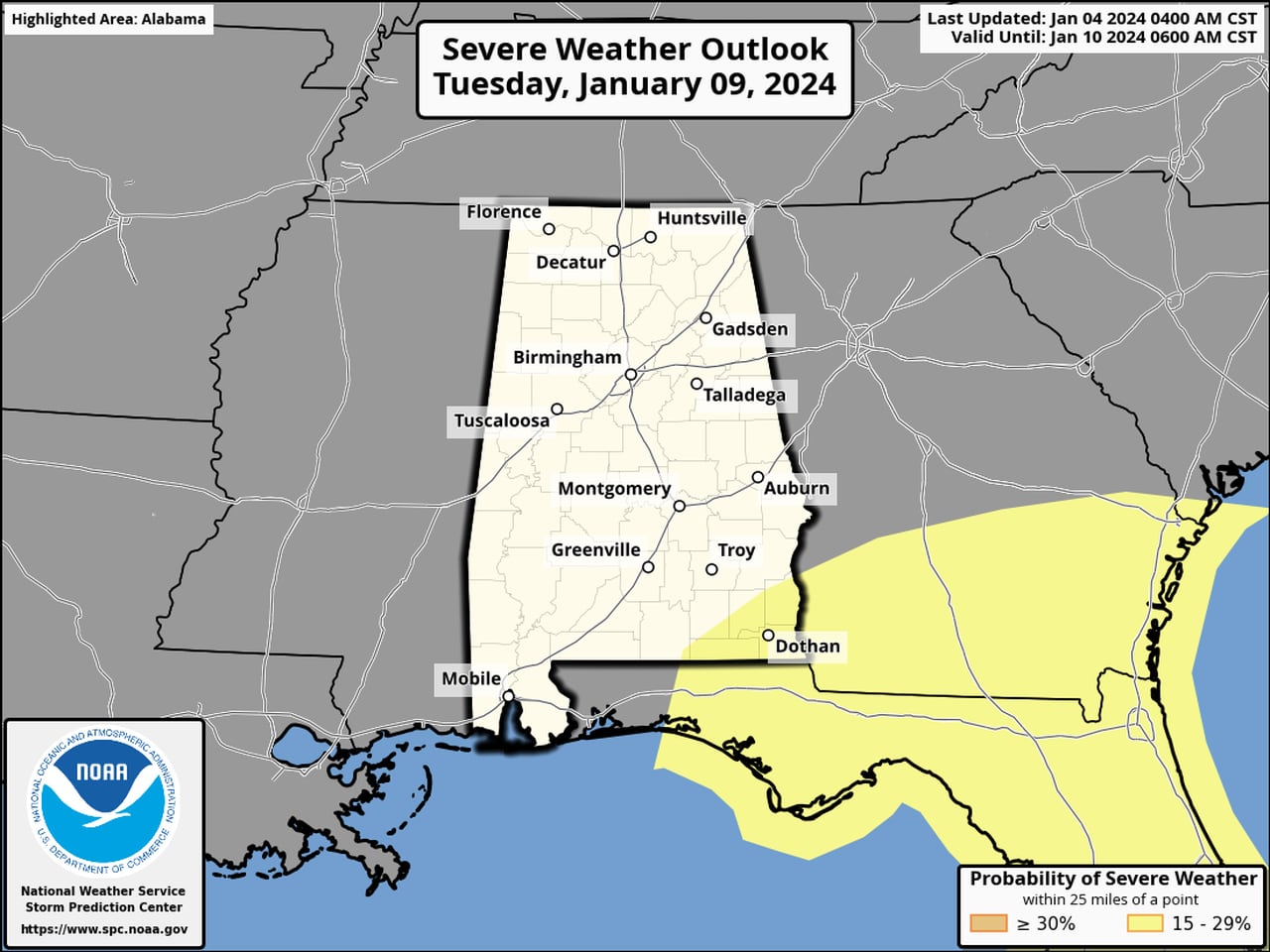
The chance for severe storms could linger into Tuesday for southeast Alabama.SPC
Friday’s Level 1 risk means that isolated severe storms will be possible. The time frame, according to the National Weather Service, will be Friday afternoon into Friday night.
The weather service expects an area of low pressure to develop and move along the Gulf Coast on Friday. Forecasters expect rain chances to increase for southwest Alabama on Friday afternoon.
Damaging winds and a tornado will be possible with any stronger storm that develops.
However, the weather service said it’s uncertain if the juiciest air will make it far enough north from the Gulf to affect southwest Alabama. If it does move northward and over Alabama, then there will be the potential for a few severe storms to develop.
The cold front is then expected to track from west to east across the region later on Friday into Saturday.
Drier conditions are expected to take over later on Saturday and into Sunday before the next weather system arrives and brings another chance for severe storms.
The Storm Prediction Center has south Alabama again in a risk for severe weather on both Monday and Tuesday.
The most likely time for storms on Monday will be later in the evening and into Tuesday morning. This system has the potential to be stronger, with better chances for damaging winds and a tornado, according to the weather service.
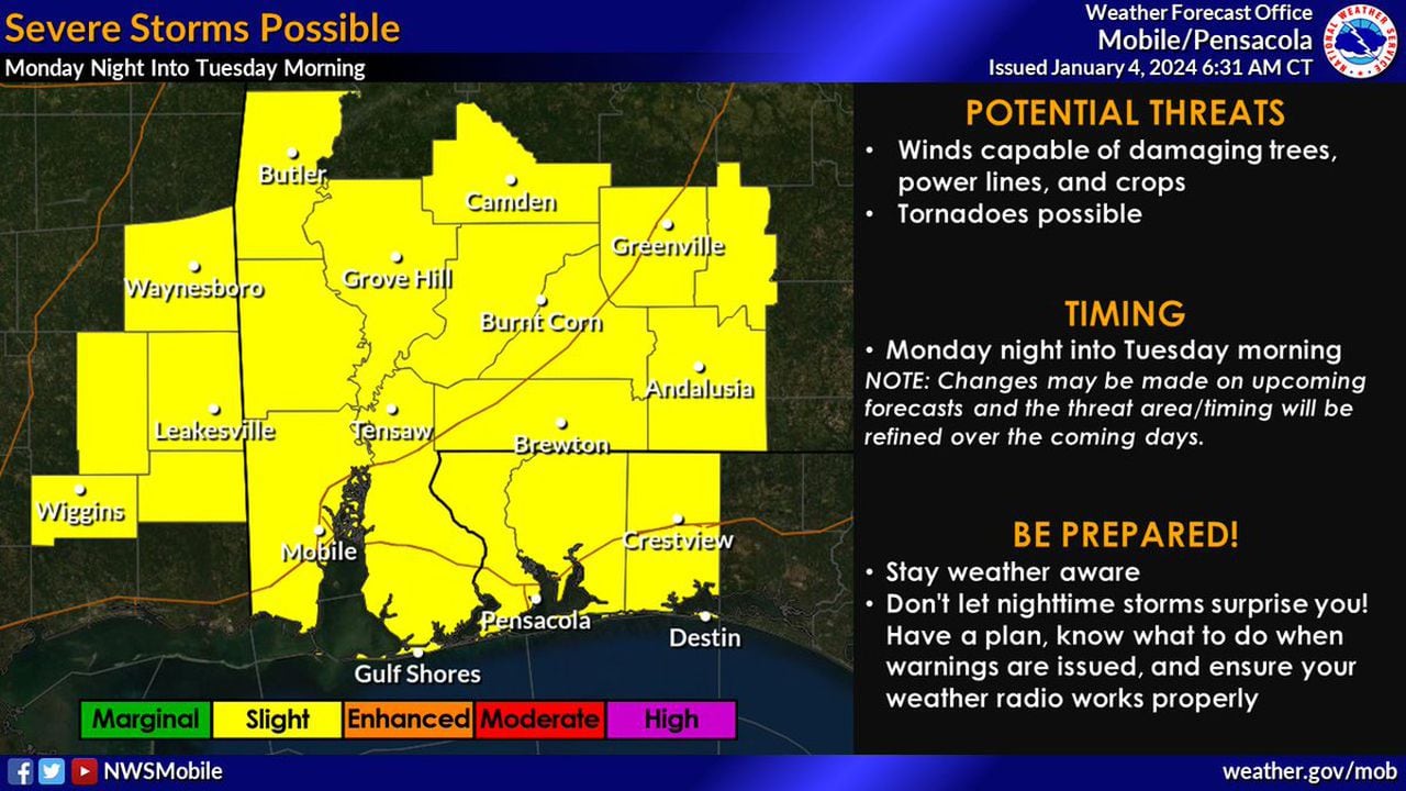
Another round of storms will be possible for south Alabama from Monday night into Tuesday morning.NWS
Forecasters think a warm front will lift northward over south Alabama on Monday, bringing along with it chances for severe storms, including tornadoes.
Then there could be a squall line of storms moving from west to east across the region into Tuesday morning, and those could be severe as well.
There could also be gusty winds with this system, which could increase the chances for rip currents and coastal flooding, according to forecasters.
The weather service cautioned that they Monday event is still evolving, so be sure and keep an eye on the forecast through the weekend.