Severe weather possible in Alabama: When will storms arrive where I live?
Winter is bringing a blast of cold weather and chances for severe storms in part of Alabama later this week.
Jim Stefkovich, meteorologist with the Alabama Emergency Management Agency, said precipitation will continue to spread northward throughout the state today, ending late afternoon or early evening. The precipitation could be accompanied by a few ice pellets with a mix of some snowflakes in far northeastern Alabama but no travel issues are expected.
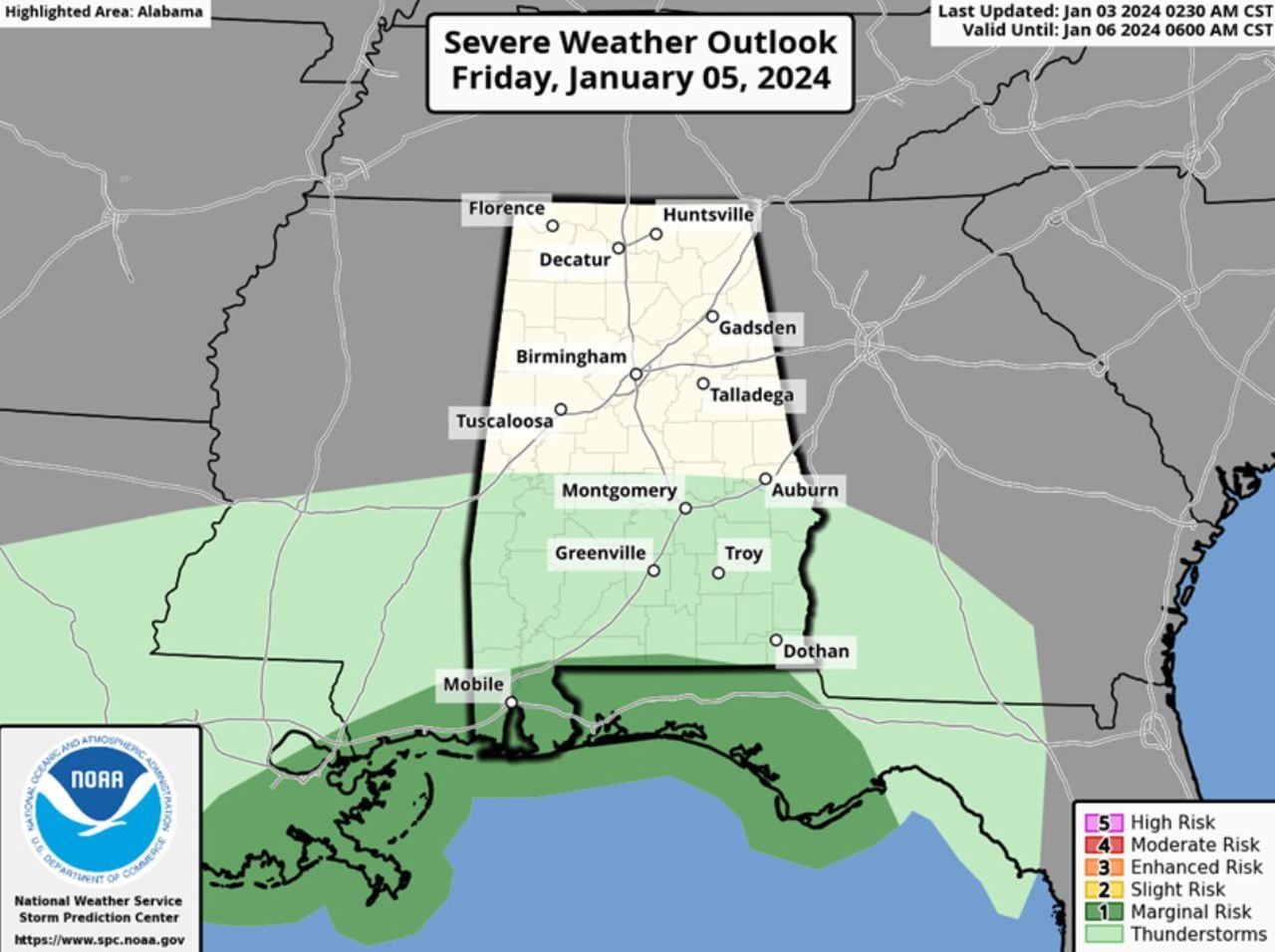
Rain and a few thunderstorms will enter western Alabama Friday afternoon, Stefkovich said, spreading across the remainder of the state by evening before ending Saturday morning. This round could bring a few strong to severe storms along the coast and for counties near the state line Friday afternoon and evening.
READ MORE: What are forecasters expecting from the weather in January 2024?
The storms could bring damaging wind gusts and the possibility of tornadoes. The highest instability will remain along the coast but that area could change to include areas further inland. Rainfall of up to 2 inches north and up to 4 inches south of Highway 80/I-85 is possible, with local amounts climbing even higher in stronger thunderstorms.
Non-thunderstorm winds will be increasing statewide from late Friday afternoon and continuing through Saturday afternoon with gusts of up to 40 mph possible.
After a dry period Saturday afternoon through Monday morning, Stefkovich said models are consistent that a “potent system” will produce supercells and the potential for more severe weather Monday afternoon through Tuesday morning. Damaging wind gusts and tornadoes will once again be possible for the southern part of the state but both the risk level and threat area could change later.
Non-thunderstorm winds ahead of the storms will likely produce gusts from 20-30 mph from late Monday afternoon into Tuesday morning. Several more inches of rain will likely occur and, when combined with the totals from Friday into Saturday, localized flash flooding is possible, especially in areas south of Hwy 80/I-85.