Low snow chances still in the forecast, but a bit later
There remains a low chance for a little snow for the northern part of Alabama later this week. But the timing has slowed down some.
The National Weather Service said the chances for snow are still on the low side, but if it happens the main window will be Thursday into Friday, with more emphasis on Friday in the latest forecasts.
No accumulations are expected at this point, according to forecasters.
The change in the forecast as of Wednesday is that computer forecast models have slowed down the arrival of the weather system that could bring the chance of snowflakes to Alabama.
As of the latest forecast from the weather service the best chance of seeing snowflakes will be delayed until late on Thursday but more likely early Friday morning as an upper-level weather system moves into the region.
Colder air is also expected to settle into the region by this time, according to forecasters.
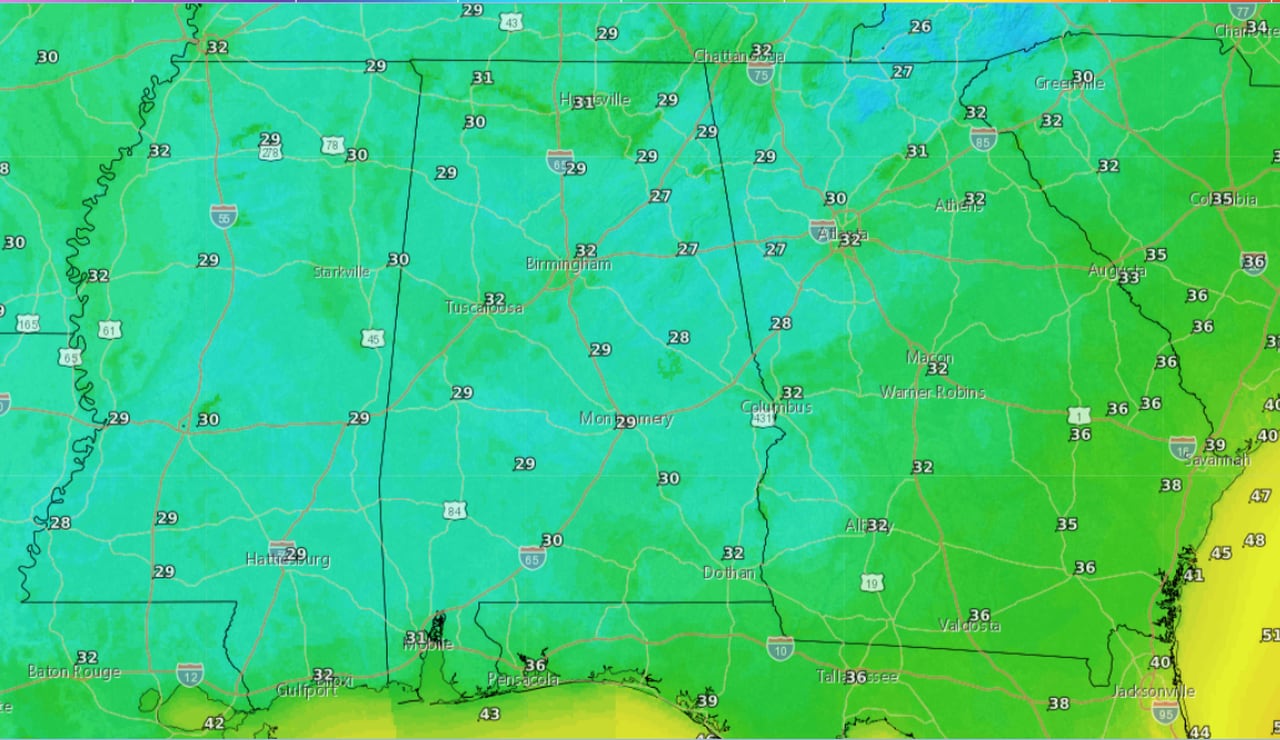
Here is the low temperature forecast for Thursday night into Friday morning:
Low temperatures are expected to fall to or below freezing across much of Alabama from Thursday night into Friday morning.NWS
The weather service said some rain or light snow could linger into Friday evening as well. In fact, the weather service in Birmingham said the best chances for north-central Alabama to see snowflakes could be Friday into Friday night.
Drier and slightly warmer weather is expected to take over starting on Saturday and through the last weekend of 2023.
This may not be the last chance for Alabama to see a few snowflakes, according to forecasters. The long-range, El Nino-influenced pattern shows several opportunities for precipitation in early January — it’s just the question of whether temperatures will be cold enough to generate any snow.