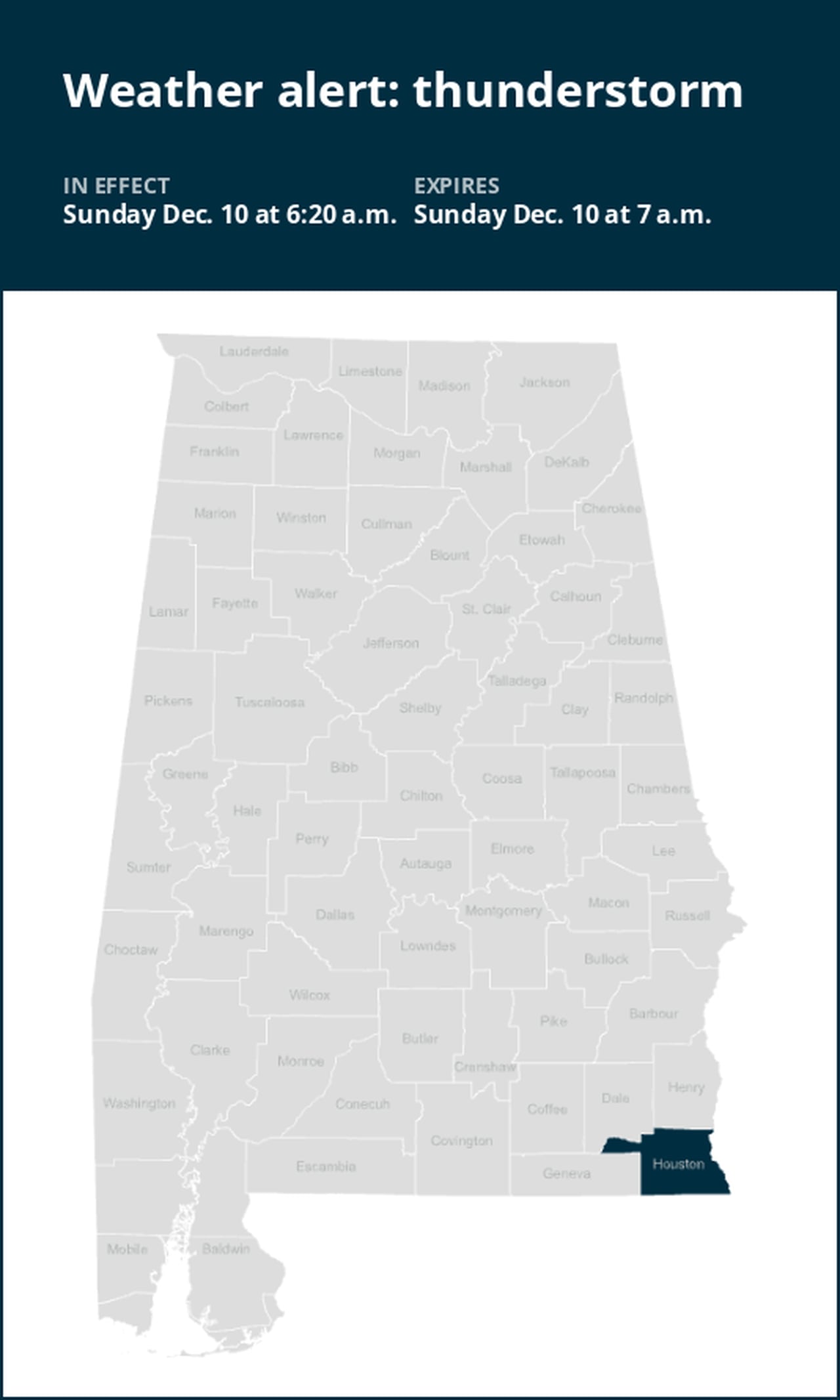
Expect strong thunderstorms in Houston County Sunday morning
A report was issued from the National Weather Service on Sunday at 6:20 a.m. for strong thunderstorms until 7 a.m. for Houston County.
Residents can expect wind gusts of up to 40 mph.
“At 6:20 a.m., Doppler radar tracked a strong thunderstorm over Cottonwood, moving northeast at 55 mph,” states the weather service. “Gusty winds could knock down tree limbs and blow around unsecured objects.”
The warning is for Colquitt, Cottonwood, Donalsonville, Marianna, Ashford, Centerville, Malone, Cottondale, Greenwood, Avon, Madrid, Gordon, Iron City, Damascus, Campbellton, Jakin, Bascom, Memphis, Crosby and Grangeburg.
According to the weather service, “If outdoors, consider seeking shelter inside a building. This storm may intensify, so be certain to monitor local radio stations and available television stations for additional information and possible warnings from the National Weather Service. A Tornado Watch remains in effect until 8 a.m. for southeastern Alabama, the Panhandle of Florida and southwestern Georgia.”
Staying safe as lightning approaches: Expert advice
Each year, lightning strikes the United States approximately 25 million times, with the majority of these electrifying events occurring during the summer months. Unfortunately, lightning is responsible for claiming the lives of approximately 20 people annually, as reported by the weather service. The threat of lightning becomes more pronounced as thunderstorms draw nearer, peaking when the storm is directly overhead and gradually waning as it moves away.
To ensure your safety during a thunderstorm, consider the following recommendations:
1. Lightning safety plan:
- When venturing outdoors, it’s crucial to have a lightning safety plan in place.
- Monitor the sky for threatening signs and listen for the sound of thunder. If thunder is audible, it’s an indication that lightning is nearby.
- Seek a safe place to shelter, preferably indoors.
2. Indoors safety measures:
- Once you’ve found shelter indoors, abstain from using corded phones, electrical appliances, or plumbing fixtures, and refrain from approaching windows and doors.
- These precautions help reduce the risk of electrical surges, as lightning can follow conductive pathways.
3. Wait for the all-clear:
- After the last lightning strike or thunderclap, wait at least 30 minutes before resuming outdoor activities.
- Lightning can strike even when a storm has seemingly passed, so exercise caution.
When indoor shelter isn’t available:
If you find yourself outdoors without access to indoor shelter during a thunderstorm, take these steps to maximize your safety:
- Avoid open fields, hilltops, or ridge crests, as they expose you to greater lightning risk.
- Steer clear of tall, isolated trees and other prominent objects. In wooded areas, stay close to lower stands of trees.
- If you’re with a group, ensure individuals are spread out to prevent lightning current from transferring between people.
- Camping in an open setting during a thunderstorm is strongly discouraged. If no alternative exists, set up camp in a valley, ravine, or other low-lying areas. Remember that a tent offers no protection against lightning.
- Do not approach water bodies, wet objects, or metal items. While water and metal don’t attract lightning, they conduct electricity effectively and can pose significant risks.
In summary, when facing the threat of lightning, vigilance and preparedness are your best allies. By following these guidelines, you can significantly reduce the chances of lightning-related accidents and prioritize your safety.
Navigating rainy roads: Safety tips for wet weather
When heavy rain strikes, safety is paramount. Equip yourself with these guidelines from the weather service to navigate wet roads and avoid hazards:
Beware of rapid water flow:
- In heavy rain, refrain from parking or walking near culverts or drainage ditches, where swift-moving water can pose a grave danger.
Maintain safe driving distances:
- The two-second rule for following distance is your ally in heavy rain. Extend it to four seconds to ensure safe spacing in adverse conditions.
Slow down and stay cautious:
- If it is raining and the roads are wet, slow down. Take your foot off the accelerator and let your speed drop gradually. Never use the brakes suddenly because this may cause the car to skid.
Choose your lane wisely:
- Stick to the middle lanes to minimize the risk of hydroplaning. Outer lanes are more prone to accumulating water.
Visibility matters:
- Enhance your visibility in heavy rain by activating your headlights. Be particularly vigilant for vehicles in blind spots, as rain-smeared windows can obscure them.
Watch out for slippery roads:
- Be extra careful during the first half hour after rain begins. Grime and oil on the road surface mix with water to make the road slippery.
Keep a safe distance from large vehicles:
- Don’t follow large trucks or buses too closely. The spray created by their large tires reduces your vision. Take care when passing them as well; if you must pass, do so quickly and safely.
Mind your windshield wipers:
- Heavy rain can overload the wiper blades. When visibility is so limited that the edges of the road or other vehicles cannot be seen at a safe distance, it is time to pull over and wait for the rain to ease up. It is best to stop at rest areas or other protected areas.
- When stopping by the roadside is your only option, position your vehicle as far off the road as possible, ideally beyond guardrails. Keep your headlights on and activate emergency flashers to alert other drivers of your position.
By following these safety measures, you can significantly reduce risks and ensure your well-being when heavy rain pours down. Stay informed about weather conditions and heed advice from local authorities to make your journey safe and sound.
Advance Local Weather Alerts is a service provided by United Robots, which uses machine learning to compile the latest data from the National Weather Service.