Severe weather in Alabama: What time will storms arrive where I live?
Multiple rounds of storms are expected in Alabama throughout the day, with a potential for damaging winds, hail, flooding rain and tornadoes.
Jim Stefkovich, Meteorologist, Alabama Emergency Management Agency, said today’s weather will be a prolonged event, beginning as early as 11 a.m. in western Alabama and exiting the southeastern section of the state as late as 11 a.m. Wednesday.
Tornado watches and flood watches are expected to be issued later today. Some spots in the southern half of the state could receive more than 6 inches of total rainfall by late Wednesday morning.
READ MORE: Enhanced risk for severe weather for Alabama on Tuesday
What to expect
According to Stefkovich, the atmosphere will become very unstable by Tuesday afternoon with strong wind shear to promote supercells. Clusters of storms will continue to develop this afternoon and evening, followed by a broken line of strong to severe storms entering northwestern Alabama after midnight Wednesday, moving eastward and exiting the southern sections around 11 a.m.
All modes of severe weather are possible, including EF2 or greater tornadoes in the Enhanced Risk area in the south central part of the state. In addition, sustained southerly winds of 10-20 mph with gusts up to 35 mph will occur from this morning until storms pass.
READ MORE: Alabama schools close, dismiss early due to severe weather Tuesday, Jan. 3
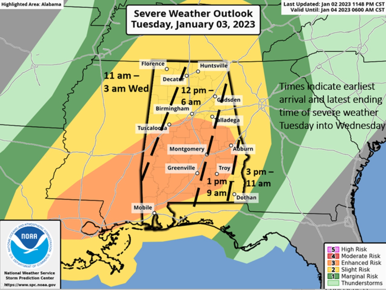
What times will storms arrive?
Most of Alabama will see storms starting Tuesday into Wednesday morning.
Storms will arrive in the northwest corner of the state as early as 11 a.m. on Tuesday before exiting, possibly as late as 3 a.m. Wednesday. The earliest arrival time for storms in the central part of the state is noon with an exit as late as 6 a.m. Wednesday.
Storms will enter the section of the state from Gadsden in the north to Troy in the south, entering around 1 p.m. Tuesday before exiting around 9 a.m. Wednesday. The extreme southeastern corner of the state will see storms in a window from 3 p.m. Tuesday to 11 a.m. Wednesday.