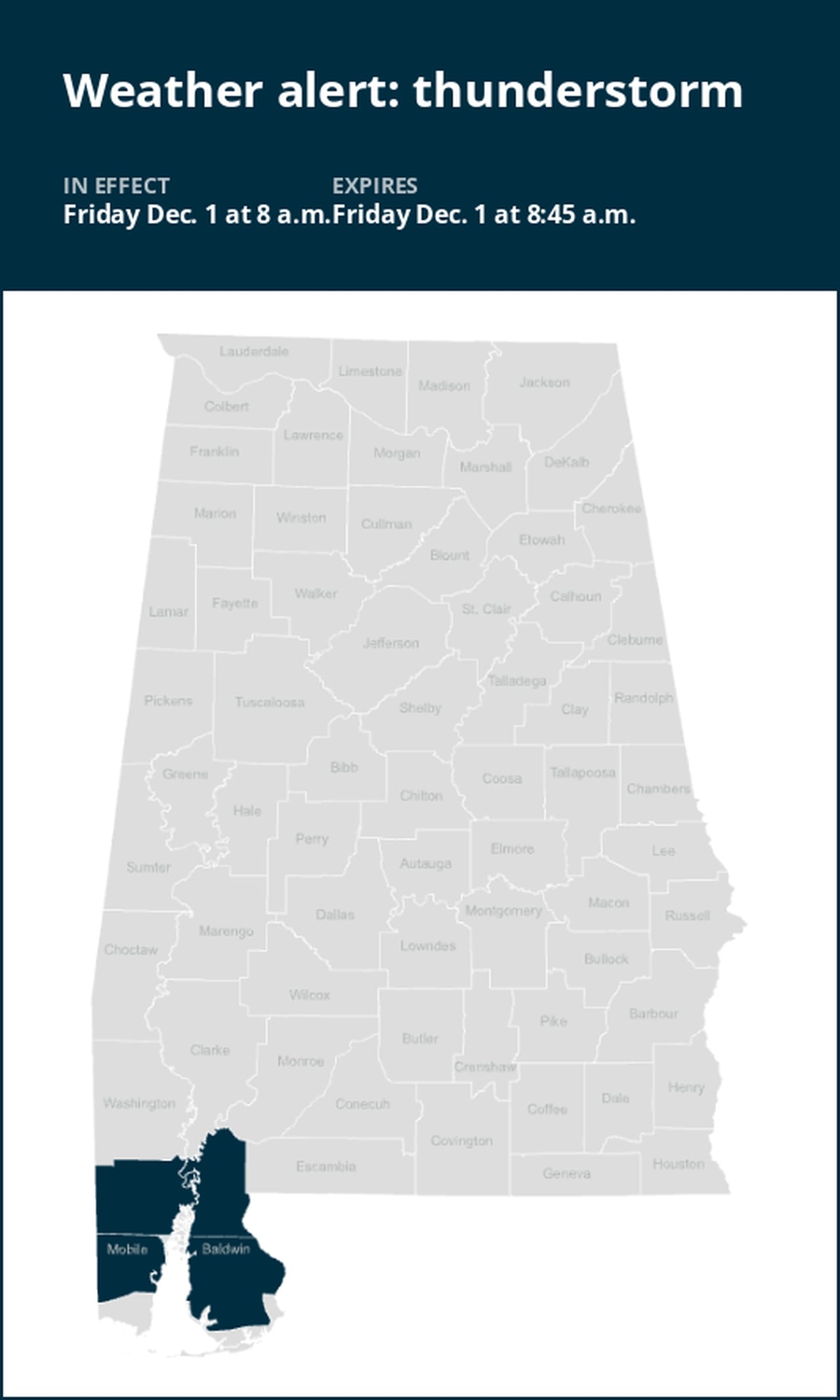
Update: Prepare for strong thunderstorms in Mobile and Baldwin counties Friday morning
An updated weather alert was issued by the National Weather Service on Friday at 8 a.m. for strong thunderstorms until 8:45 a.m. for Mobile and Baldwin counties.
Residents may experience wind gusts of up to 40 mph.
“At 8 a.m., Doppler radar tracked a strong thunderstorm over Wilmer, or 14 miles northwest of Midtown Mobile, moving east at 35 mph,” states the weather service. “Gusty winds could knock down tree limbs and blow around unsecured objects.”
The warning is for Midtown Mobile, Downtown Mobile, Prichard, Saraland, Bay Minette, Chickasaw, Satsuma, Spanish Fort, Creola, Chunchula, Stockton, Stapleton, Axis, Semmes, Tanner Williams, I65 And I165, Mobile Regional Airport, Wilmer, I65 And AL 225 and I65 And AL 158.
The weather service comments, “If outdoors, consider seeking shelter inside a building.”
Lightning on the horizon: Expert safety measures for thunderstorms
Lightning strikes the United States approximately 25 million times each year, with the bulk of these electrical discharges occurring during the summer months. Tragically, lightning claims the lives of about 20 individuals annually, as reported by the weather service. The risk of lightning-related incidents escalates as thunderstorms draw near, reaching its peak when the storm directly looms overhead. However, it gradually recedes as the tempest moves away.
To protect yourself during a thunderstorm, take these recommendations into consideration:
1. Lightning safety plan:
- When venturing outdoors, it’s vital to establish a clear plan for seeking shelter in case of lightning.
- Monitor the sky for threatening signs and listen for the sound of thunder. If thunder is audible, it’s an indication that lightning is nearby.
- Seek shelter promptly in a safe location, preferably indoors.
2. Indoors safety measures:
- Once you’re indoors, avoid using corded phones, electrical devices, plumbing fixtures, and stay away from windows and doors.
- Lightning can follow conductive pathways, and these precautions reduce the risk of electrical surges.
3. Wait for the all-clear:
- After the last lightning strike or thunderclap, wait at least 30 minutes before resuming outdoor activities.
- Lightning can strike even when a storm has seemingly passed, so exercise caution.
When indoor shelter isn’t available:
If you find yourself outdoors without access to indoor shelter during a thunderstorm, take these steps to maximize your safety:
- Avoid open fields, hilltops, or ridge crests, as they expose you to greater lightning risk.
- Steer clear of tall, isolated trees and other prominent objects. In forested areas, stay close to lower stands of trees.
- If you’re with a group, ensure individuals are spread out to prevent lightning current from transferring between people.
- Camping in an open setting during a thunderstorm is strongly discouraged. If you have no alternative, set up camp in a valley, ravine, or other low-lying areas. It’s crucial to note that a tent provides no protection against lightning.
- Do not approach water bodies, wet objects, or metal items. Although water and metal do not attract lightning, they conduct electricity effectively and can pose significant risks.
In summary, when facing the threat of lightning, preparedness and vigilance are your best allies. By following these guidelines, you can significantly reduce the likelihood of lightning-related incidents and prioritize your safety.
Rainy roadways ahead: Essential safety tips for heavy rain
When heavy rain strikes, safety is paramount. Equip yourself with these guidelines from the weather service to navigate wet roads and avoid hazards:
Beware of rapid water flow:
- During heavy rain, avoid parking or walking near culverts or drainage ditches, where swift-moving water can pose a serious risk.
Maintain safe driving distances:
- The two-second rule for following distance is your ally in heavy rain. Extend it to four seconds to ensure safe spacing in adverse conditions.
Reduce speed and drive cautiously:
- On wet roads, slowing down is paramount. Gradually ease off the accelerator and avoid abrupt braking to prevent skidding.
Choose your lane wisely:
- Stick to the middle lanes to minimize the risk of hydroplaning. Outer lanes are more prone to accumulating water.
Visibility matters:
- Enhance your visibility in heavy rain by activating your headlights. Be particularly vigilant for vehicles in blind spots, as rain-smeared windows can obscure them.
Watch out for slippery roads:
- The initial half-hour of rain is when roads are slickest due to a mixture of rain, grime, and oil. Exercise heightened caution during this period.
Keep a safe distance from large vehicles:
- Don’t follow large trucks or buses too closely. The spray created by their large tires reduces your vision. Take care when passing them as well; if you must pass, do so quickly and safely.
Mind your windshield wipers:
- Overloaded wiper blades can hinder visibility. If rain severely impairs your vision, pull over and wait for conditions to improve. Seek refuge at rest areas or sheltered spots.
- When stopping by the roadside is your only option, position your vehicle as far off the road as possible, ideally beyond guardrails. Keep your headlights on and activate emergency flashers to alert other drivers of your position.
By following these safety measures, you can significantly reduce risks and ensure your well-being when heavy rain pours down. Stay informed about weather conditions and heed advice from local authorities to make your journey safe and sound.
Advance Local Weather Alerts is a service provided by United Robots, which uses machine learning to compile the latest data from the National Weather Service.