Severe storms possible Monday and Tuesday in Alabama
Isolated to scattered severe storms will be possible in parts of Alabama on Monday and Tuesday, according to the National Weather Service.
South and west Alabama will be the areas that could see the strongest storms. Those could bring wind gusts up to 60 mph, the chance of a tornado and heavy rain.
Storms will be possible starting Monday night in western Alabama and shift eastward overnight and into Tuesday.
NOAA’s Storm Prediction Center has slightly upgraded the severe weather risk for Alabama on Sunday. Forecasters have added a Level 2 out of 5 risk for part of southwest Alabama. A Level 2 risk means that scattered severe storms will be possible.
A Level 1 risk has been expanded and now includes most of the western half of Alabama. A Level 1 risk means that isolated severe storms will be possible.
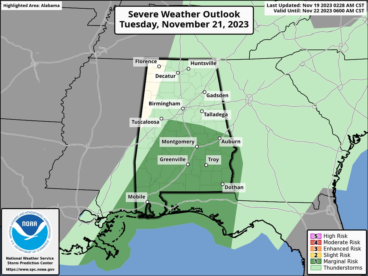
A Level 1 risk will also be in place for only south Alabama on Tuesday.
Since this could be an overnight event for some it is important to make sure you have two reliable methods of getting severe weather warnings that could wake you up if needed. (Some examples are weather radios or smartphone apps. Remember to not put your phone on silent Monday night if you live in the Level 1 risk area.)
On Tuesday the best chances for isolated severe storms will be confined to southern Alabama.
Here is the severe weather outlook for Tuesday:
Isolated severe storms will be possible on Tuesday in the areas in dark green.SPC
The weather service said winds could be strong both in and away from storms, and that could pose a danger to trees weakened by months of drought conditions.
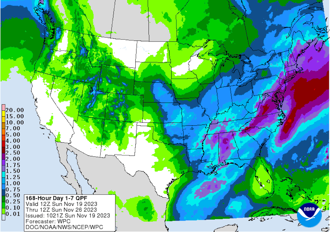
On the flip side, the storm system could bring much of the state 1 to 2 inches of badly-needed rainfall.
Here is the rainfall outlook from NOAA’s Weather Prediction Center for the next seven days:

Here is the precipitation outlook for the next seven days. Parts of Alabama stand to get up to 2 inches of rain during that time.Weather Prediction Center
The Storm Prediction Center is not expecting any other chances for severe weather in Alabama after Tuesday.
