Hurricane Otis hits Mexico but won’t bring Alabama rain
The Pacific’s Hurricane Otis left forecasters stunned on Tuesday as it incredibly intensified from a tropical storm to a Category 5 hurricane with 165 mph winds in mere hours.
Otis then made landfall near the heavily populated Acapulco, Mexico, early Wednesday morning.
According to the National Hurricane Center, Hurricane Otis made landfall at 1:25 a.m. Wednesday near Acapulco — a city with about 1 million people — with 165 mph winds, a solid Category 5 hurricane on the Saffir-Simpson wind scale.
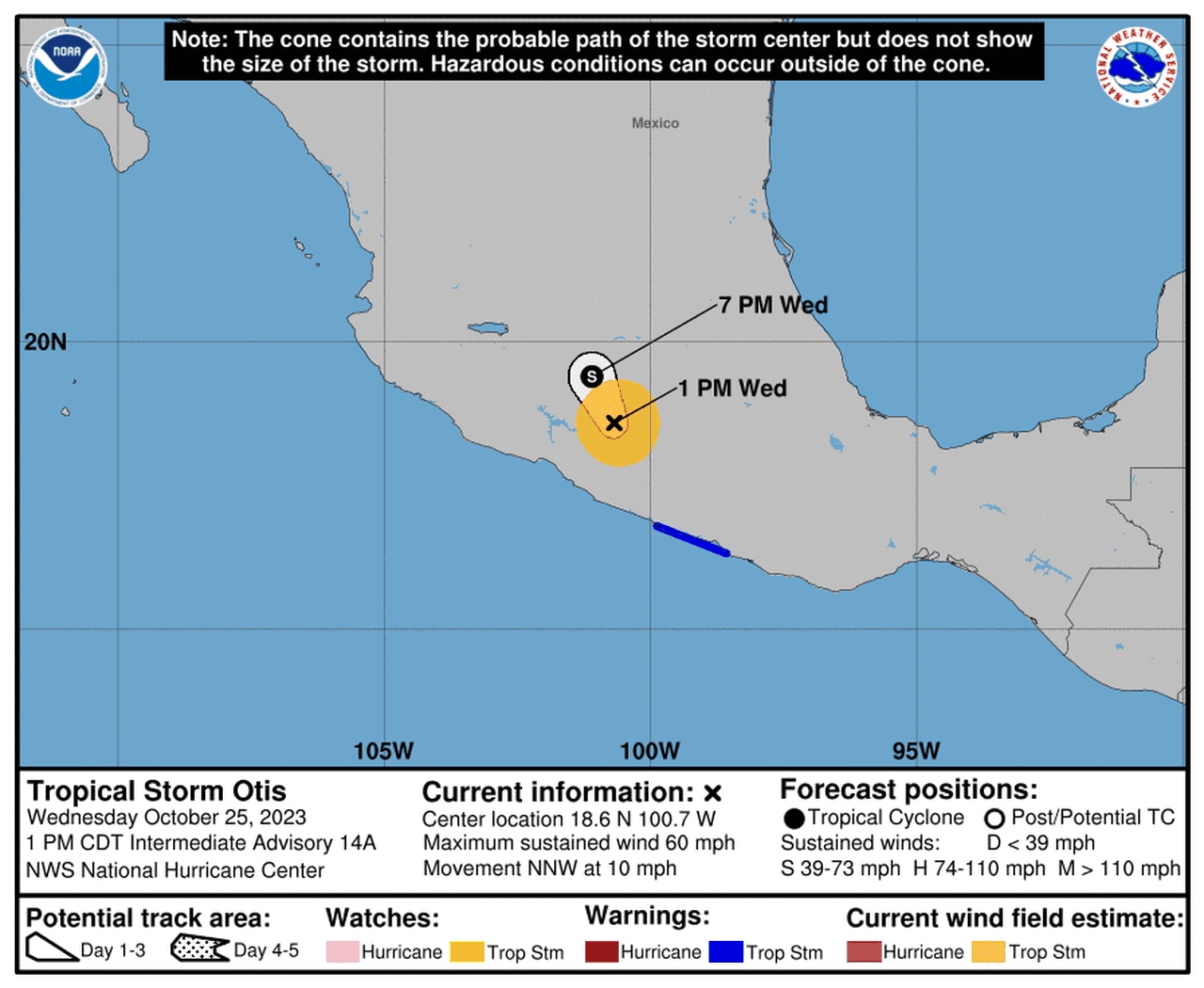
Otis has weakened after landfall and was a tropical storm with 60 mph winds as of 1 p.m. CDT Wednesday. The hurricane center is forecasting the storm to dissipate over southern Mexico over the next few days.
Here’s the forecast track as of Wednesday afternoon:
Otis is expected to dissipate over southern Mexico soon.National Hurricane Center
Will any of Otis’s rain make it to Alabama? It doesn’t appear so.
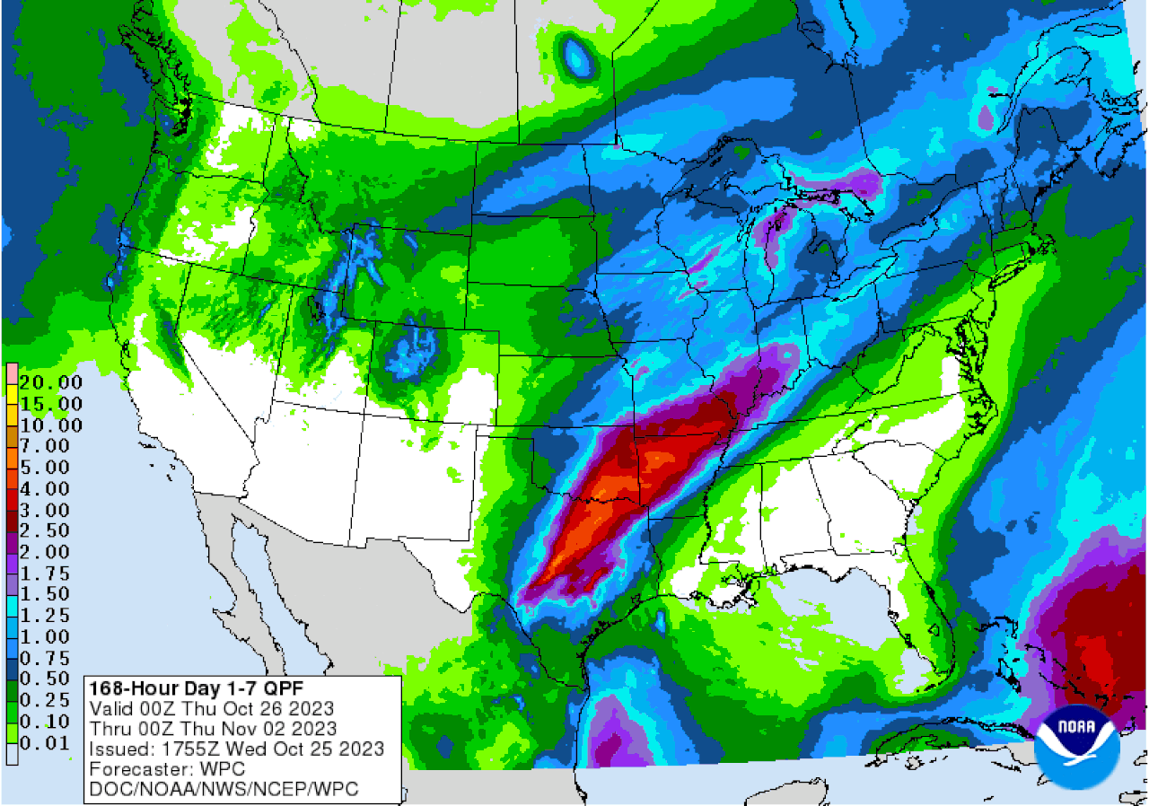
NOAA’s Weather Prediction Center is forecasting little to no rain for Alabama over the next week. Alabama remains situated under a dome of high pressure, which is keeping temperatures on the warm side and rain chances on the very low side.

Alabama is not expected to get much, if any, rain over the next seven days. The seven-day precipitation outlook is above.Weather Prediction Center
Any moisture from Otis that manages to make it this far north will be shunted to the west of Alabama.
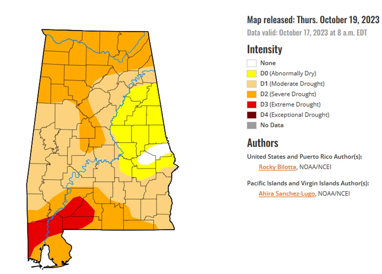
Alabama is in the midst of a worsening drought, and conditions are not likely to improve in the near future.
The U.S. Drought Monitor will release a look at drought conditions on Thursday. Last week’s report shows most of the state either in varying stages of drought or on the verge of it. The most parched areas are in southwest Alabama.

Drought conditions backed off a bit in a few spots but expanded in others in the past week. Not much if any improvement is expected in the coming week with little rain in the forecast.
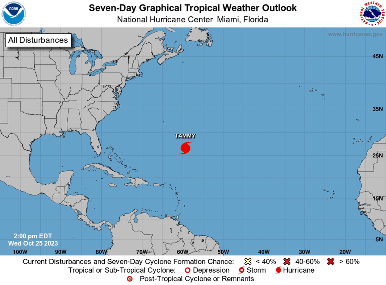
The hurricane center is also tracking Hurricane Tammy in the Atlantic. Tammy is expected to transition to a non-tropical system in the next few days and could impact Bermuda. Tammy is not expected to affect the U.S.
The hurricane center isn’t tracking any other potential tropical systems in the Atlantic as of Wednesday.

The National Hurricane Center continued to track Hurricane Tammy on Wednesday, but it is not expected to be a concern for the U.S.NHC
