Tropical storm may form off Southeast coast today
A storm on a path for the Carolina coast could become Subtropical or Tropical Storm Ophelia soon, according to forecasters.
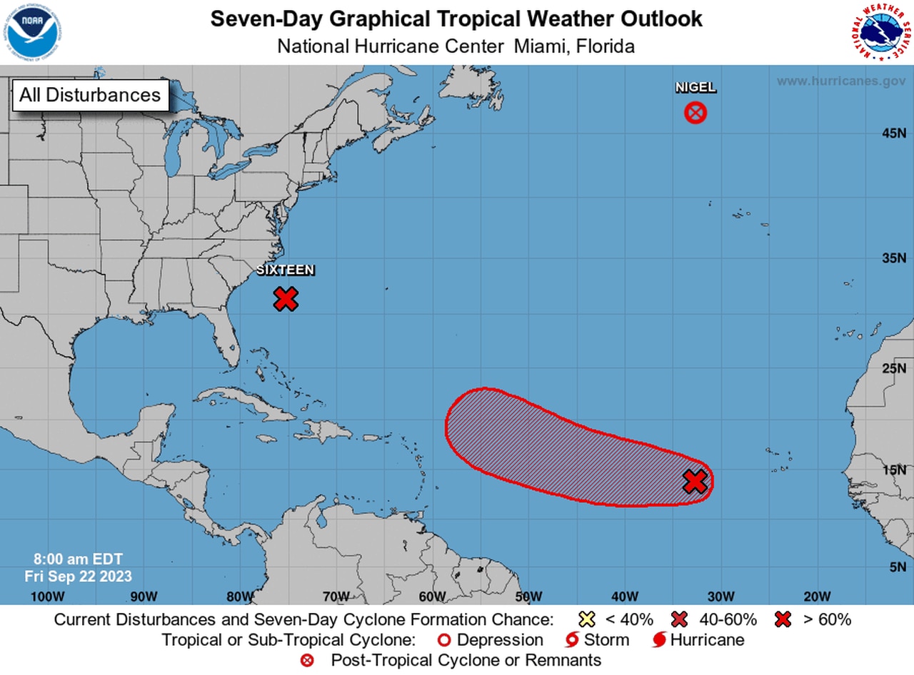
The National Hurricane Center on Friday continued to track the storm, which was being called Potential Tropical Cyclone 16.
Forecasters said it could strengthen into Ophelia later today and make landfall in North Carolina.
The hurricane center said tropical storm conditions are expected to begin along the North Carolina coast later this morning, and spread northward through Saturday.
Tropical storm and storm surge warnings were in effect along part of the East Coast as of Friday morning.
The potential Ophelia could bring a storm surge of 2 to 4 feet along the coast and 3 to 5 feet along area rivers, according to the hurricane center, as well as tropical storm wind gusts and 3 to 5 inches of rain.
As of 7 a.m. CDT Friday, Potential Tropical Cyclone 16 was located about 250 miles east-southeast- of Charleston, S.C., and was moving north at 14 mph.
The system had sustained winds of 50 mph, which is more than enough to be considered a tropical storm. The hurricane center said the storm was strengthening but still didn’t check all the boxes that would qualify it as a tropical or subtropical storm.
But its title doesn’t matter, according to forecasters, because it will still bring tropical-storm effects as it moves closer to shore.
The hurricane center said the storm was on a northward path on Friday morning and will track to the north or north-northwest over the next few days. On the forecast path the center will approach the coast of North Carolina tonight, and then move across eastern North Carolina, southeastern Virginia, and the Delmarva Peninsula Saturday and Sunday.
Tropical-storm-force winds extend outward up to 240 miles from the center of the storm.
Here are the warnings and watches as of Friday:
* Surge Warning for Duck, N.C., to Chincoteague, Va.; Chesapeake Bay south of Windmill Point; Neuse and Pamlico Rivers and portions of Pamlico and Albemarle Sounds.
* Tropical Storm Warning from Cape Fear, N.C., to Fenwick Island, Del.; Albemarle and Pamlico Sounds; Tidal Potomac south of Cobb Island and Chesapeake Bay south of North Beach.
* Storm Surge Watch from Surf City to Duck, N.C.; Chesapeake Bay north of Windmill Point to Smith Point; Tidal Potomac south of Colonial Beach and the remainder of Pamlico and Albemarle Sounds.
ELSEWHERE IN THE TROPICAL ATLANTIC
A tropical wave in the central Atlantic could become a tropical depression in the next few days.
The hurricane center also continued to track Nigel, which had been a hurricane but was a post-tropical storm on Friday in the northern Atlantic.
And also continuing to draw speculation was a tropical wave in the central Atlantic that could become the next tropical depression. That system was forecast to move in the general direction of the Lesser Antilles, but it’s still too soon to say if it will affect the islands or pass to the north of them.
The hurricane center expects the system to become a depression in the next few days as it tracks to the west-northwest.