Hurricane Lee path update: Lee could brush New England
Hurricane Lee was still a Category 3 storm with 115 mph winds on Tuesday as it continued slowly moving to the northwest on Tuesday.
Lee is expected to stay clear of the Leeward Islands, Puerto Rico and the Bahamas, but the storm could bring gusty winds, rough seas and heavy rain to Bermuda and perhaps parts of the Northeast U.S. later this week.
The National Hurricane Center thinks Lee will weaken before it makes its closest approach to New England, but the storm is also expected to grow larger, which could spread wind and rain over a greater area.
On Tuesday the hurricane center’s forecast cone, which shows only where the center of the storm could go, includes Bermuda, Maine and parts of Atlantic Canada.
Lee could make its closest approach to Bermuda on Thursday and Friday, according to the hurricane center. Then it could approach New England and Atlantic Canada by Saturday or Sunday.
Hurricane center forecasters issued a familiar caution on Tuesday, saying “It remains too soon to know what level of additional impacts Lee might have along the Northeastern U.S. coast and Atlantic Canada late this week and this weekend. However, since wind and rainfall hazards will extend well away from the center as Lee grows in size, users should continue to monitor updates to Lee’s forecast during the next several days.”
As of 4 a.m. CDT Tuesday, the center of Hurricane Lee was located about 575 miles south of Bermuda and was on a path west-northwest at 7 mph. (The next update on Lee will come later this morning.)
Lee was a Category 3 hurricane with sustained winds of 115 mph, according to the hurricane center.
Forecasters said Lee is expected to gradually weaken during the next few days.
The big question remains about Lee’s future path. The hurricane center said that on the forecast track Lee is expected to pass near but to the west of Bermuda in a few days. Tropical storm watches could be issued for the island sometime today, forecasters added.
The most immediate concern for those along the U.S. East Coast will be rough surf and deadly rip currents which will spread northward along the coast this week.
HURRICANE MARGOT
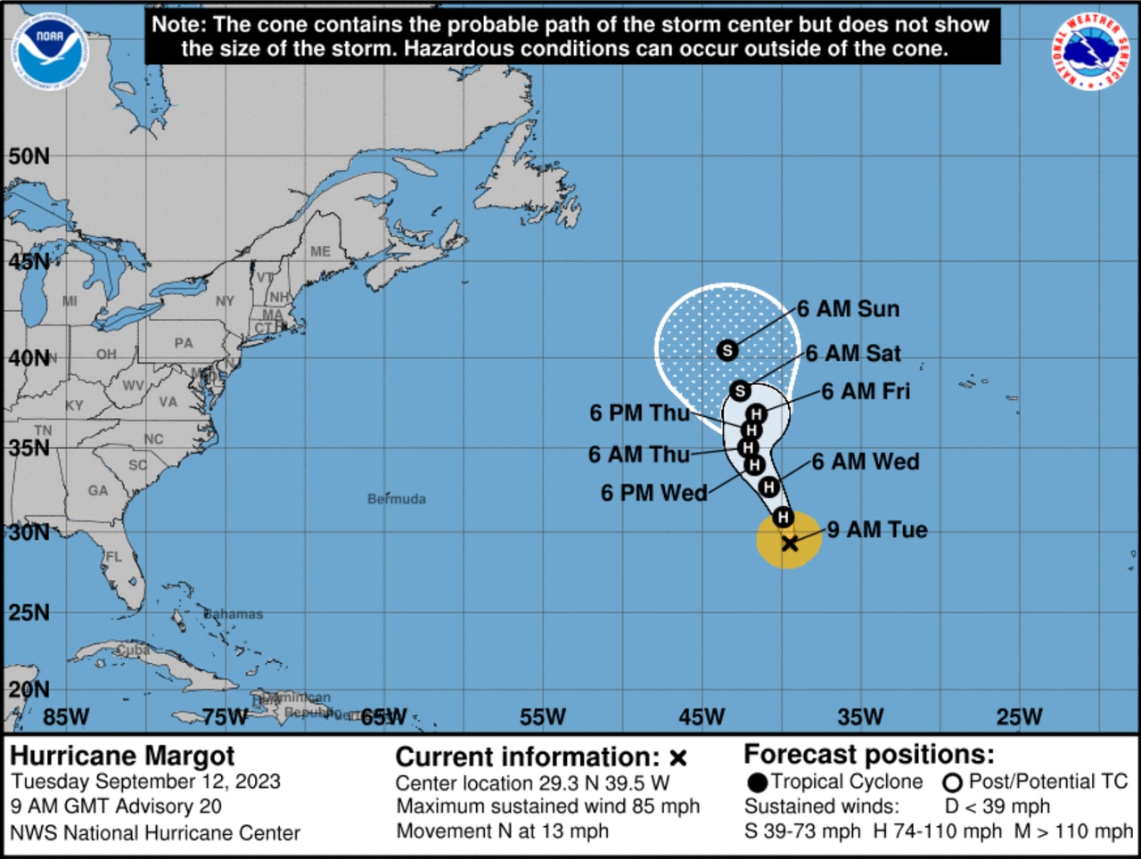
Forecasters say Hurricane Margot is expected to remain in the open Atlantic and won’t pose a direct threat to land.National Hurricane Center
The hurricane center was also tracking strengthening Hurricane Margot on Tuesday. Margot is not expected to threaten land.
As of 4 a.m. CDT Tuesday, Hurricane Margot was located about 935 miles southwest of the Azores and was moving north at 13 mph.
Margot had 85 mph winds, making it a Category 1 hurricane. It could strengthen some more before a weakening trend is expected to begin on Thursday.
The hurricane center expects Margot to remain a hurricane for a few days — but it will also remain out at sea.
Forecasters also continued to watch a tropical wave in the eastern Atlantic to the south of both Lee and Margot that could become a tropical depression by this weekend as it tracks to the west-northwest or northwest at 15 mph.
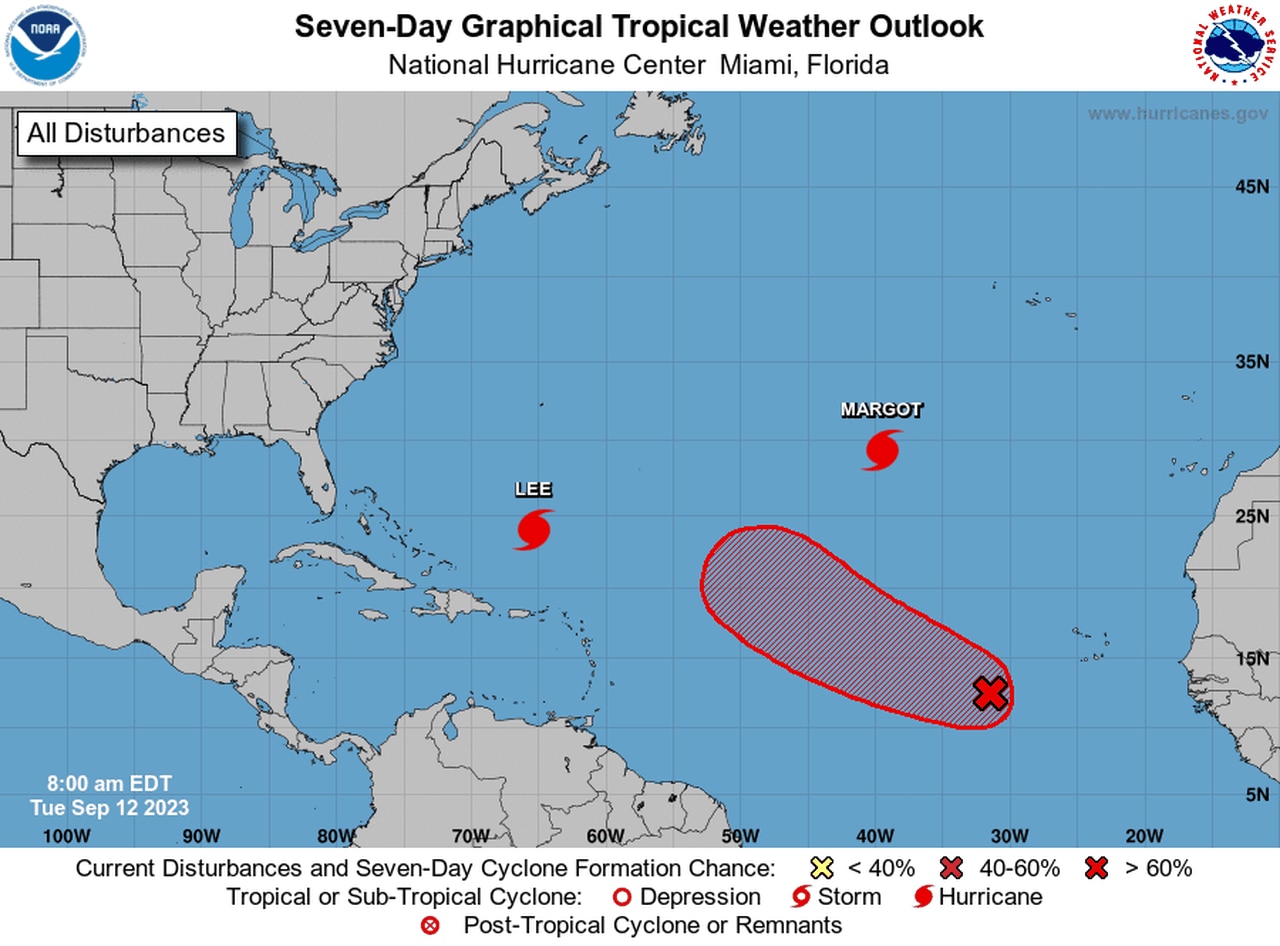
A new tropical depression could form by this weekend.