Hurricane Lee forecast sends Category 2 storm north
Hurricane Lee was battling wind shear and dry air but strengthened a little on Sunday as the Category 2 hurricane slowed down on its northwestward path in the Atlantic.
Lee, which last week peaked as a Category 5 hurricane with 165 mph winds, had sustained winds of 110 mph on Sunday morning, according to the National Hurricane Center. The hurricane center said Lee could strengthen some over the next few days.
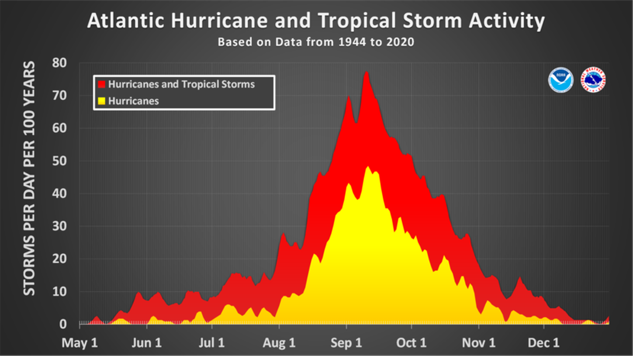
Sunday marks the climatological peak of the Atlantic hurricane season. In typical seasons activity gradually begins to taper off from this point until the end of the season, which will be on Nov. 30.
The Atlantic hurricane season typically peaks in September.
Hurricane Lee is expected to stay north of the Leeward Islands and Puerto Rico for the next few days. As of 10 a.m. CDT Sunday, the center of Lee was located about 270 miles north-northeast of the northern Leeward Islands and was tracking to the west-northwest at 8 mph.
Lee is expected to stay on a path that will keep it north of the islands and Puerto Rico, and likely will keep it east of the Bahamas. The hurricane center expects Lee to make a more pronounced turn to the north this week, and the official path forecast keeps the storm well offshore of the U.S. East Coast through Friday.
But it is still too soon to sound the all-clear for the East Coast, according to forecasters. “It remains too soon to know what level of impacts, if any, Lee might have along the U.S. East Coast, Atlantic Canada, or Bermuda late next week, especially since the hurricane is expected to slow down considerably over the southwestern Atlantic,” the hurricane center said Sunday.
Lee was battling dry air and wind shear on Sunday, but the hurricane center thinks it could re-intensify this week, possibly becoming a Category 4 hurricane again with 130 mph winds in 36 hours or so.
Lee is churning up the Atlantic and sending big swells outward that are causing rough surf and rip currents in the Leeward Islands, the Virgin Islands, Puerto Rico, Hispaniola, the Bahamas and Bermuda.
Rough surf and potentially deadly rip currents could affect areas along the U.S. East Coast starting today and could get worse through the week, the hurricane center said.
The next update on Lee will come later this afternoon.
ELSEWHERE IN THE ATLANTIC
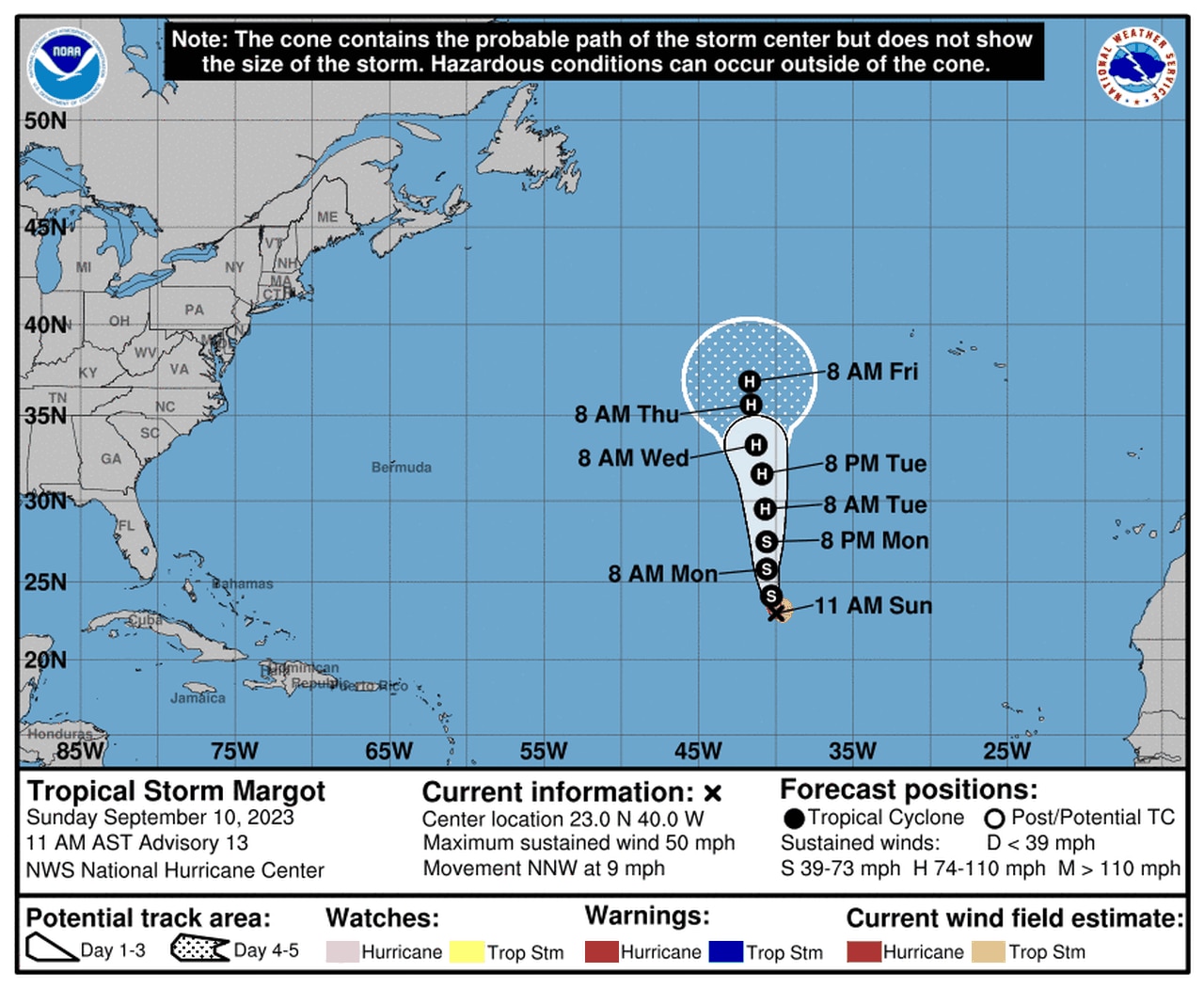
Margot is expected to stay in the open Atlantic this week.
The hurricane center also continued to track Tropical Storm Margot in the central Atlantic on Sunday.
Margot is no threat to land and had 50 mph winds on Sunday morning, according to the hurricane center.
Forecasters think it could strengthen to a hurricane later this week over the open Atlantic.
There were also two tropical waves being watched for potential development on Sunday. Both were in the eastern Atlantic and no threat to the U.S. Both had low chances of development as of Sunday.
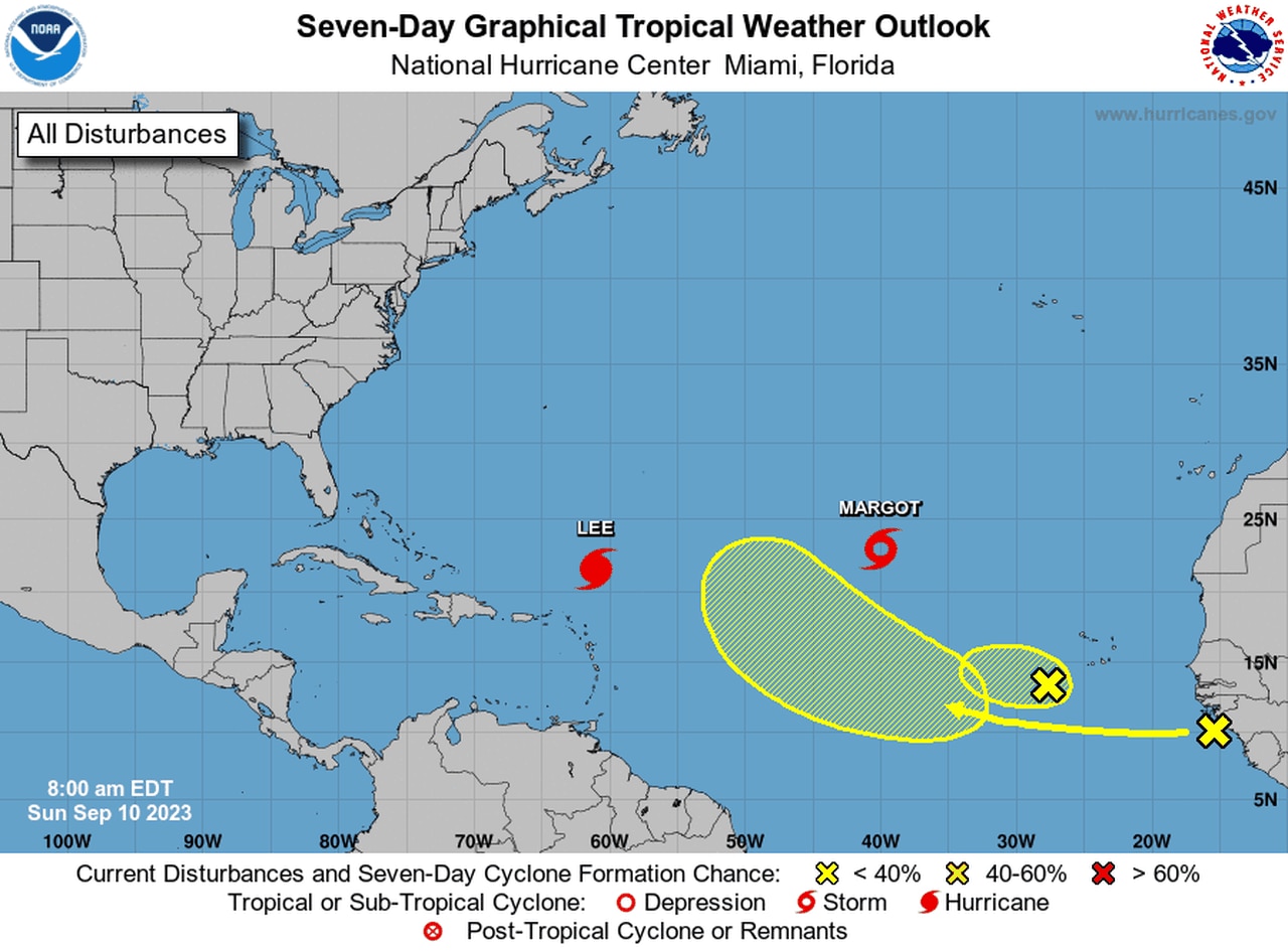
Besides Lee and Margot there are two tropical waves that are being tracked for potential development.