Tropical Storm Idalia: What can Alabama expect?
Tropical Storm Idalia continued to strengthen as it neared the southern Gulf of Mexico on Monday.
The National Hurricane Center expects Idalia (pronounced ee-DAL-ya) to become a hurricane later today and make landfall on Wednesday on Florida’s Gulf Coast as a dangerous Category 3 storm.
The hurricane center’s “cone of uncertainty” on Monday stretched from east of Apalachicola to south of Tampa. The cone shows only where the center of the storm is expected to go. Idalia could spread wind and rain far from where the center comes onshore.
So what does that mean for Alabama? The National Weather Service offices that covered the state — in Mobile, Birmingham and Tallahassee, Fla., where keeping a close watch on the storm on Monday.
No one was ready to let their guard down just yet, but the threat for significant effects for Alabama seemed to be decreasing with the forecast track for the storm shifting more eastward toward Florida.
“Although the trends have been positive with regard to our area and no definitive tropical impacts related to Idalia are currently indicated for our forecast area based on the latest NHC information, but residents should continue to closely monitor this situation for the next day or so,” the weather service in Mobile said in its Monday morning forecast discussion.
No part of the state was in the forecast track cone as of Monday, but that doesn’t mean Alabama won’t feel that a hurricane is nearby.
Along the coast, expect seas to get rougher starting today, according to the weather service.
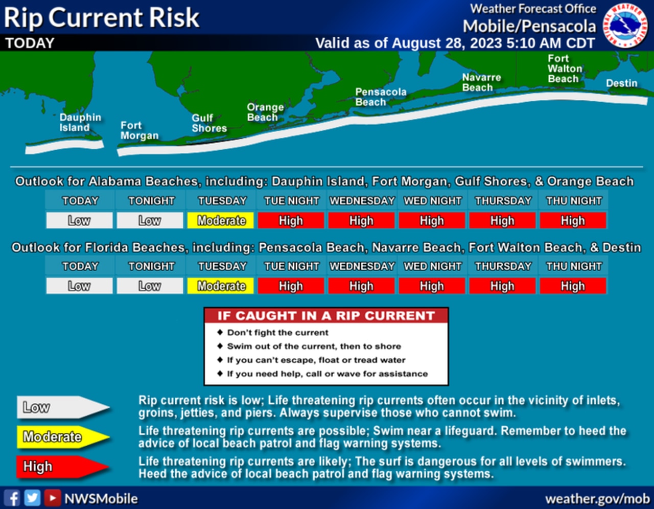
But the biggest and potentially most deadly hazard will be the threat for rip currents along the coast. The weather service in Mobile is already forecasting a high risk for rip currents along the Alabama and northwest Florida beaches starting on Tuesday night and lasting into at least Thursday.
Here’s the rip current forecast as of Monday:
Idalia will bring the threat for deadly rip currents to the Alabama and northwest Florida beaches starting on Tuesday.
Areas in southeast Alabama, though well inland, will be the closest to the storm and could feel the most from Idalia. The weather service said gusty winds and heavy rain will be possible as the storm makes landfall. However, Alabama will be on the west side of the center of the storm and won’t have the threat of tornadoes to contend with. Rain rates could be less as well.
The rest of Alabama may not have to contend with Idalia at all except for an increase in rain chances by Wednesday, according to forecasters. Winds could be breezy, but the weather service expects them to stay under the threshold for a wind advisory.
