Hurricane center keeps an eye on Gulf, 2 other systems
After a quiet stretch, the tropical Atlantic Ocean seems to be waking up.
And those along the western Gulf Coast will need to keep watch on the Gulf.
The National Hurricane Center on Thursday was watching three areas for potential tropical development, and one was in the Gulf of Mexico.
On Thursday it had only a 30 percent chance of becoming a tropical depression in the next seven days. However, that’s an increase from 20 percent on Wednesday.
Forecasters expect an area of low pressure to form in the central or western Gulf early next week and track to the west, toward the Texas coast. Some slow development would be possible during that time.
The hurricane center said the system could approach the western Gulf Coast by the middle of next week. It’s not expected to pose a threat to the Alabama coast.
The hurricane center was also tracking two other tropical waves, and both could become tropical depressions soon.
Both were far away in the central Atlantic.
One disturbance (tagged Invest 99) was located about 900 miles west-southwest of the Cabo Verde Islands. The hurricane center said conditions were favorable for gradual development, and a tropical depression could form in the next few days while the system tracks to the west-northwest at 10 to 15 mph.
The second disturbance (Invest 98) was a disorganized area of rain and storms located to the west and southwest of the Cabo Verde Islands. It could become a tropical depression over the weekend as it tracks to the west-northwest or northwest at about 10 mph.
The hurricane center doesn’t expect that system to last all that long, however, and it could run into unfavorable conditions early next week.
There have been four named storms and one unnamed storm so far this year in the Atlantic. There has only been one hurricane, Don, which didn’t affect land.
The next names on the 2023 Atlantic storm list are Emily, Franklin and Gert.
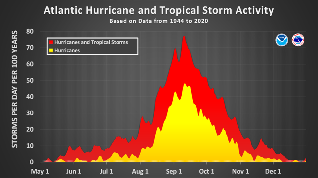
The Atlantic hurricane season is entering what is typically its busiest stretch and has a climatological peak on Sept. 10.
The Atlantic hurricane season typically peaks in September.
